DUKE GEOLOGICAL LABORATORY
TWENTY-FIRST CENTURY
LECTURE ARCHIVE 2026-2000
Current Lecture Topics Available
All Images © 2026
Saturday, 16 May 2026; 1:30-3:00 PM
Sterling Hill Mining Museum, 30 Plant Street, Ogdensburg, NJ 07439
FOMS Members and guests
Exploration and Geology of the Earth's Moon
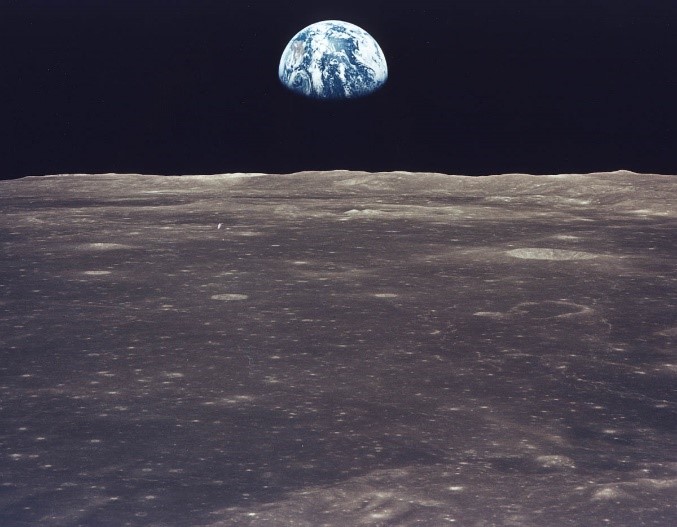 Dr. Charles Merguerian discussed the geology of the Earth’s moon against the backdrop of the history of space exploration and discovery including pre-1969 sci-fi movies and world literature that accurately predicted our coming conquests. An active, published research scientist in the fields of Geology and Astrogeology and professor of many lunar geology courses, he chronicled the lunar missions including the 2022-28 Artemis Program and geological evolution of the Moon paying particular attention to the sequence of human endeavors and discoveries that have led to our recognition of an open lunar window into the time of earliest Earth history where little terrestrial geological evidence exists. Indeed, based upon data analyzed from the seat-of-the-pants Apollo 11 through 17 missions of the 1960s and 1970s and subsequent decades of remote spacecraft and earth-based studies, our current understanding indicates that the Moon’s crustal rocks, regolith and surface features yield significant peeks into the first billion or so years of solar system history – a period of time from which few terrestrial rocks can be found.
To view a .pdf version (12 Mb) of his lecture click here.
Better still, an older 2025 video of this repeat by popular demand PowerPoint lecture can be seen at the following YouTube link.
Sunday, 19 April 2026; 4:20 PM
Stonybrook University, Stonybrook, NY
Free Admission
Geological Controls on Constructability – An Excavation Guide for New York City
 Presenting remotely from Dukelabs in Stone Ridge, NY, Dr. Merguerian shared a video-laced PowerPoint lecture with the 33rd Annual Geology of Metropolitan NY Conference in
Stonybrook, NY via Zoom in early 2026. Reporting on the results of joint research with coauthor J. Mickey Merguerian, Merguerian the Elder discussed the overall subsurface expectations in NYC and vicinity and focused on the geological underpinning likely to be encountered by contractors working in the region.
Presenting remotely from Dukelabs in Stone Ridge, NY, Dr. Merguerian shared a video-laced PowerPoint lecture with the 33rd Annual Geology of Metropolitan NY Conference in
Stonybrook, NY via Zoom in early 2026. Reporting on the results of joint research with coauthor J. Mickey Merguerian, Merguerian the Elder discussed the overall subsurface expectations in NYC and vicinity and focused on the geological underpinning likely to be encountered by contractors working in the region.
In NYC, the ultimate success of both TBM and traditional drill and blast tunneling efforts as well as top-down mechanical excavations through regolith and into bedrock is fundamentally governed by the geology of the ground. Maps showing the subsurface depth, thickness and expectation of both bedrock and regolith were shown and discussed. Shallow construction efforts through regolith and for shafts or secant piles into rock is governed by top-of-rock (TOR) conditions including the absence or presence of Cretaceous sediment strata, the weathering profile at TOR, groundwater flow patterns within regolith aquifers and through open fractures at or near the TOR.
Regarding the Proterozoic and Paleozoic bedrock substrate, the hardness and density of the bedrock are controlled by lithology, mineralogy, intergranular texture, metamorphic grade and geological structure. These parameters are generally characterized through pre-bid subsurface investigations.
For a free download of their summary abstract as presented kindly follow this link to (Merguerian and Merguerian 2026a).
A .pdf version (35 Mb) of their Powerpoint can be found here.
Friday, 10 April 2026; 7:00 PM
Orange County Mineral Society
Chester, NY
Free Admission, Refreshments
NYC Earthquakes: Can It Happen Here?
 Modern seismicity along NW-trending faults in NYC is a matter of scientific record. The epicenter of a small earthquake (~2.4 Richter) localized in NYC on 17 January 2001 plots adjacent to the trace of the
Dr. Merguerian will provide evidence that the NW-trending faults of NYC should be considered “active faults”. Unequivocal post-glacial ground rupture is difficult to demonstrate in NYC where most bedrock faults are deemed to have formed at depth and then later elevated and eroded up to the surface. Yet, the Bronx River, which formerly flowed SSW in an open valley underlain by the Inwood Marble, shows diversion away from its "pirated" marble valley by exhibiting displacement of course across the NW-trending right-lateral Mosholu fault. South of the fault, the river now flows in a non-glaciated south-trending V-shaped gorge through more-competent gneiss and schist of the Hartland Formation.
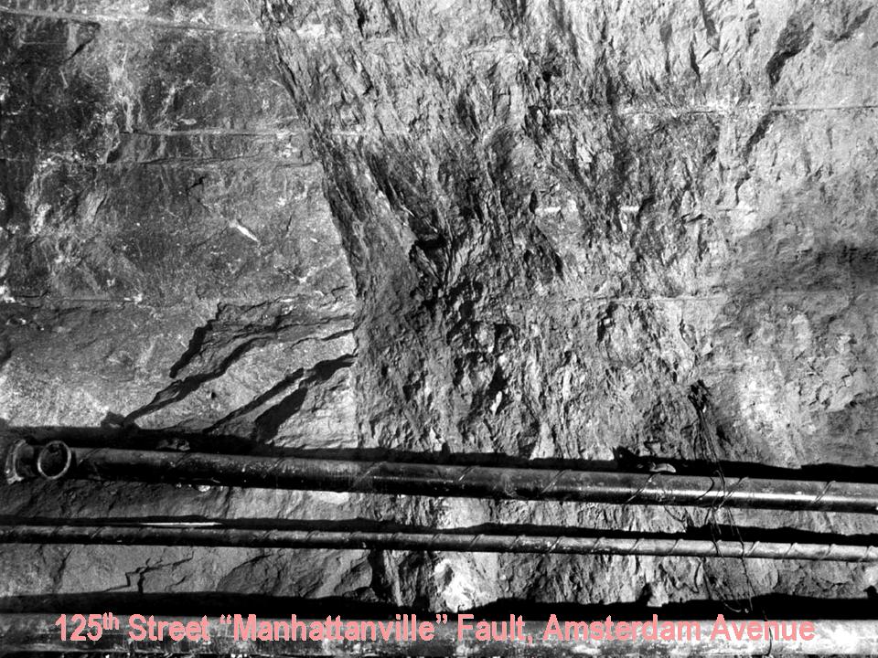
Image above right shows crush zone of the 125th Street "Manhattanville" fault iexposed and studied in City Water Tunnel #3, the result of protracted right-lateral normal oblique-slip fault motion.
A .pdf version (22 Mb) of his PowerPoint lecture can be found here.
Sunday, 22 March 2026; 4:50 PM
Geological Society of America Northeast Section (GSA)
Hartford Convention Center, 100 Columbus Avenue, Hartford CT 06103
Cameron's Line and the St. Nicholas Thrust in New York City (NYC)
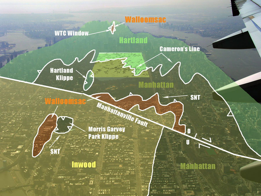 Dr. Charles Merguerian discussed his work on the structural geology and tectonic interpretation of Cameron's Line in NW Connecticut and both Cameron's Line (CL) and the St. Nicholas Thrust (SNT) zones in New York City - both structural elements of the Taconian suture of the New England Appalachians. Rocks found east of CL provide an exhumed view of a former accretionary wedge produced by oceanward subduction of the Laurentian margin beneath fringing oceanic strata adjacent to the Ammonusuc-Bronson Hill volcanic arc. Both CL and adjacent rocks exhibit shear folds, down-dip lineations, imbrication, mylonite, crystal-size reduction, migmatite and serpentinite - all elements of a major deep-seated shear zone. Although no age control exists in NYC as yet, in western CT, CL is intruded by mafic-ultramafic 446 to 452 Ma (Late Ordovician) intrusives, fixing a pre-Silurian age for the Taconian suture.
Mapping throughout Manhattan and the NY Botanical Garden, Bronx Zoo, Boro Hall and Crotona parks in the Bronx NY also shows annealed mylonite, migmatite and serpentinite associated with both CL and the SNT. His lecture ended with the field-based suggestion that medium- to high-grade sheared accretionary orogens may be best understood by abandoning simple layer-cake stratigraphic models and entertaining the idea that shearing and imbrication may be more pervasive than outcrop mapping may indicate, thus begging the question - Are there shear zones surrounding many exposures? His presentation abstract can be downloaded here.
To view a .pdf version (15 Mb) of his lecture click here.
Tuesday, 16 September 2025; 8:00 PM
Coykendall Science Building, SUNY New Paltz, NY
MHAA, Meetup Members and guests
Exploration and Geology of the Earth's Moon
Dr. Charles Merguerian discussed the geology of the Earth’s moon against the backdrop of the history of space exploration and discovery including pre-1969 sci-fi movies and world literature that accurately predicted our coming conquests. An active, published research scientist in the fields of Geology and Astrogeology and professor of many lunar geology courses, he will describe the lunar missions and geological evolution of the Moon paying particular attention to the sequence of human endeavors and discoveries that have led to our recognition of an open lunar window into the time of earliest Earth history where little geological evidence today exists. Indeed, based upon data analyzed from the seat-of-the-pants Apollo 11 through 17 missions of the 1960s and 1970s and subsequent decades of remote and spacecraft studies, our current understanding indicates that the Moon’s crustal rocks, regolith and surface features yield significant peeks into the first billion or so years of solar system history – a period of time from which few terrestrial rocks persist.
To view a .pdf version (12 Mb) of his lecture click here.
Better still, a video of his entire PowerPoint lecture can be seen at the following YouTube link.
Saturday, 17 May 2025; 1:30 PM
Franklin Mineral Museum, Franklin, NJ
FOMS Members and guests
Metamorphism and Metamorphic Rocks
 Presenting in person at the Franklin Mineral Museum, Dr. Merguerian shared a video-laced PowerPoint lecture with FOMS that unravelled the intricacies of metamorphism and metamorphic rocks with full discussion of regional, contact, shock and dynamic varieties. He provided field and petrographic images to document the variety of minerals and textures found in these disparate lithotypes and how to interpret their protoliths and tectonic position.
A .pdf version (14 Mb) of his Powerpoint can be found at the following link.
Friday, 09 May 2025; 6:30 PM
Orange County Mineral Society
Chester, NY
Free Admission, Refreshments
Constructing the Second Avenue Subway, NYC, NY
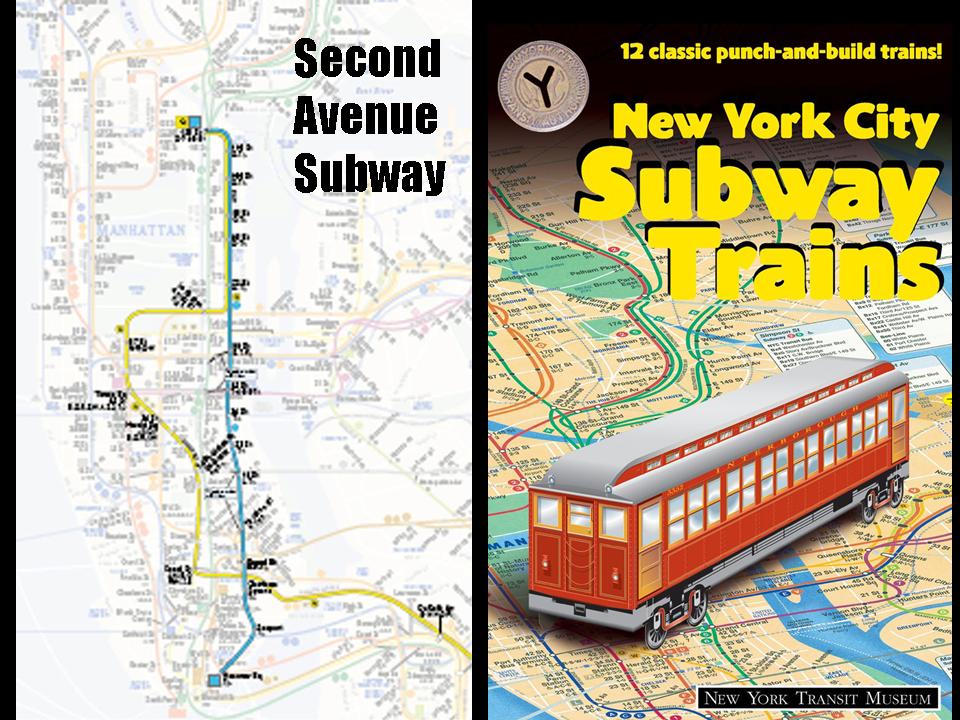 Presenting in person at the Orange County Mineral Society, Dr. Merguerian shared his involvement in as-built mapping of the 86th Street station complex of the Second Avenue Subway project in NYC, NY. He provided field and petrographic images to document the top-down construction methods that wonderfully displayed the structural geology, mineralogy and metamorphism of the subway cavern and the ancillary subsurface construction efforts including ancillary caverns, shafts and public access portals. These to provide access to the main tunnels which were constructed earlier utilizing a TBM.
A .pdf version (12 Mb) of his Powerpoint can be found at the following link.
Sunday, 06 April 2025; 2:30 PM
Stonybrook University, Stonybrook, NY
Free Admission
Tectonostratigraphy of Paleozoic New York City Schistose Rocks
 Presenting remotely from Dukelabs in Stone Ridge, NY, Dr. Merguerian shared a video-laced PowerPoint lecture with the 32nd Annual Geology of Metropolitan NY Conference in
Stonybrook, NY via Zoom in early 2025. Reporting on the results of his joint research with coauthor J. Mickey Merguerian, he discussed the history of NYC geological investigations and focused on issues concerning the stratigraphy and structure of the region.
Presenting remotely from Dukelabs in Stone Ridge, NY, Dr. Merguerian shared a video-laced PowerPoint lecture with the 32nd Annual Geology of Metropolitan NY Conference in
Stonybrook, NY via Zoom in early 2025. Reporting on the results of his joint research with coauthor J. Mickey Merguerian, he discussed the history of NYC geological investigations and focused on issues concerning the stratigraphy and structure of the region.
In NYC, the subvertical orientation, hardness and stitching granitoid intrusives of Manhattan Schist were perfect for sustaining the load of tall buildings and for supporting surface and subsurface infrastructure projects. After over 200 years of geological field study the pendulum has swung wildly from initial evaluations of a single formation (Manhattan or Hudson Schist) resting above Inwood Marble and older “Primitive” crystalline rock (Fordham-Inwood basement cover sequence) to our subdivision of the Manhattan Schist into regionally traceable essentially coeval lithostratigraphic equivalents with different formational names and former depositional settings.
Careful stratigraphic, structural and petrographic analysis has led to recognition of imbricated mylonitic rock units at subdivision boundaries forcing our view that NYC schistose rocks are separated by regionally important ductile faults that distinguish tectonostratigraphic units mapped as the Manhattan, Walloomsac and Hartland formations. These formations are traceable on the ground to far reaching lithostratigraphic correlatives to the north and northeast of NYC where rocks tend to be less metamorphosed and in some instances fossil-bearing.
For a free download of the extended abstract as presented kindly follow this link to (Merguerian and Merguerian 2025b).
A .pdf version (14 Mb) of their Powerpoint can be found here.
Wednesday, 11 December 2024; 7:00 PM
New York Mineralogical Club
NYC, NY
Free Admission
Geology of the NY Botanical Garden, NYC
 Presenting remotely from Dukelabs in Stone Ridge, NY, Dr. Merguerian shared a video-laced PowerPoint lecture with the NY Mineralogical Club via Zoom in late 2024. Reporting on the results of his joint research with coauthor J. Mickey Merguerian wherein he discussed the history of NYC geological investigations, widening of the Bolton Canal to produce the Harlem Ship Canal, views of minerals collected from that project at the turn of the century by the NYMC and focused on the stratigraphy and structure of the Botanical Garden. Enthusiasts or those posing as such should be aware that a .pdf version of his Powerpoint (22 Mb) can be found at the following link and a full video
of his presentation (large files) can be downloaded here in two resolution versions.:
Presenting remotely from Dukelabs in Stone Ridge, NY, Dr. Merguerian shared a video-laced PowerPoint lecture with the NY Mineralogical Club via Zoom in late 2024. Reporting on the results of his joint research with coauthor J. Mickey Merguerian wherein he discussed the history of NYC geological investigations, widening of the Bolton Canal to produce the Harlem Ship Canal, views of minerals collected from that project at the turn of the century by the NYMC and focused on the stratigraphy and structure of the Botanical Garden. Enthusiasts or those posing as such should be aware that a .pdf version of his Powerpoint (22 Mb) can be found at the following link and a full video
of his presentation (large files) can be downloaded here in two resolution versions.:
Friday, 10 May 2024; 6:30 PM
Orange County Mineral Society
Chester, NY
Free Admission, Refreshments
Fault Zone Minerals of the Queens Water Tunnel, NYC
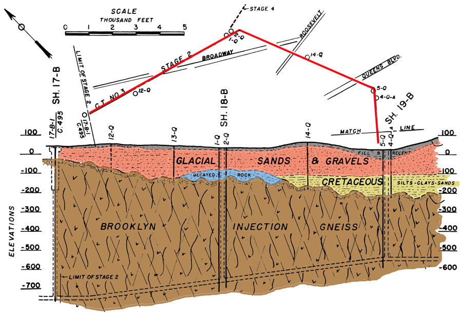
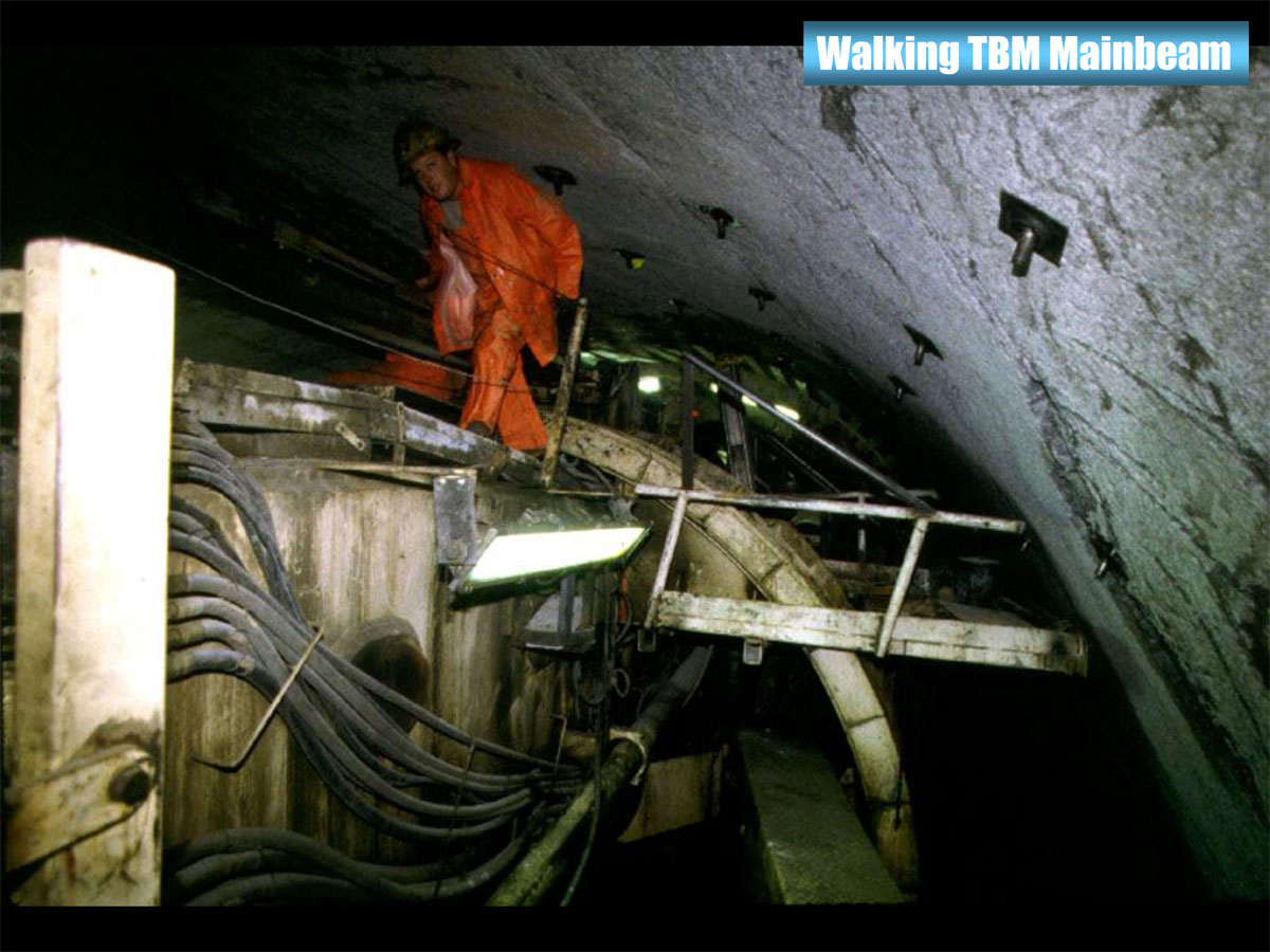
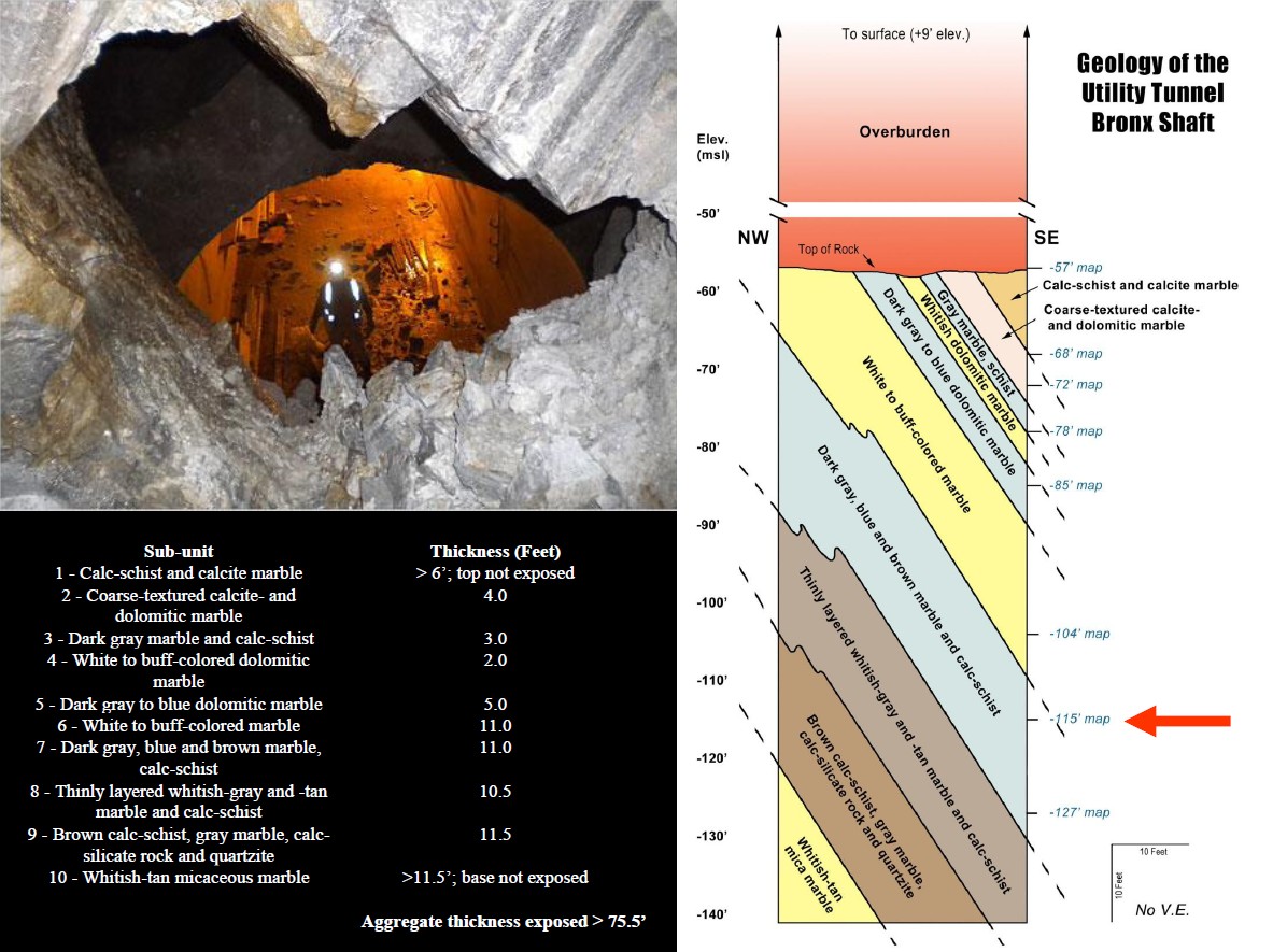
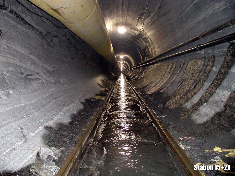
Between 1996 and 1999, a high-performance tunnel-boring machine (TBM) excavated a 23’ wide, 5-mile-long tunnel through metamorphic rocks of the Appalachian mountain chain in an area where no natural surface bedrock exposures exist except for the subsurface of southwestern Queens (Figure 1). Varying in depth from 690’ to 760’ below the surface and extending in a curved path from Maspeth northeastward to Woodside thence westward to Long Island City, the tunnel has been excavated by a 300’ long tunnel boring machine or TBM (Figure 2). The new tunnel, lined with concrete beginning in 2000, has exposed a treasure trove of new information on the bedrock geology of New York City that we were fortunate enough to map in detail at a tight scale of 1” = 10’.
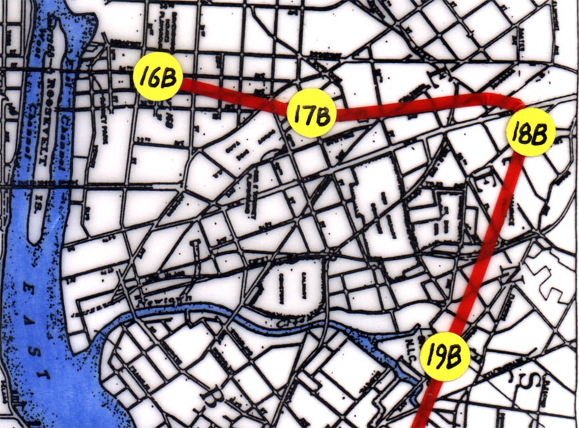
Index map showing the trace of the 25,000’ long Queens Tunnel (red line) and the intervening shafts (16B, 17B, 18B, 19B). Tunnel stations begin at Station 0+00 at the main construction shaft (19B) and mark footages from Shaft 19B to 18B (~Station 100+00; 10,000’ away from 19B) where the tunnel curves from a NNE trend to a WNW trend. Note that Shaft 17B is at Station 171+00 and Shaft 16B is at Station 250+00.
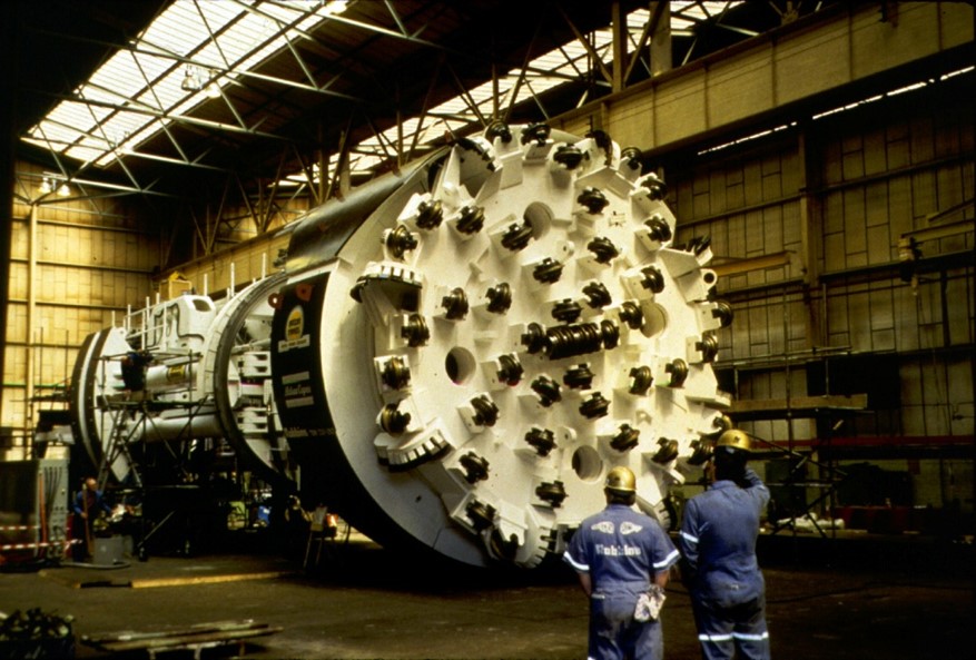 The front cutterhead and thrust assembly (business-end = 84' length and 23' diameter) of the Tunnel Boring Machine that formerly operated beneath western Queens. With a total length of nearly 300', the complete machine excavates, processes, and removes the rock chipped by the cutters. The cutterhead rotates against the raw rock face with thrust applied hydraulically by mechanical contact from behind against the sides of the bored tunnel. The TBM holed-through beneath Long Island City in October 1999 after three years of nearly continuous subsurface mining.
The geological staff at Duke Geological Laboratories were retained as geological consultants for the joint venture contractors (Grow-Perini-Skanska) during the construction of the Queens Tunnel between 1998 and 2001. During that interval, detailed geological mapping of the tunnel perimeter resulted in 250 maps of the tunnel and a number of technical publications.
Five generations of brittle faults are superimposed on polydeformed bedrock units of the Queens Tunnel often causing brittle reactivation of ductile faults and pre-existing brittle faults (Merguerian 2002b). A hitherto unknown, steeply dipping, major NNE-trending fault set cuts the Queens Tunnel from beginning to end but most are strongly concentrated along the NW tunnel leg just beyond the major curve in the tunnel. In general, brittle faults are outlined by zones of fault breccia, clay-rich gouge, zeolite+calcite+pyrite mineralization, and quartz veins.
The NNE-trending faults constitute a third (~100) of all mapped brittle faults in the tunnel. They form a system of geologically young dip-slip faults and related joints with an average N21°E trend and steep dips. The faults are characterized by thick clay, breccia, and clayey gouge that vary in thickness from 1 cm up to 5 m. Minerals found healing the NNE-trending faults show a clear paragenesis of apophyllite and/or heulandite followed by stilbite of two generations (yellow to orange followed by translucent stilbite). The stilbite is overgrown with spheres and interpenetrant cubes of pyrite, calcite, and clear crystals of chabazite.
Dr. Merguerian’s well-attended PowerPoint lecture included a discussion of the bedrock geology and brittle fault history of NYC based on his studies of the Queens Tunnel and his decades of mapping elsewhere in NYC. The lecture will be highlighted with images of the fault zone minerals.
A .pdf version of his PowerPoint lecture (13 Mb) can be found here.
Sunday, 14 April 2024; 1:30 PM
Stonybrook University - 31st Annual Geology of Metropolitan NY Conference
Stonybrook, NY
Free Admission
Stratigraphy, Structure and Tectonic Implications of the New York Botanical Garden, Bronx, NY
 With coauthor J. Mickey Merguerian, Dr. Merguerian reported on two decades of joint field mapping, structural analysis and petrography of bedrock at the New York Botanical Garden (NYBG) in the Bronx, NY. Starting with our dear late colleague Dr. John E. Sanders, our analysis began with research in support of our On-The-Rocks field trip program of the NY Academy of Science of post-Woodfordian Bronx River diversion (Merguerian and Sanders 1996a, 1997), mapping and petrography of a NYBG building site (Pfizer Building) then under construction in the NW corner of the Garden (Merguerian and Sanders 1998) and adjacent Bronx parks (Fuller, Short and Merguerian 1999). Research continued in 2011 and 2024 with outcrop mapping of the entire grounds and a recent guidebook and field trips for the LIAPG in April 2024. Here we compile the results of these protracted studies with new geological maps, a location map and our findings on the structural geology and tectonics of the NYBG. For a free download of the extended abstract as presented kindly follow this link to Merguerian and Merguerian 2024b.
A .pdf version (12 Mb) of their extended abstract can be found here.
Friday, 12 May 2023; 6:30 PM
Orange County Mineral Society
Chester, NY
Free Admission, Refreshments
Geology and Mineralogy of the Hudson Highlands and Bear Mountain
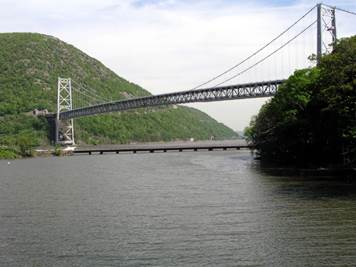 Dr. Merguerian’s video-enriched PowerPoint lecture will discuss the history and current understanding of the age and geological development of the Bear Mountain region including the history of bedrock studies of the metasedimentary and metaigneous rocks, the classic mineral specimens from local mines, the emphatic structural controls on the zig-zag course of the Hudson River through the Hudson Highlands and the evidence for the multi-glacial history of the region. In addition, he will discuss his recent geotechnical work on the cable strengthening project and historic two-year (1923-24) construction of the Bear Mountain Bridge – a unique engineering feat with both above- and sub-roadbed suspension.
 Merguerian’s 2003 mapping and analysis showed that the explanation for the shifting of bedrock cable ties and supports that resulted in measurable concrete bunker cracking, shifting and rupture of individual cable strands and stretching of the cables and the remedial efforts that took place to ensure safety of the anchorages, tiebacks, bridge towers and roadway. Detailed bridge anchorage area mapping showed the presence of deeply weathered NNE-trending, steep NW dipping brittle faults that reactivate older ductile structures in the rock mass and show opening and separation within the east anchorage. This unfavorable orientation, perpendicular to the cables, was the cause of great concern given the regional importance of this transportation connecting link and the seismic potential of the area.
A .pdf version (22 Mb) of his Powerpoint can be found at this link.
Thursday, 26 May 2022; 1:30 PM
American Society of Civil Engineers
Metro New York Conference
NYC, NY
Con Edison’s New Plasma Tool (PT) for Trenching and Shallow Excavations
 Working as consultants for Con Edison, your heroes CM and JMM worked with Con Edison personnel and outside consultants on the development of a new plasma tool employing pulse technology for breaking rock. Our input involved understanding how rocks break – namely 10 times easier under tension than compression! The plasma tool was developed by Petram Technologies in NJ based on principles employed by NASA for space missions. This joint paper was copresented by Dr. Merguerian of Dukelabs and Silvia Khurrum of Con Edison.
 The tool is a high voltage probe that uses a fully charged capacitor bank to send a massive energy pulse down the probe into a pre-drilled hole in bedrock, placed to take advantage of natural failure features or dislocations (foliation, joints, faults). A small amount of water is placed into the drill hole and the plasma tool is inserted before powering up with a high voltage pulse. The water becomes instantly vaporized into plasma and the rapid expansion and instantaneous rarefaction of the rock mass creates a tension environment that breaks rock easily under tension. Useful for urban construction efforts in hard rock where blasting is prohibited, removal of boulders in glacial drift and other instances where artisanal rock removal, our joint paper with Con Edison and Petram (Merguerian, Khurrum, Merguerian and Magnotti 2022) is available for free download.
A .pdf (14 Mb) of our joint presentation can be found at this link.
Thursday, 26 May 2022; 2:00 PM
American Society of Civil Engineers
Metro New York Conference
NYC, NY
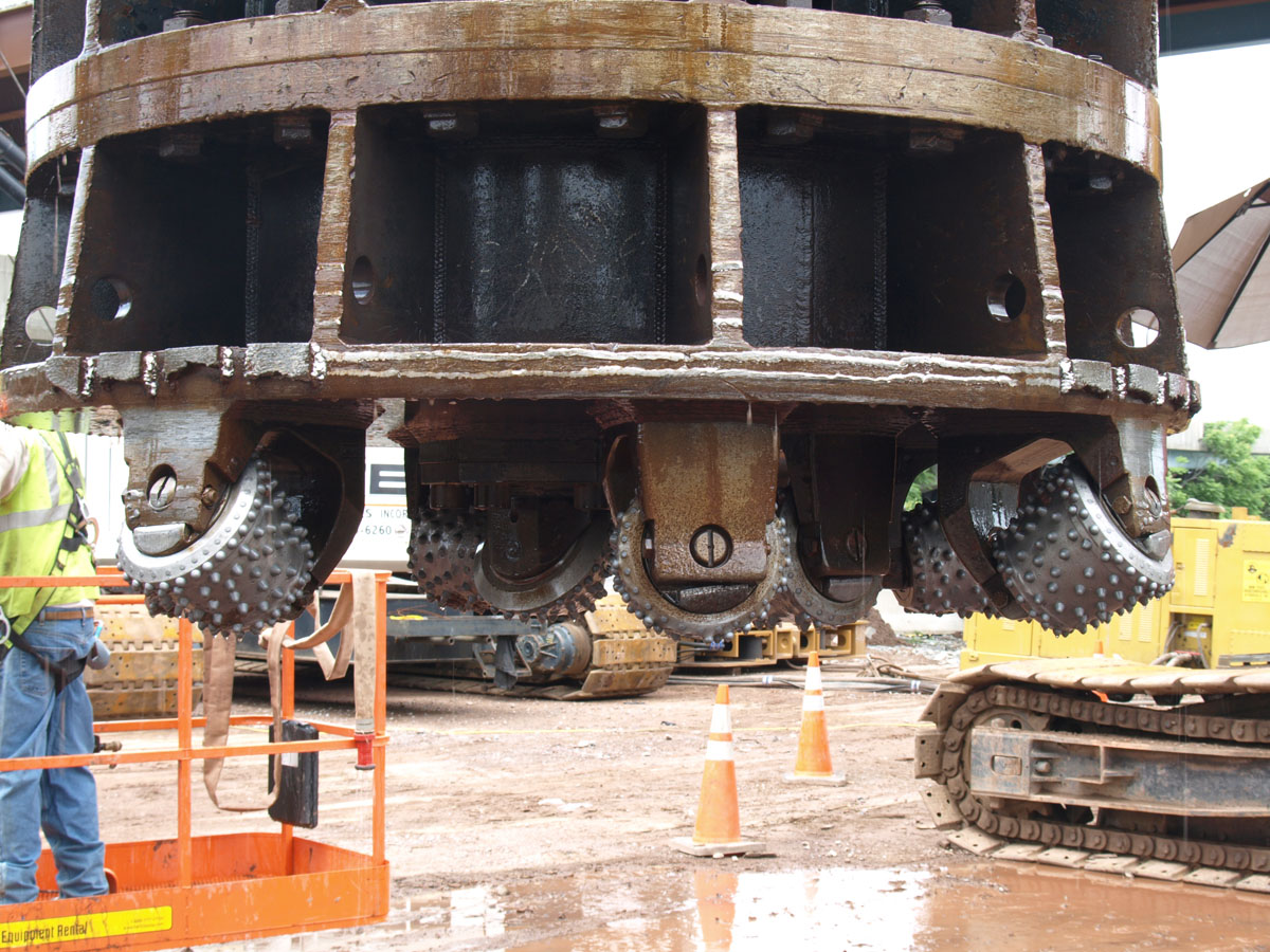
Geological Solutions Providing a Scientific Basis for Differing Site Condition (DSC) Claims
 Mickey’s presentation at the ASCE conference in NY from Dukelabs DSC, with coauthor Merguerian the Elder of Dukelabs watching from the gallery, provided geotechnical specialists, engineers, cost analysts and bid preparers guidance for avoiding construction claims with effective risk analysis based on latent geological controls for bedrock projects. Using varied case histories from TBM hard-rock tunneling in Proterozoic orthogneiss of the Queens Water Tunnel of City Tunnel #3, to caisson installations into Mesozoic sedimentary rocks in NJ and drilled pile sites in fractured Paleozoic marble in NYC, he shared some of the techniques we have employed to provide a scientific basis for DSC claims.
 Basic geological investigations are the basis for any construction efforts that take place in rock. Rock is not just rock – there are differences! Unless rock mass properties and regional geological structure are fully understood, excavation means and methods are a moving target. Cost effective rock removal depends on the yield properties of rock not detected in core boxes but in the real world with real rocks both surrounding and beneath them. Thus, behavior depends on many factors which in many cases can be evaluated and detected pre-bid. Their joint paper (Merguerian and Merguerian, 2022b).
A .pdf (13.6 Mb) of their joint presentation can be found here.
Saturday, 23 April 2022; 10:00 AM
Long Island Geologists
Stony Brook, NY
Geological Solutions for Providing a Scientific Basis for Differing Site Condition Claims
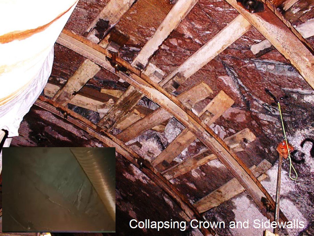
 As an adjunct to construction risk assessment and to establish as-built claim recoveries over the years, we have applied many simple geological techniques to evaluate a broad array of anomalous subsurface conditions that resulted in impeded production rates and expanded construction costs throughout the NYC metropolitan region. These issues were detected in varied geological terrains for both tunnel boring machine (TBM) and traditional drill and blast tunnel excavations, large-diameter vertical shafts and smaller-diameter caisson and pile installations. The natural subsurface conditions resulted in costly remediation efforts and prolonged differing site condition (DSC) claims where unanticipated underlying geological causes resulted in low penetration rates, short stand-up times, water and material inflows, sidewall- and crown collapse and invert heave. Job-suspending excessive inflows of water and materials during drilling of vertical shafts were also experienced at various locations.
J. Mickey Merguerian made the late-Covid online presentation and we have the video (573 Mb) to prove it! A copy of their joint paper (Merguerian and Merguerian 2022a) and a .pdf (9 Mb) of their PowerPoint presentation can be found at this link.
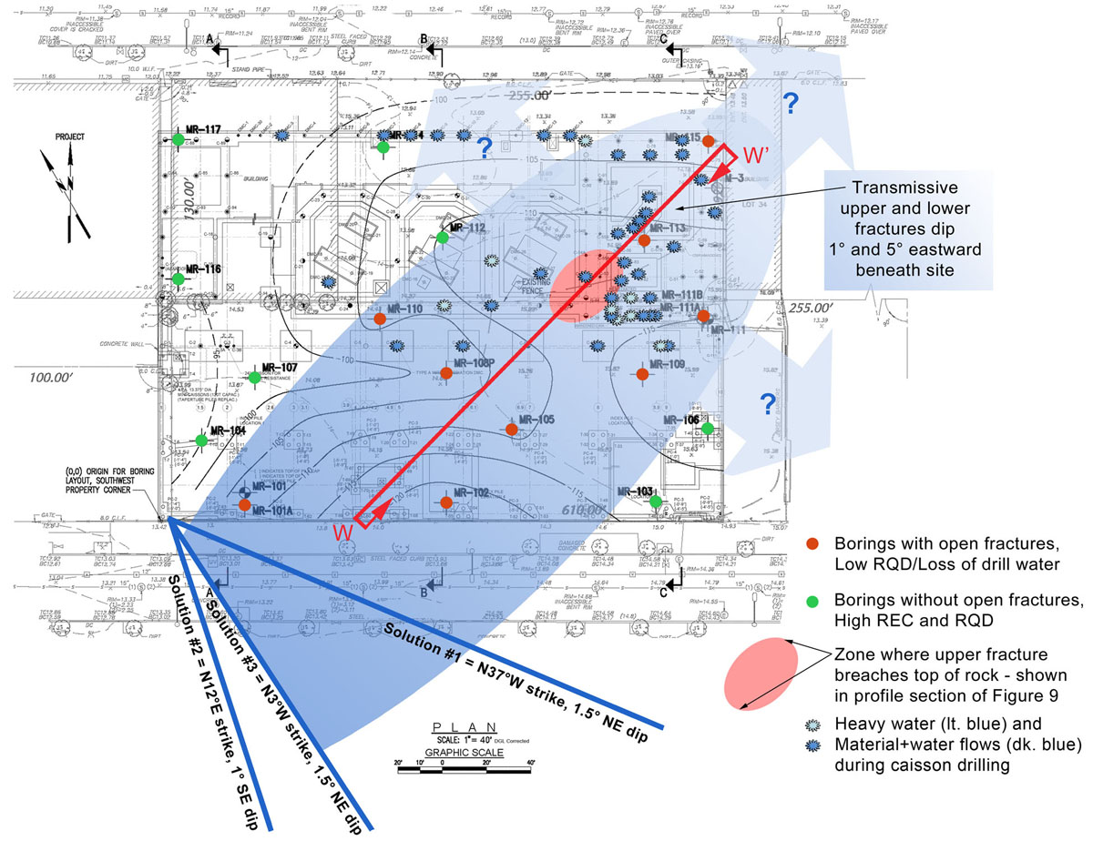
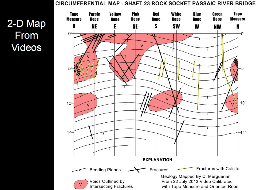
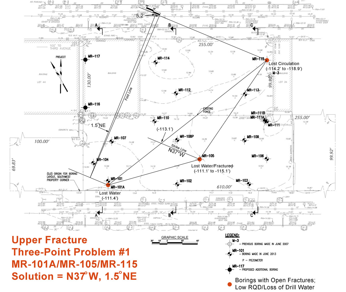
Simplified plan map showing the three strike solution results of the three-point analysis solutions provided in their text (dark blue lines) and two additional solutions not shown and borings harboring open fractures, low REC/RQD % and reported loss of drill water (red dots). Note the spatial coincidence of these borings with the projected footprint of the transmissive upper and lower fracture zones (eastward dipping blue ellipsoid) and their possible extensions down-dip and along strike (extended blue arrows). Also projected upward into plan view is the breached zone where the upper fracture zone is at or near the top of rock (pink ellipse).
Friday, 11 March 2022; 6:30 PM
Orange County Mineral Society
Chester, NY
Free Admission, Refreshments and Autographs
Gold Mining History and Geology of the Sierra Nevada Range
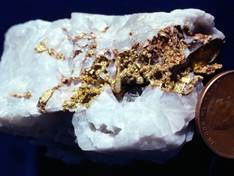
During the Cretaceous Era, gold-bearing fluids associated with the geological development of the Sierra Nevada range introduced gold+quartz veins into the Earth’s crust. Erosion related to the Cenozoic uplift and tilting of the range exposed these veins to the surface and concentrated the dense gold in stream beds where a serendipitous late 1847 discovery at Sutter’s Mill in northern California led to the greatest rush of people, equipment and resources to the region ever witnessed. There’s “gold in dem thar hills!” – an expression that spread like wildfire around the world and caught the eye of savvy investors and entrepreneurs on the East Coast who gave the thumbs up – the Gold Rush had begun. Within five years, the terrain was dug up, overturned and searched by many different cultures using very different techniques.
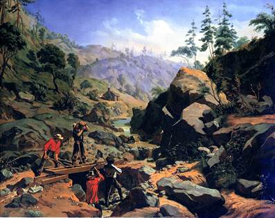 Having spent four summers mapping rocks in the Sierra Nevada range and specifically in the central California gold belt the speaker (an 8-ohm speaker, btw, with no resistance to sharing his knowledge) has intimate knowledge of the geology and mining history of the region. His Powerpoint lecture will explain the genesis of gold-bearing fluids and their injection into the roots of the Sierra and the geological processes that resulted in gold concentration in the wallrocks of the Sierra Nevada batholith. With discussion of the geology, terrain and human migration to the area the lecture will explain the various methods of
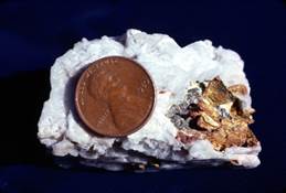 gold mining and end with images taken of the old hard-rock and placer mines and other gold venture sites and show the result of the gold miner’s efforts in the form of nugget and crystalline gold.
A .pdf version (27 Mb) of his PowerPoint lecture can be seen here.
Friday, 09 July 2021; 6:30 PM
Orange County Mineral Society
Chester, NY
Free Admission, Refreshments and Autographs
History of Mining and Their Minerals - Western Connecticut
Tonight’s lecture exposed club members to the four types of mineralization mechanisms that have been detected in the rocks of western Connecticut. Each with a distinctive suite of minerals, these include 1) volcanic- and shallow-level intrusive systems, 2) intermediate depth hydrothermal systems, 3) deep magmatic systems and 4) intermediate- to deep metamorphic agencies.
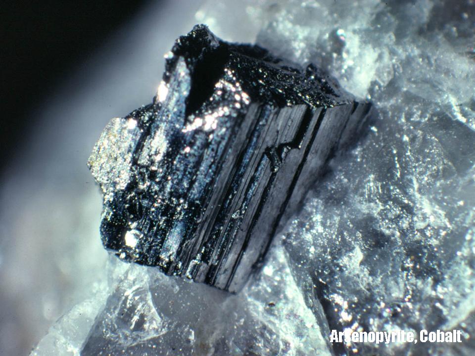 Through the use of maps, cross-sections, and diagrams a discussion of the bedrock geology of western Connecticut in the context of the plate tectonic assembly, will prep the stage but the lecture will be dominated by highly illustrated “visits” to many of the classic collecting localities explored during his career including specimen images from the Dukelabs.com collection. Localities described with maps and images will include:
Bristol Copper Mine
Cobalt Mine
Hodges Nickel Mine
Lane’s Tunsten Mine
Long Hill Tungsten Mine
Newgate Prison Locality
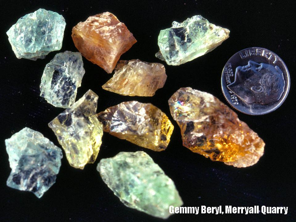
Pegmatites (Branchville, Merryall, Harwinton, Thomaston, Southbury, Middletown District, etc.)
Roxbury Garnet Mine
Roxbury Iron Mine
Salisbury Iron District
West Redding Garnet-Epidote Locality
A .pdf version (32 Mb) of his PowerPoint lecture can be seen here.
Thursday, 28 September 2017; 7:00 PM
Ulster County Community College
Stone Ridge, NY
Free Admission, Refreshments and Autographs
NYC Earthquakes: Can It Happen There?
 Modern seismicity along NW-trending faults in NYC is a matter of scientific record. The epicenter of a small earthquake (~2.4 Richter) localized in NYC on 17 January 2001 plots adjacent to the trace of the
Dr. Merguerian will provide evidence that the NW-trending faults of NYC should be considered “active faults”. Unequivocal post-glacial ground rupture is difficult to demonstrate in NYC where most bedrock faults are deemed to have formed at depth and then later elevated and eroded up to the surface. Yet, the Bronx River, which formerly flowed SSW in an open valley underlain by the Inwood Marble, shows diversion away from its "pirated" marble valley by exhibiting displacement of course across the NW-trending right-lateral Mosholu fault. South of the fault, the river now flows in a non-glaciated south-trending V-shaped gorge through more-competent gneiss and schist of the Hartland Formation.
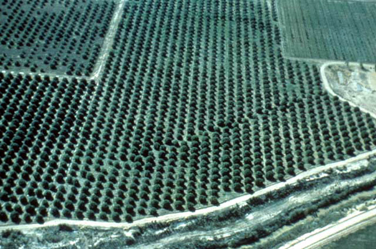
Image above right shows obvious offset of orange grove planted in former straight rows across the San Andreas fault in California, the result of protracted fault creep.
(Image above by John W. Shelton, Geology Illustrated, 1976.)
A .pdf version (16 Mb) of his PowerPoint lecture can be seen here.
Tuesday, 12 April 2016; 7:00 PM
Ulster County Community College
Stone Ridge, NY
Free Admission and Refreshments
9 Million Thirsty People - Supplying NYC With Catskill Water
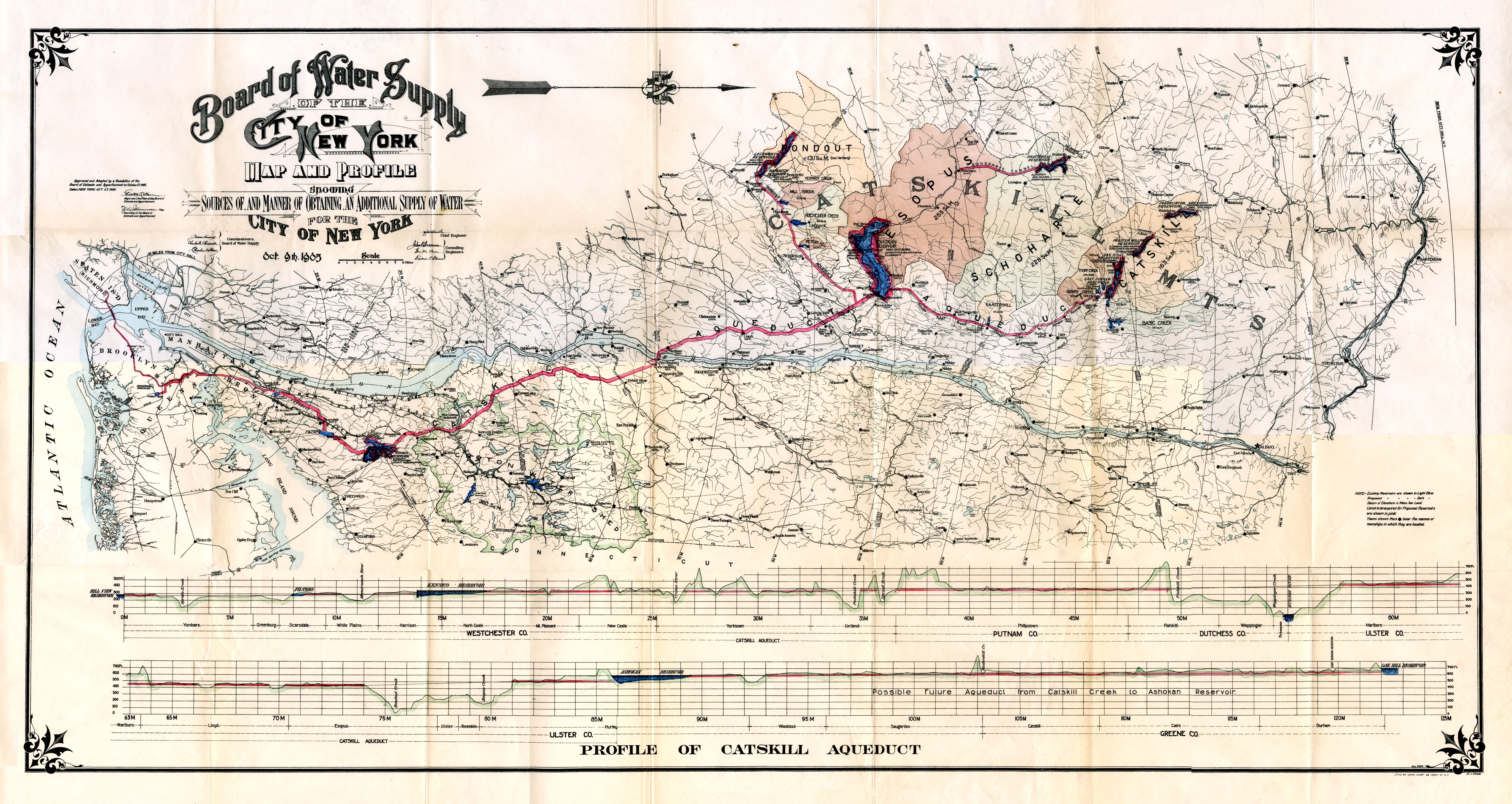 Most of New York City and all ofLong Island are, in fact, islands surrounded by saltwater. So how do we get enough fresh drinking water to supply over 9 million people? New York City relies on a system of tunnels to bring fresh water from pristine reservoirs in the Catskills (Click here for high resolution 1906 Board of Water Supply map of Catskill Aqueduct). This gravity-feed tunnel system relies on the difference in elevation between the Catskills and NYC. It passes just south of the UCC campus, under the Rondout Creek and Shawangunk ridge southward to NYC traversing through an extremely variable geological underpinning. The water tunnels, whose alignment and engineering intricacies were dictated by regional geology, are one of the great engineering works of the Twentieth Century. Dr. Merguerian, who has been in almost all of the NYC tunnels during his 40+ year career as a geotechnical consultant, will explain how we get our water and take us deep (over 700') under the city inside a 23'-diameter water tunnel that was excavated beneath Queens by a 300'-long tunnel boring machine. Digital images and allied video as seen through the eyes of a geologist will bring participants underground to see the inner workings of the tunnels and the machines and people that constructed them. Bring rubber boots, just in case of a major leak. What's that noise?
A .pdf version (17.6 Mb) of his PowerPoint lecture can be seen here.
Friday, 13 November 2015; 7:00 PM
Geological Society of Connecticut
Meriden, CT
Free Admission, Refreshments, and a Rub-down
Wallrocks of the Hodges Complex and Tyler Lake Granite, West Torrington, CT
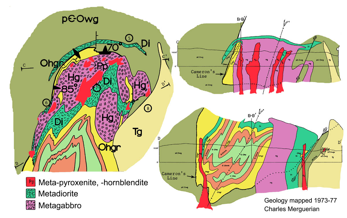 This lecture focused on the bedrock stratigraphy and structure of the wallrocks and contact relationships of the mid-Ordovician (455 Ma) Hodges and younger Tyler Lake intrusives in West Torrington, CT. The lecture included the history of prospect mining, mineralogy, and research on the Hodges Nickel prospect. The related Spring 2016 field trip included many stops to best illustrate the stratigraphy and structure of the region, as mapped by the author in 1973-77 (Merguerian 1977). A link to this publication and included detailed geological maps can be found here (Plates 1 and 2 [Note: large files!]).
Merguerian's other CT publications can be downloaded from www.dukelabs.com/Publications/PubsPdf/DLPubs.html.
Ample time was spent examining and discussing separation of the subunits of the Hartland and Waramaug formations on either side of Cameron's Line, a folded Taconian plate boundary suture zone. Ductile structures and lithologies associated with Cameron's Line and contact relationships with crosscutting plutons will be examined. The trip will be an amalgam of stops from a previous NEIGC trip conducted three decades ago (Merguerian 1985d) and will include additional stops based on more recent investigations. A guidebook will be provided.
A .pdf version (16.6 Mb) of his PowerPoint lecture can be seen here.
Saturday+Sunday, 16-17 October 2015
Geological Association of New Jersey
Lafayette College, Lancaster PA
Review of New York City Bedrock with a Focus on Brittle Structures
Dr. Merguerian participated in delivering a lecture and providing conference proceedings for the 32nd Annual GANJ Conference. His presentation focused on unravelling the brittle fault history of the NYC area using data from mapping of brittle fractures cutting the oldest of NYC rocks (1.1 Ga Queens Tunnel Orthogneiss Complex) exposed during TBM tunneling of the Queens Water Tunnel of City Tunnel #3.
Conference organizer, colleague and dear friend Dr. Gregory C. Herman was instrumental in importing fracture measurements into Google Earth to produce a 3D graphical view as seen below.
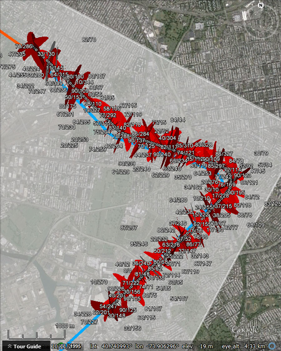
Google Earth views of structures mapped in part of the Queens Tunnel showing the predominance of NNE- and NW-trending brittle discontinuities. Red ellipses show brittle fault planes. Google Earth KMZ file available through the GANJ web site, and visualized by G. C. Herman. Data from Merguerian (2000).
A .pdf of the GANJ conference paper (Merguerian 2015b) and a .pdf (12 Mb) of his conference PowerPoint lecture can be downloaded here.
Wednesday, 14 October 2015; 8:00 PM
New York Mineralogical Club
NYC, NY
Free Admission
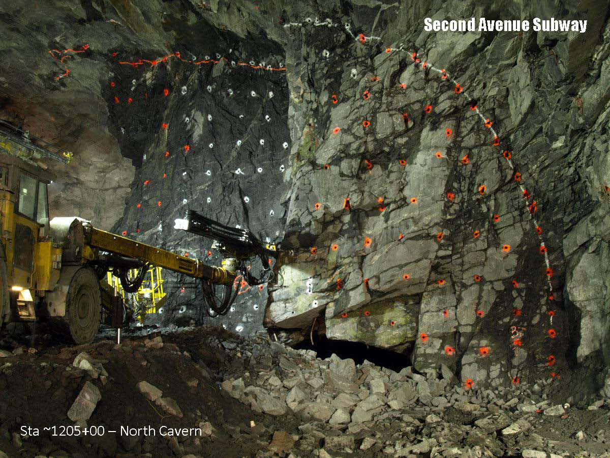
Geology and Mineralogy of the Second Avenue Subway, NYC, NY
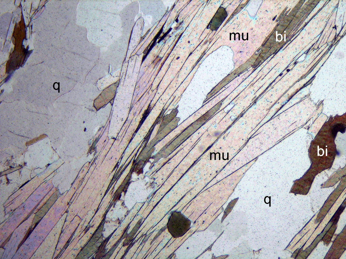
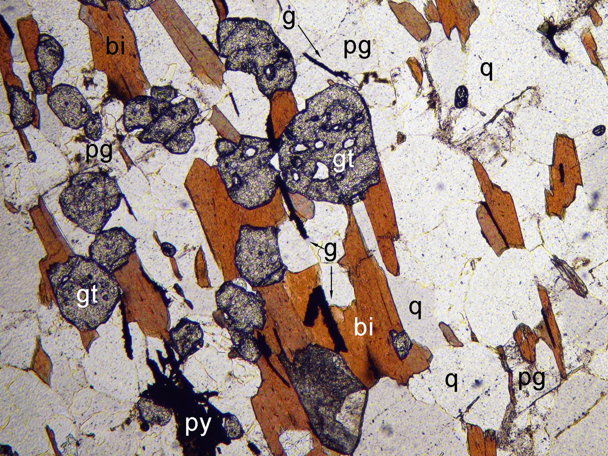
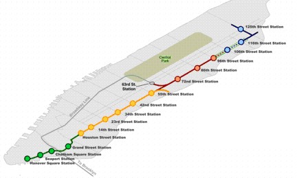 The Second Avenue Subway project in NYC has provided for a thorough three-dimensional study of the stratigraphy, structure, and metamorphism of the Hartland Formation in NYC. Site inspections and mapping over a period of 1.5 years of TBM-bored tunnels and top down ancillary station complex excavations indicate that the Hartland in this part of NYC exposes a very well-layered schistose to gneissic rock mass consisting of the assemblage muscovite-quartz-plagioclase-biotite±kyanite±staurolite±garnet with interlayers of quartz plagioclase-mica granofels, greenish amphibolite±biotite±garnet and subordinate gray quartzite±biotite±garnet. The schistose facies is lustrous and consists primarily of aligned fine- to coarse-textured muscovite and thus splits readily along the foliation and also lithologic contacts. The mica gneiss, granofels, amphibolite, and quartzite interlayers are typically massive and quite hard, contain much less mica than the schist and may not show pronounced foliation.
Superposed ductile structures are cut by brittle features including foliation joints (J1) produced parallel to the regional foliation and by steep NNE- to NE-trending (J2) joints and dip-slip faults mineralized and infilled by stilbite+calcite, by younger steep NW-trending (J3) joints and strike-slip faults (Manhattanville "125th Street" series) infilled by K-feldspar, microcrystalline epidote, quartz and pyrite, and by moderately dipping J4 joints. Gently inclined well-layered Hartland rocks in NYC cut by intersecting steep discontinuities have proven to be excellent candidates for efficient subsurface mining by TBM, traditional drill and blast techniques, and by mechanical means and methods of excavation. The Powerpoint lecture will take attendees on a virtual tour of the subsurface of NYC and show some interesting occurrences and specimens of mineral that have been discovered in the open joints and fractures.
A .pdf version (21 Mb) of Merguerian's PowerPoint lecture can be seen here.
Saturday, 11 April 2015
Long Island Geologists - Geology of Metropolitan NY Conference
Stonybrook, NY
Free Admission
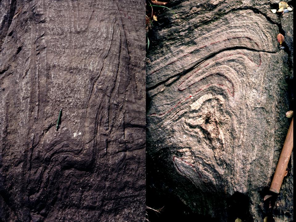
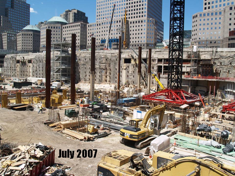
Structural Geology and Metamorphism of the World Trade Center Site
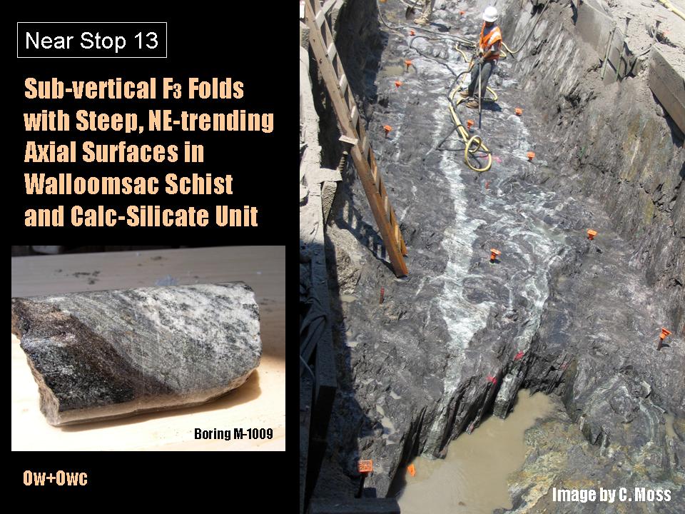
 Dr. Merguerian and coauthor Cheryl Moss of Mueser-Rutledge Consultants contributed to the twenty-second Annual Conference on Geology of Long Island and Metropolitan New York at SUNY Stony Brook on their bedrock analysis at the World Trade Center site. Detailed bedrock mapping, highlighted in 2008 in the History Channel documentary Super City New York, has shown that NE-trending foliated metamorphic rocks of the Hartland and Walloomsac formations traverse the site from NE to SW. Their field and petrographic data documents the presence of field- and petrographically distinct features that expand on an earlier effort presented at an earlier conference meeting (Merguerian 2010) and shown below [graphitic Walloomsac (below R) and aluminous Hartland (above L)].
 Previous published maps of southern Manhattan identify the bedrock in the area of the World Trade Center to consist of Manhattan Schist (Kemp 1887; Mather 1843; Berkey 1910 and 1933) covered by a thin mantle of glacial drift. Our dear friend Charles Baskerville’s 1994 map of Manhattan indicates all Manhattan Schist south of Canal Street, following the published work of all previous workers. By contrast their studies found no Manhattan Schist, rather schistose rocks belonging to lithostratigraphically different formations. Analysis of the equilibrium mineral assemblages indicate that depth of burial of the current surface bedrock was formerly at a minimum of 24 km.
A .pdf (8 Mb) of Merguerian’s lecture can be found here.
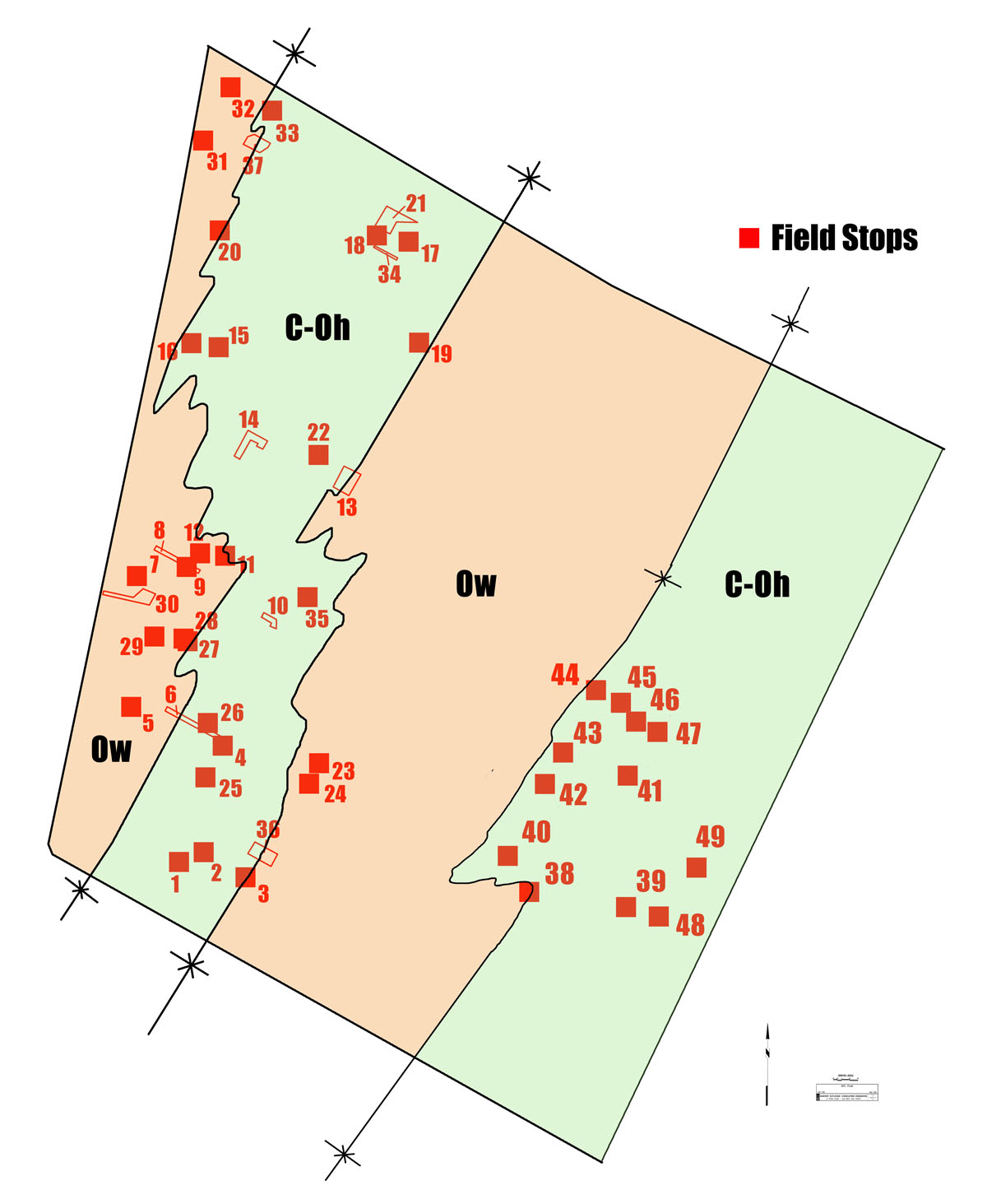
Figure 7 from Merguerian and Moss (2015) – Preliminary geological map showing stop locations for most of the stop locations used in this study. Note the duplication of two parallel belts of Walloomsac (Ow) and Hartland (C-Oh) rocks describing an overall steeply dipping sequence with NE-trend and late folding of contacts by asymmetric F3 folds. It is unknown at present whether the duplication is the result of isoclinal folding, strike-parallel shearing or both. Petrographic analysis of collected samples shown in smaller images above.
Wednesday, 18 March 2015; 7:00 PM
Hudson-Mohawk Professional Geologists Association (HMPGA)
Albany, NY
Geological Controls on Megaconstruction Tunneling Projects, NYC
 Speaking to a HMPGA dinner meeting as guest speaker, Dr. Merguerian listed all twelve of the major TBM tunneling efforts in NYC from 1971 to 2015 and virtually, using PowerPoint slides and embedded video clips, took the well-fed audience into three megacontruction projects he was fortunate enough to be retained as site geologist – The Queens Water Tunnel, East Side Access and Second Avenue Subway projects.
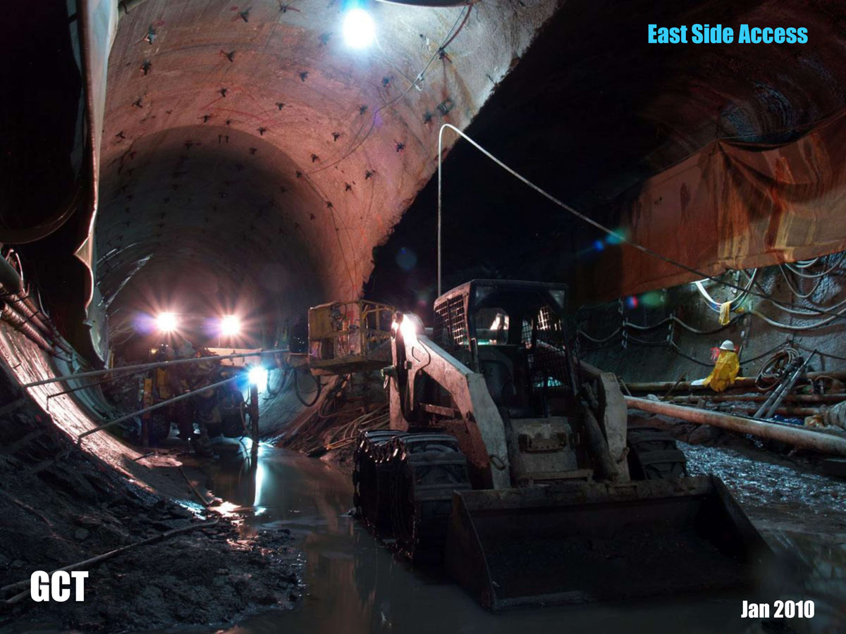
He explained the general difficulties encountered in deep TBM tunneling in NYC and specifically the types of ground behavior that created downtime and loss of utilization of the TBM system in selected projects. He explained how unanticipated subsurface geological features by bidding contractors and poor pre-bid risk analysis contributed to the as-built construction losses.
A .pdf version (22.6 Mb) of his PowerPoint lecture can be found here.
Saturday + Sunday, 06-07 September 2014
Lamont-Doherty Earth Observatory (LDEO)
Palisades, NY
Manhattan Prong Overview and NYC Bedrock Tribulations
Professor Merguerian delivered the opening overview lecture at a two-day workshop devoted to the current state of understanding of the geology of the Manhattan Prong and outlining the outstanding issues of confusion for future work. Merguerian, along with coauthor J. Mickey Merguerian also led a conference field trip on Sunday, 07 September to Isham and Inwood parks in northern Manhattan based on their joint research. A .pdf guidebook (9.5 Mb) for this field trip can be downloaded here. Organized by our dear friend and colleague Dr. Terry Plank, his and other presenters working in the Prong and in similar Appalachian rocks described their field, geochemical and geochronologic techniques for unravelling the intricacies of such complexly deformed metamorphic terrains.
A bloated .pdf (38 Mb) of his keynote lecture presentation can be downloaded at this link.
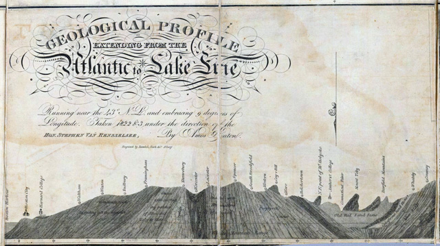
Figure shows a historic geological profile section from the Atlantic Ocean to Lake Erie by Amos Eaton (1825).
Sunday, 29 June 2014
Aldrich Contemporary Art Museum
Ridgefield, CT
The Science Behind Cameron’s Line
Artist Michael Joo’s fascination with the textures and fabrics of the rocks associated with sutured plate boundary known as Cameron’s Line in western Connecticut resulted in a museum opening of his magnificent sculpture entitled Drift as shown to left. It was the hook to get Professor Merguerian involved in a joint presentation where he “opened the opening” with a PowerPoint lecture on the geology and significance of Cameron’s Line – a cryptic suture in the New England Appalachians.
Merguerian relayed the instance when at a technical conference after publication of his 1983 American Journal of Science paper on Cameron’s Line, how Dr. Eugene Cameron, an economic geologist from the University of Wisconsin confronted him. In disbelief upon seeing his name tag on approach, Merguerian was delighted to hear from Cameron himself that he liked the AJS paper. Then, his hero Gene Cameron humbly divulged “I don’t know why they called it Cameron’s Line – it was John Agar who told me about it”.
A .pdf of Merguerian’s opening of the opening presentation can be found here.
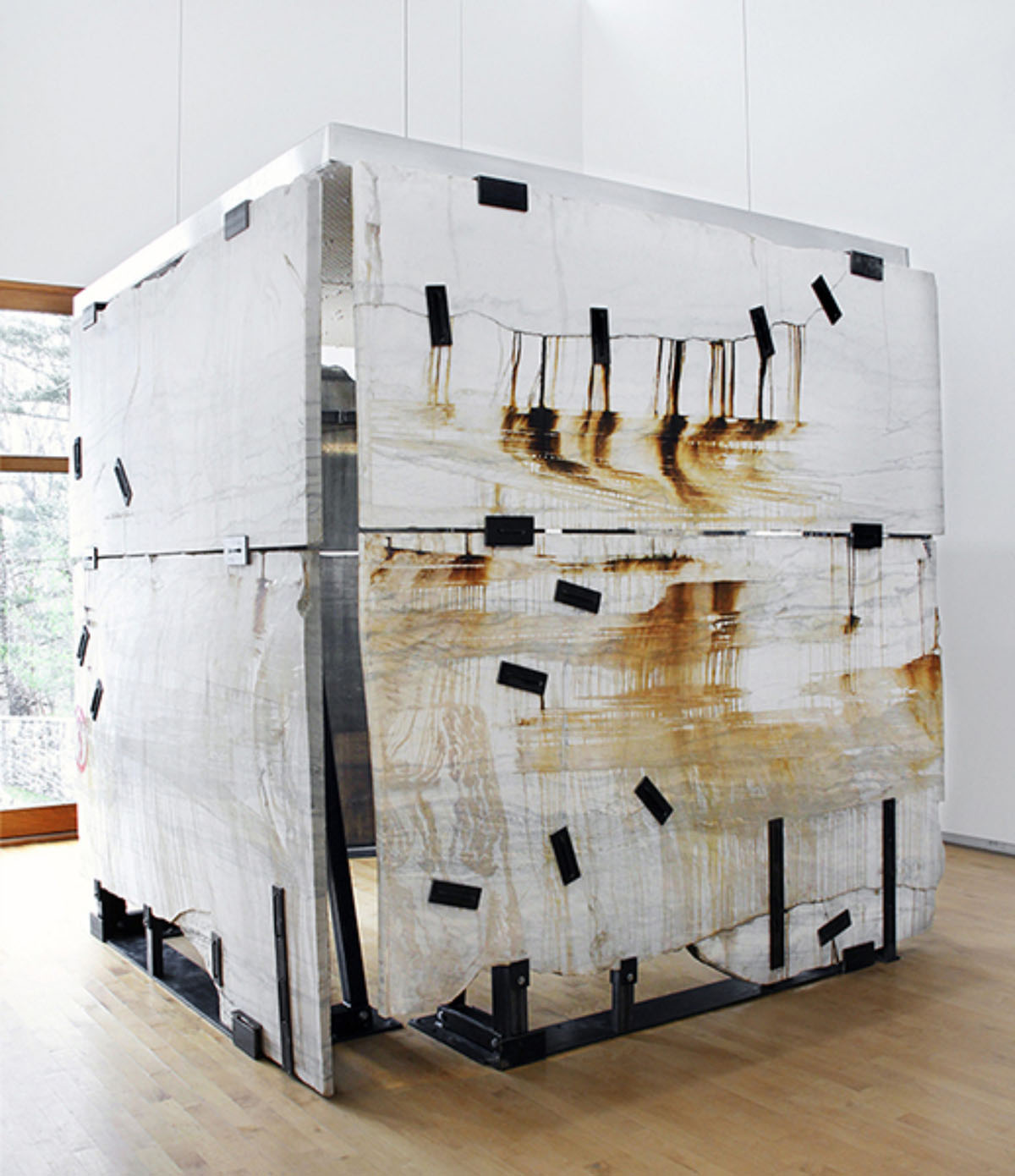
Artist Michael Joo's interpretive work entitled Drift which was inspired by Cameron's Line.
23-25 March 2014
Geological Society of America – Northeast Section
Lancaster, PA
Stratigraphy, Structural Geology and Rock Mass Properties of the Hartland Formation, Second Avenue Subway, NYC, NY
 Offering the result of a joint study withcoauthor J. Mickey Merguerian, Dr. Charles Merguerian spoke at the 49th annual meeting of the Northeast Section of the Geological Society of America on the rock mass properties and excavation of the Hartland Formation exposed in the Second Avenue Subway project near 86th Street, NYC, NY. An abstract of their presentation can be seen here.
A .pdf (9 Mb) of his PowerPoint presentation can be found at this link.
Thursday, 16 May 2013
American Association of Civil Engineers (Metropolitan Section)
New York City, NY
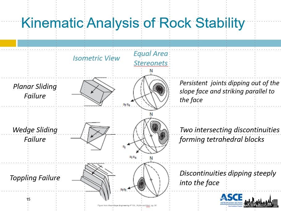
Structural Geology and its Influence on the Kinematics of Rock Stability: A Critical Foundation Consideration in Urban Environments
 Colleague and dear friend and engineer Daniel Vellone and Professor Merguerian coauthored a paper for the Foundation Challenges in Urban Environments Conference hosted by the Geo-Institute Chapter of the ASCE Metropolitan Section in New York City. Their joint collaboration outlined their methods of kinematic analysis of rock stability for excavations by detailing field data collection methods and the application of stereonets to predict excavated rock mass failures including planar-, wedge- and toppling varieties. Three case history examples were provided from New York (2) and Massachusetts.
A .pdf (5 Mb) of their joint presentation can be found at this link.
02 May 2013; 7:00 PM
IDEAS Institute
Hofstra University, NY
Admission Free! In fact, each participant were paid $5 to attend
Deep Science of Subterranean New York City
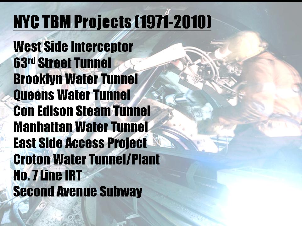
 Dr. Charles Merguerian, Chair and Professor of Geology at Hofstra University for over 30 years and active consultant on subsurface geotechnical projects in New York shares his insights and investigations as he leads you through a rich video and Powerpoint lecture that will take viewers to a depth of 800 feet below the hustle and bustle and the towering heights of New York City construction. In this quiet environment produced by mechanized moles (tunnel boring machines), mechanized excavators and traditional drill and blast technology witness this exploration of the NYC tunnels and the geology exposed within them. Exposing over 1,100 million years of geological history, a subterranean landscape unfolds through the construction of utility, transportation, and water tunnels -- catapulting us forward in a very short span of the past forty years -- largely as the result of huge advances in geotechnical, metallurgical and mechanical engineering research. Experienced in all but the very first mechanized tunneling job in NYC (West-side Interceptor Tunnel in 1969), Dr. Merguerian will share his discoveries on such varied engineering constructs as the 63rd Street Subway Tunnel, the water tunnels in Brooklyn, Queens and Manhattan, the East Side Access Project, the No. 7 Line IRT tunnels and the Second Avenue Subway. Join Dr. Merguerian for this dynamic lecture and learn first-hand just how tunnels are planned and constructed for public benefit in the hard crystalline rocks of New York City and share in the unique “deep science” discoveries made during his three decades of investigations in the subterranean world of our metropolis.
A .pdf version (23.7 Mb) of Merguerian's PowerPoint lecture can be seen here.
Thursday, 25 April 2013; 4:00 PM
Long Island Geologists
Stonybrook, NY
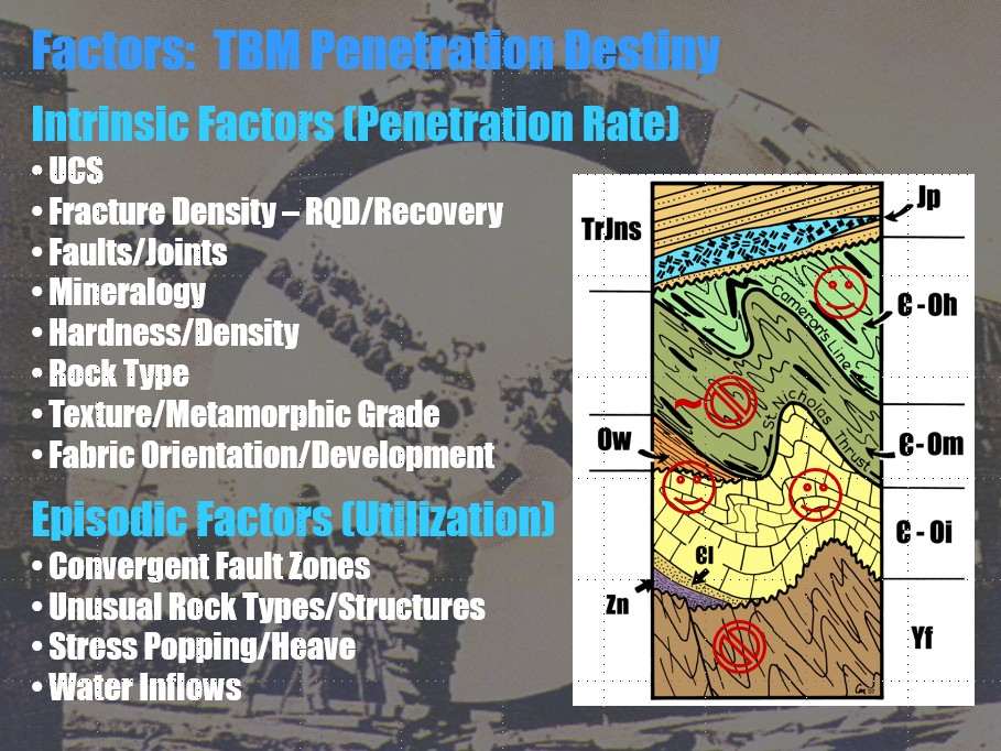
Geological Controls on Megaconstruction Projects, NY
Professor Merguerian was asked to deliver a lecture concerning his research into geological controls on TBM tunneling and other types of construction projects for an afternoon meeting of the Long Island Geologists. Both intrinsic and episodic TBM effects were discussed in the context of active or recently as-built case histories. Intrinsic effects include Excessive Fines, Blocky Ground, Unstable Headings and Sidewalls, Stress Popping and Water Inflows which are controlled by Rock Strength, Fracturing, Hardness, Metamorphic Grade, Structural Orientation of Fabrics, Degree and Orientation of Fracture Systems and many other factors. These controls can lead to excessive cutter damage, cutter wear and machine stoppages resulting in poor penetration and low utilization. Some NYC formations are simply more conducive to rapid excavation by using various removal techniques including traditional drill and blast, TBM, hydraulic splitters, roadheaders and hoe rams deemed most suitable for the endeavor.
A .pdf (11 Mb) of his lecture can be downloaded or read here.
Saturday, 13 April 2013
Long Island Geologists
Stonybrook, NY
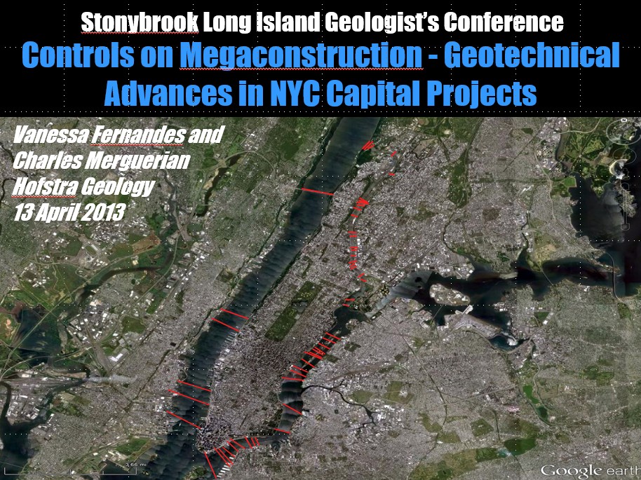
Technological Advances in NYC Capital Construction Projects – The Geological Controls on Megaconstruction
While Professor Merguerian sat in the audience smiling and sipping coffee, Hofstra University geology major Ms. Vanessa Fernandez presented their joint paper on the geological controls on capital construction projects using TBMs in NYC including the 63rd Street subway tunnels (1980), the Brooklyn Water Tunnel (1994-97), Queens Water Tunnel (1996-99), Con Edison Steam Tunnel (2002-03) as well as the on-going contemporary excavations of the Manhattan Water Tunnel, East Side Access, the Croton Water Tunnel, the No. 7 Line IRT extension and the Second Avenue Subway. Each of these projects encountered different bedrock units and consequent equipment choices as outlined in their presentation.
A .pdf of their extended abstract can be found here.
A .pdf (13.5 Mb) of her presentation can be found at this link.
Saturday, 19 May 2012; 1:30 PM
Franklin-Ogdensburg Mineral Society
Franklin Mineral Museum, Franklin, NJ
Free Admission
Mines and Minerals of Connecticut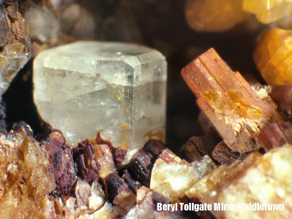
Decades ago when minerals were still abundant and access to famous localities was if not allowed at least tolerated, travels into the wilds of Connecticut always resulted in smiles on the faces of mineral collectors and geologists. Though almost 100 known localities exist in the Nutmeg State, few are available to collectors today. Merguerian began his geological investigations in West Torrington, Connecticut during his Masters research in 1972 and continues to this very day. In an effort to better understand the geology of the crystalline highlands of western Connecticut the distribution of ore deposits can be used as a tool to better understand large-scale ancient tectonic settings as well as localized geological events. Come see and hear the details of Dr. Merguerian’s travels and investigations in Connecticut and documentation of his discoveries in the form of digital images, maps and integrated video. As always, bring ripe fruit and a limber throwing arm!
A .pdf version (23.9 Mb) of Merguerian's PowerPoint lecture can be seen here.
Wednesday, 09 May 2012; 6:45 PM
New York Mineralogical Club
NYC, NY
Free Admission
Geology and Mineralogy of the Inwood Marble, Northern Manhattan, NYC, NY
 Field studies of the Inwood Marble in the type locality together with field data from nearby engineering construction projects have afforded fresh sampling and petrographic study of the Inwood in NYC. Consisting predominately of recrystallized dolomite and subordinate calcite marble the Inwood Marble was used for quarrying and mineral collecting yet the bland carbonate mineralogy and paucity of indicator minerals impeded the use of the Inwood Marble as a geological indicator of metamorphic conditions during tectonism in NYC.
Image = Whitish tremolite pseudomorphic after diopside.
Studies of the Inwood Marble formation come from field mapping conducted on all of the natural exposures in the Inwood section of Manhattan starting in the mid-1970s, subsurface data collected during a mapping program in the East River section of NYC Water Tunnel #3 in 1985-86, and core examination combined with detailed mapping of a utility tunnel during 2009. In addition to collections made during field mapping, samples were studied from Isham Park, Inwood Hill Park and from other natural exposures in northern Manhattan and The Bronx. Interestingly, Inwood metacarbonate rocks of northern Manhattan contain minerals that are consistent with metamorphic facies estimates from the kyanite-staurolite-garnet-bearing pelitic rocks surrounding the marble of NYC. Late tremolite pseudomorphic after diopside (shown below) suggests that retrograde metamorphism has affected the rock mass in the replacement of diopside, a higher grade phase. As this is a work in progress, we continue our efforts to better refine this preliminary study. Come see and hear the details of Dr. Merguerian’s investigations and documentation of his new discoveries in the form of digital images, maps and integrated video. As always, bring ripe fruit and a limber throwing arm!
A .pdf version (23.9 Mb) of Merguerian's PowerPoint lecture can be seen here.
Monday, 19 March 2012; 11:20 AM
Geological Society of America – Northeast Section
47th Annual Meeting
Hartford, CT
Structural Geology and Metamorphism of the Inwood Marble, NYC, NY
 Dr. Merguerian and son unit J. Mickey Merguerian coauthored an abstract highlighting their joint studies of the Inwood Marble formation in NYC. Merguerian’s 20-minute talk covered their mapping of Isham and Inwood parks and surrounds and provided correlative insight into tunnel and shaft mapping of the Con Edison Cable tunnel in northern Manhattan completed in 2009. Petrographic analysis identified new, unreported mineral phases and they provided possible prograde and retrograde metacarbonate reactions to explain the
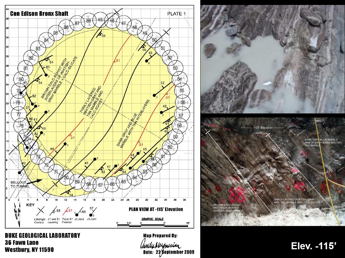 types of marble coloration and the minerals and textures found in the field.
A .pdf (7.4 Mb) of their presentation can be seen at this link.
Tuesday, 21 February 2012; 7:30 PM
Dirt Talk
Sycamore Bar and Flower Shop Brooklyn, NY
Admission Fee
Geology and Soils of New York City
 Geological discoveries in the fields of hardrock and glacialgeology have been made during the past four decades of research, the result of continuous mapping and laboratory research on collected samples from New York City. Indeed, access to surface and subsurface exposures has produced a treasure trove of geological information that alters our view of the Paleozoic tectonic development of this portion of the Appalachian mountain chain as well as the Pleistocene glacial history of New York City and vicinity. Holocene (post-glacial) alteration of the in-situ and transported glacial regolith has produced our modern soils. With ample overview of the regional geology, the talk will zero in on the geology and soils of Brooklyn. Come see and hear the details of Dr. Merguerian’s investigations and documentation of his new discoveries in the form of digital images, maps and integrated video.
A .pdf version (20.3 Mb) of Merguerian's PowerPoint lecture can be seen here.
Saturday, 21 May 2011; 2:30 PM
Franklin-Ogdensburg Mineral Society
Franklin, NJ
Free Admission and Refreshments
Bring Ripe Fruit for Throwing!
Geological Wonders of the World Trade Center Site
 Join Charles Merguerian of Hofstra’s Geology Department and Duke Geological Laboratory (shown here on-site with field assistant H. Manne) for a lecture on the unique geological discoveries made during excavation for the World Trade Center site in southern Manhattan. Visits to the site during blasting and construction and study of the mapping and collected samples has allowed a new interpretation to emerge concerning the bedrock geological development of NYC. In addition, new insights into the timing and effects of glaciation including the development of giant plunge pools within the top of rock have been discovered. Come see and hear how the new construction effort in Manhattan has offered a treasure trove of new geological information that has changed the way we interpret the geology of New York City and vicinity.
A .pdf version (20.4 Mb) of Merguerian's PowerPoint lecture can be seen here.
23 November 2010; 6:00 PM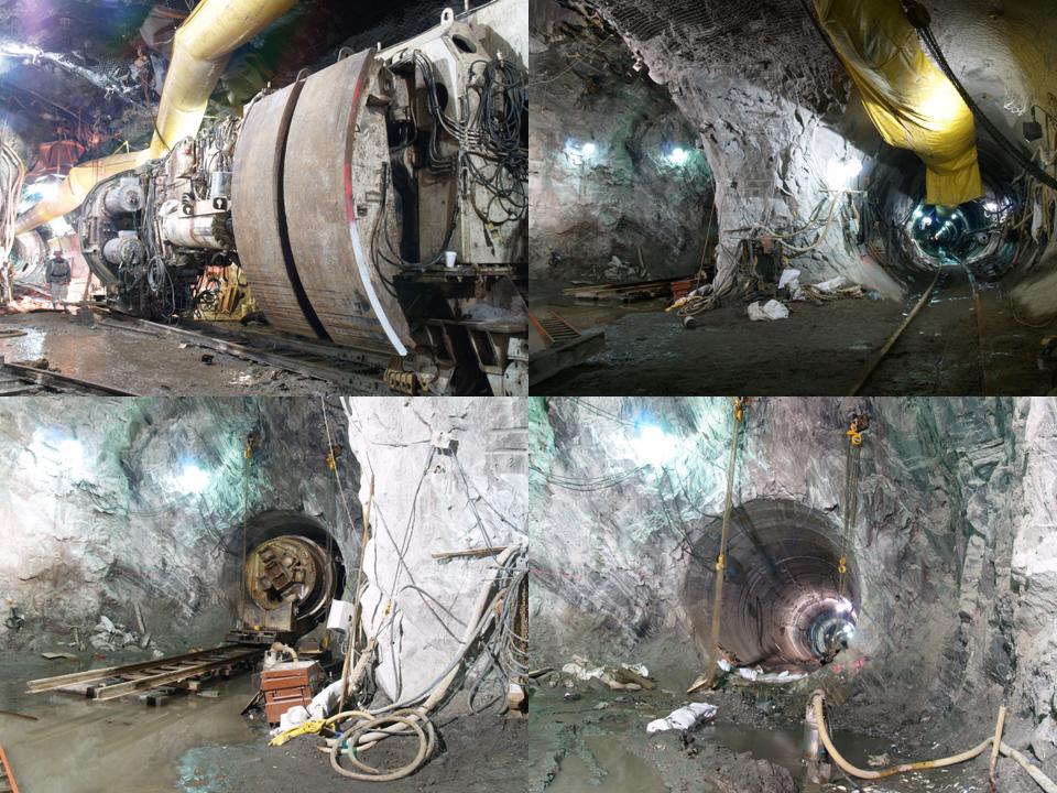
American Society of Civil Engineers
20th Annual Mueser Rutledge Technical Lecture
CUNY Graduate Center
NYC, NY
Geological Constraints on TBM Penetration on Hard Rock Tunneling, NYC
Principal Dr. Charles Merguerian of Duke Geological Laboratory and Professor of Hofstra’s Geology Department offered a lecture detailing the intrinsic and episodic geological features that constrain TBM penetration and utilization in hard rock crystalline terrains as found in New York City. Drawing from his personal involvement and using case histories from the NYC area including the 63rd Street Tunnel, Brooklyn Tunnel, Queens Tunnel, Con Edison Steam Tunnel,Manhattan Water Tunnel, Croton Tunnel, No 7 Line Extension Tunnel, and East Side Access, Merguerian explained how the combined effects of lithology, metamorphism, and geological structure have controlled efficient tunneling. Simple geological investigations during the pre-bid stage are the most cost-effective means to mitigate losses encountered during TBM tunneling. Promotions offering free admission and refreshments filled the audience.
For a download or read of his lecture, a .pdf (19 Mb) can be found here.
Also see:
12 May 2010
New York Mineralogical Club
People's Center
American Museum of Natural History,
NYC, NY
The World Trade Center Site: New Perspectives on New York City Geology
Milking the lecture circuit big-time, Dukelabs own Dr. Charles Merguerian of Hofstra University’s Geology Department presented a lecture on the unique geological discoveries made since 2004 and during recent excavations at the World Trade Center site. Visits to the site during blasting and construction combined with the study of the mapped and collected samples have afforded a new interpretation to emerge concerning the bedrock geological development of Manhattan. In addition, new insights into the timing and effects of glaciation including the development of giant 100' deep plunge pools within the top of rock have been discovered. Participants who stayed awake and alert (thanks Mom) heard how the new construction effort in Manhattan offered a treasure trove of new geological information that changed the way we interpret the bedrock development and glacial geology of New York City and vicinity. Follow this link to Merguerian's 2008 History Channel appearance on Super City: New York.
Also, for a download or read of his lecture, a .pdf (21 Mb) can be found here.
17 April 2010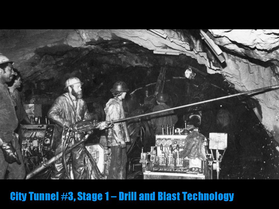
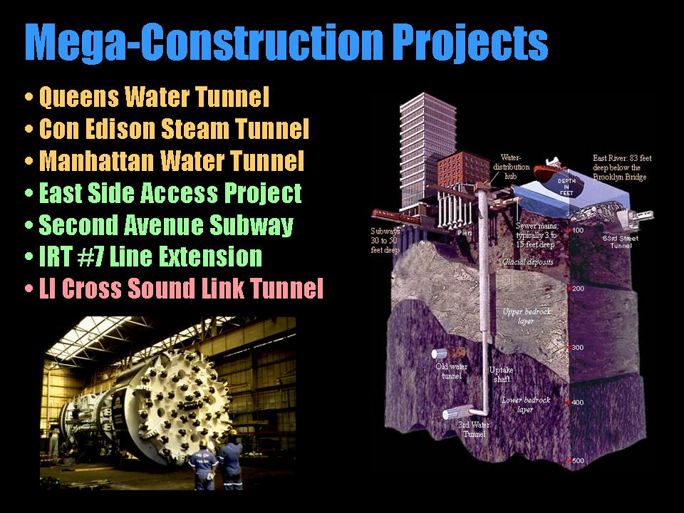
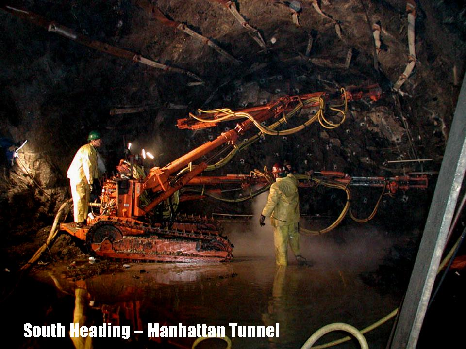
Garvies Point Museum
Glen Cove, NY
Geology of Subsurface Mega-Construction Projects, New York City, NY
Constructing new and the repair of existing water tunnels, subway tunnels and buildings all involve digging into what lies beneath New York City (NYC). Having spent many years specializing in investigating the surface and subsurface geology of NYC, Dr. Merguerian’s popular and oft-repeated lecture concentrated on the geologic controls on the utilization of tunnel-boring machines. His research has paved the way for more efficient tunneling in crystalline terrains and has opened the field for municipal mega-construction projects, including water, utility and transportation tunnels. His lecture focused on exciting new tunneling contracts in NYC including the Third NYC Water Tunnel, the Second Avenue Subway, the East Side Access project, and the #7 Line IRT Extension project.
For a download of his historic lecture, a .pdf (11 Mb) can be detected here.
15 March 2010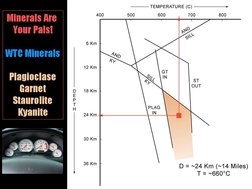
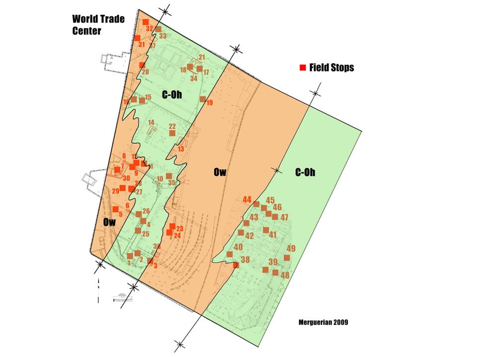
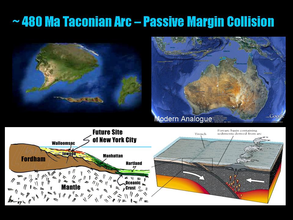
Geological Society of America, NE Section
Baltimore, MD
Tectonics Implications of Bedrock Studies at the World Trade Center Site, New York City
Dr. Merguerian presented the distinctions he has found between disparate metamorphic rock formations at the World Trade Center site that have afforded new interpretations on the tectonic history and former depth of formation of NYC bedrock. A packed house in Baltimore was treated to full exposure to the field occurrence and petrographic differences between the Walloomsac, Hartland, and Manhattan formations which were formerly lumped together as the Manhattan Schist. Investigations at the WTC site have indicated that an equilibrium metamorphic mineral assemblage (kyanite-garnet-staurolite) indicates a minimum depth of burial of 24 km (~14 miles) below the earth's present surface.
For a download of his historic lecture, a .pdf (11 Mb) can be detected here.
19 November 2009; 6:00 PM
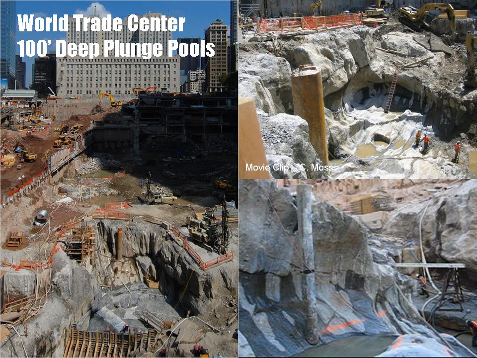
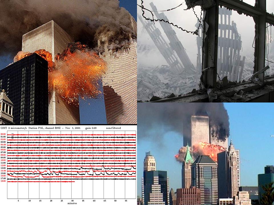
IDEAS Institute
Hofstra University, NY
The World Trade Center Site: New Perspectives on New York City Geology
Charles Merguerian of Hofstra’s Geology Department presented an IDEAS lecture on the unique geological discoveries made during recent excavations of the World Trade Center site. His visits to the site since 2004 during blasting and construction as well as the study of the mapped and collected samples have allowed a new interpretation to emerge concerning the bedrock geological development of Manhattan. In addition, new insights into the timing and effects of glaciation including the development of giant 100' deep plunge pools within the top of rock have been discovered. Participants who for some strange reason managed to stay interested heard how the construction effort in southern Manhattan has offered a treasure trove of new geological information that has changed the way we interpret the bedrock development and glacial geologic sculpting of New York City and vicinity. Follow this link to Merguerian's 2008 National Geographic appearance on Naked Science - Birth of America.
A remarkable .pdf version (20.5 Mb) of Merguerian's PowerPoint lecture can be seen here.
16 November 2009
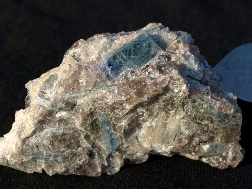
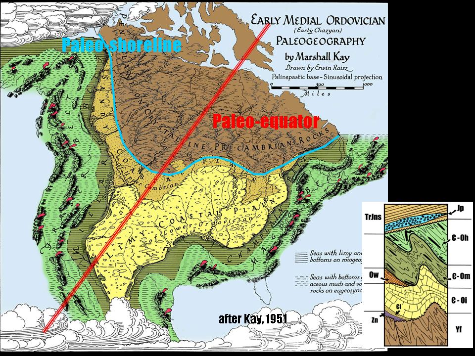
Suffolk Gem and Mineral Club
Bayshore Library, NY
Geology of the World Trade Center Site
Rising out of the ashes of the devastation at the World Trade Center site in Manhattan, geologist Charles Merguerian presented a lecture to the enthusiastic Suffolk Gem and Mineral Club on new interpretations of the bedrock geology of NYC based on mineralogical discoveries in rocks at the WTC site. In addition to the textural evidence for shearing and folding of two rock formations (the Hartland and Walloomsac formations) the petrographic data indicates an assemblage kyanite-staurolite-garnet that has fixed a minimum depth of metamorphic recrystallization of the exposed bedrock at 24 km (~14 miles) below the earth's present surface. Follow this link to Merguerian's 2008 National Geographic appearance on Naked Science - Birth of America.
Dial up a .pdf (23.2 Mb) of his lecture here.
02 June 2009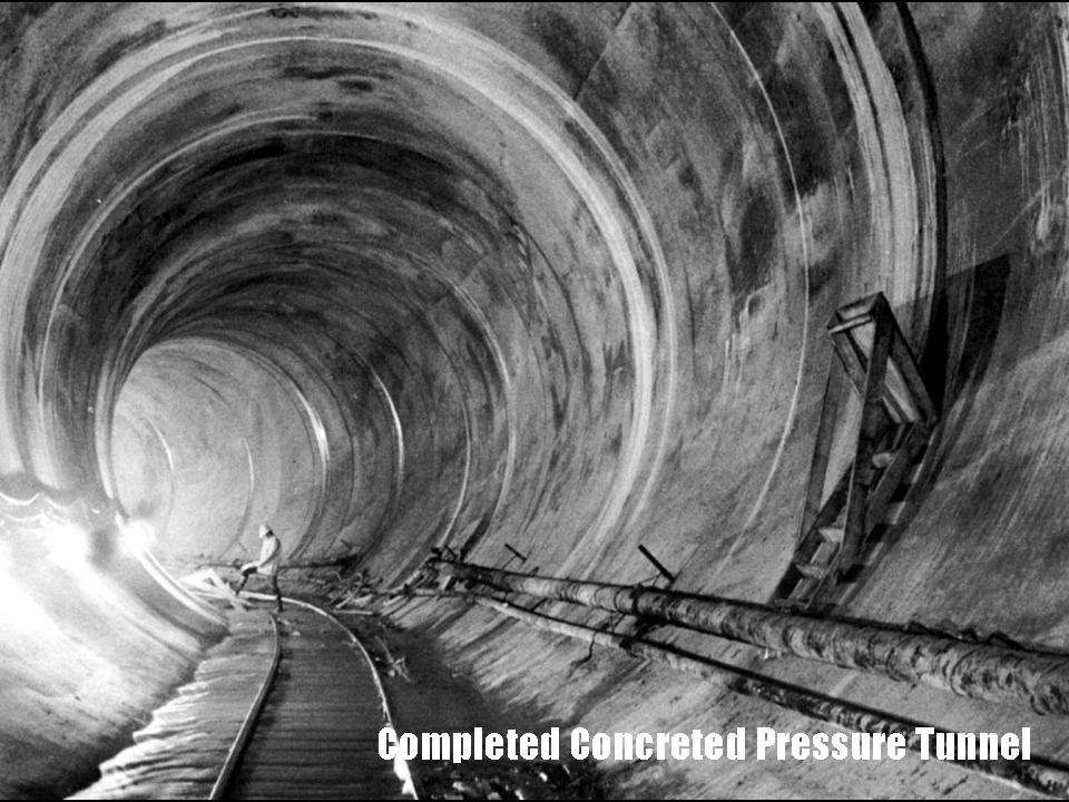
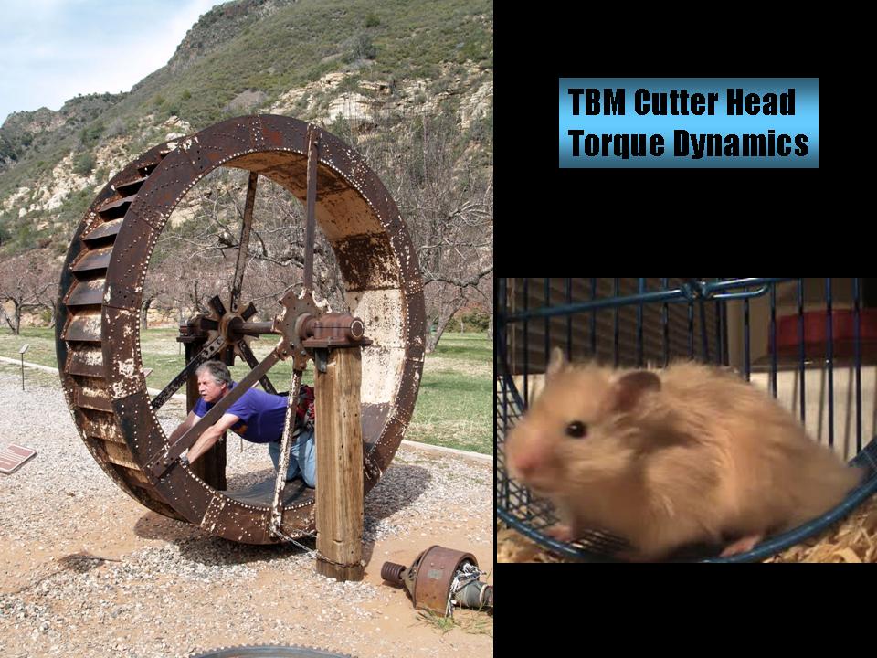
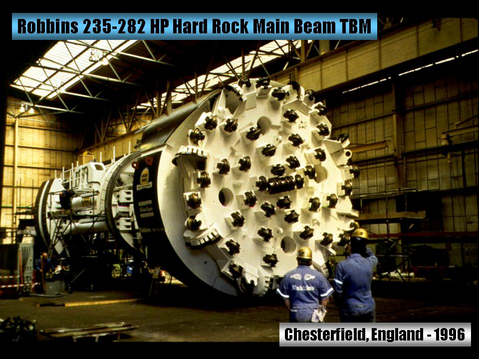
W.T. Clarke High School Science Fair
Westbury, NY
Mega-Construction Projects in Subsurface New York City
Intrepid Hofstra University Professor and Dukelabs geologist Charles Merguerian spoke to junior and senior-level high school science students on the scope of his research concerning the utilization of tunnel-boring machines in the subsurface of NYC. The talk included information about the third NYC Water Tunnel, the Second Avenue Subway, the East Side Access project, and the #7 Line IRT Extension project.
For a .pdf (5.7 Mb) of his lecture, simply click here.
17 April 2009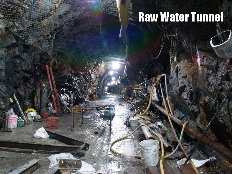
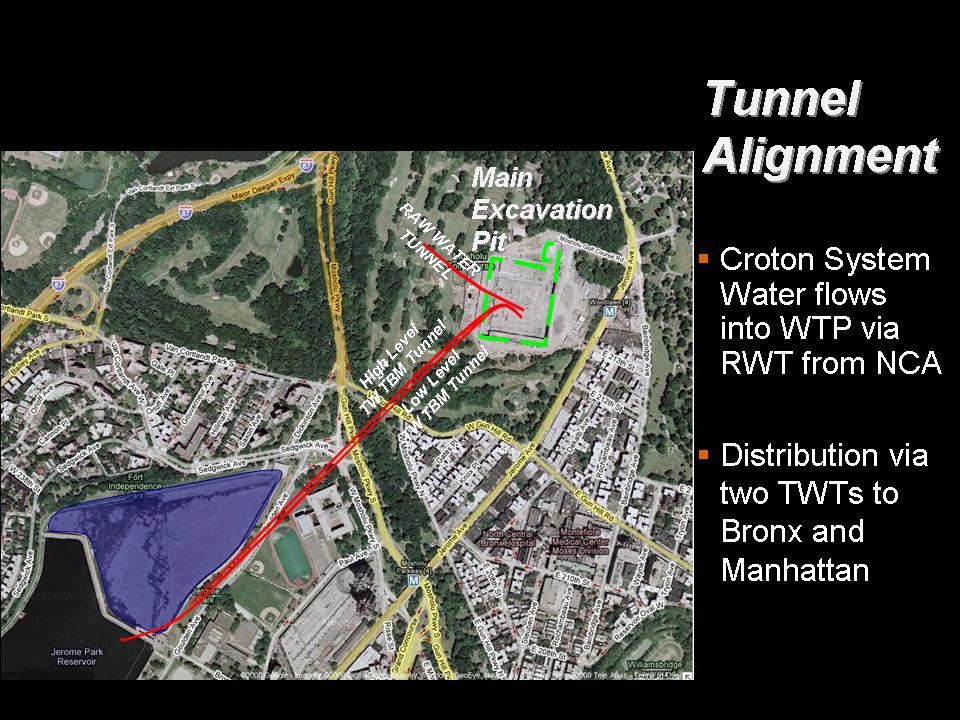

Natural Science Research Symposium
Hofstra University, NY
The Southern Termination of the Yonkers Gneiss in Van Cortlandt Park, New York City, NY
Learning early how to milk the presentations, Dukelabs geologist J. Mickey Merguerian presented the work he had conducted with Dr.Charles Merguerian at the 2009 Hofstra University Natural Science Research Symposium. His Powerpoint talk provided a new interpretation of the Mosholu fault and the distribution of the Yonkers and Fordham gneisses near Van Cortlandt Park in NYC. This work has changed the New York State geological map by allowing for an extension of the Yonkers Gneiss southward from its previous mapped termination in The Bronx (see map and joint paper link below).
For a full-color .pdf (10.7 Mb) of his NSRS talk, kindly click this link.
28 March 2009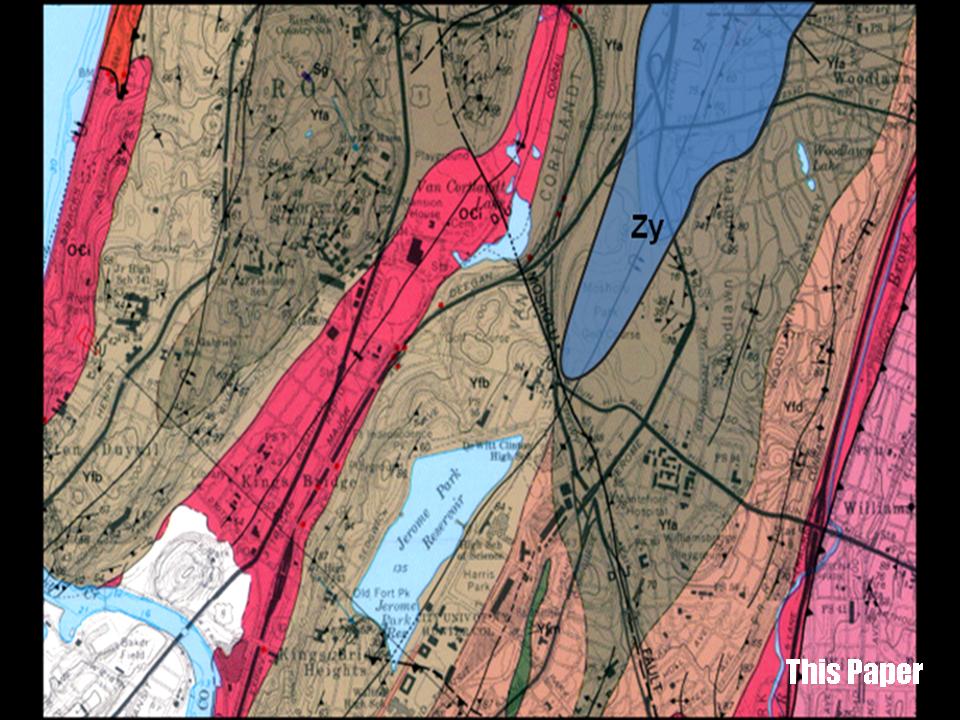
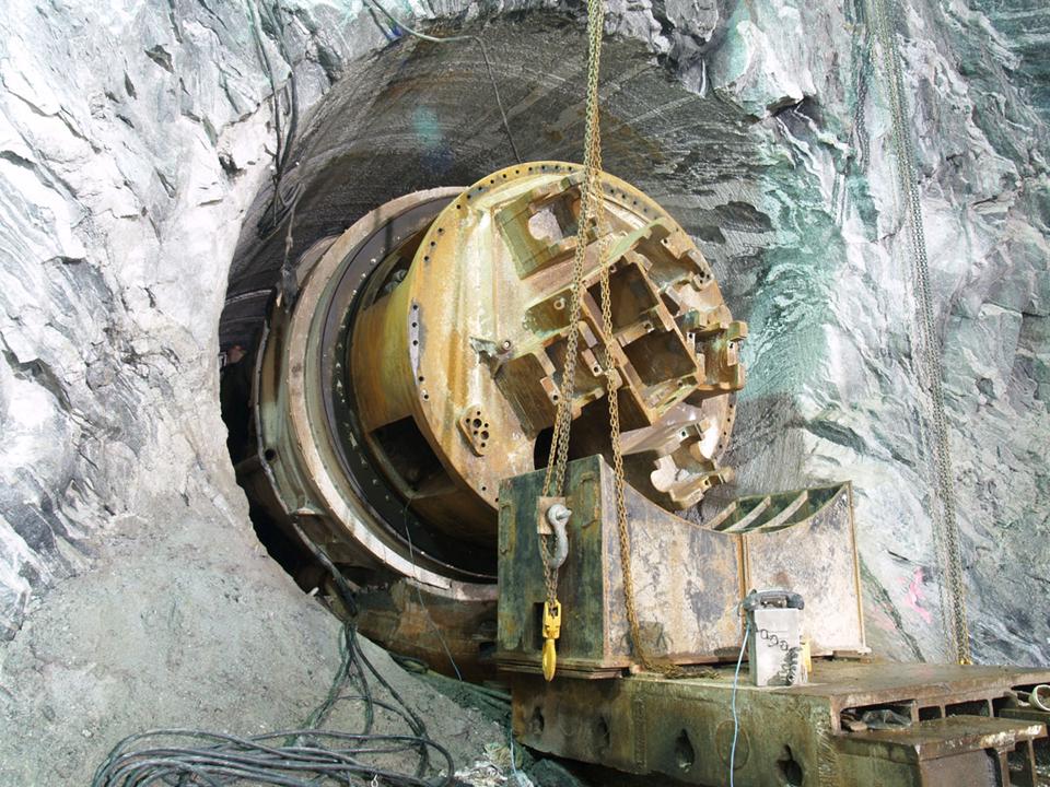
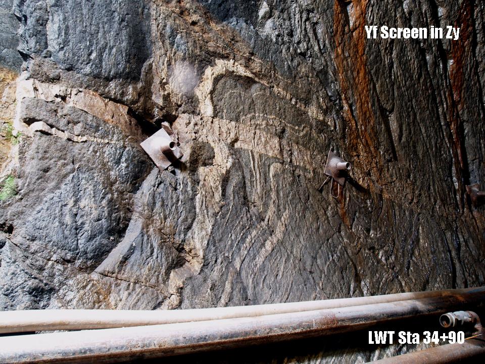
Long Island Geologists
Stony Brook, NY
Redefining the Southern Terminus of the Intrusive Contact Between the Yonkers and Fordham Gneiss in Van Cortlandt Park, New York City, NY
Dr. Merguerian presented and coauthored a joint paper along with Daniel Vellone, Doug Isler, and son unit J. Mickey Merguerian at the 2009 Long Island Geologists conference focusing on their work in the Croton Water Tunnel - a part of the NYC aqueduct system. The Merguerians' detailed study of the structure, lithology, and petrography of the Proterozoic rocks exposed in the tunnel along with the detailed mapping performed by Dan Vellone and Doug Isler has helped provide a new interpretation of the Mosholu fault and the distribution of the Yonkers and Fordham gneisses near Van Cortlandt Park in NYC. This work has changed the New York State geological map by allowing for an extension of the Yonkers gneiss southward from its previous mapped termination in The Bronx.
For a fabulous unsigned full-color .pdf (22.9 Mb) of his 2009 LIG talk, kindly click this link. For this, when you die, you'll receive total consciousness - so you'll have THAT going for you. And, that's pretty good.....
07 March 2009
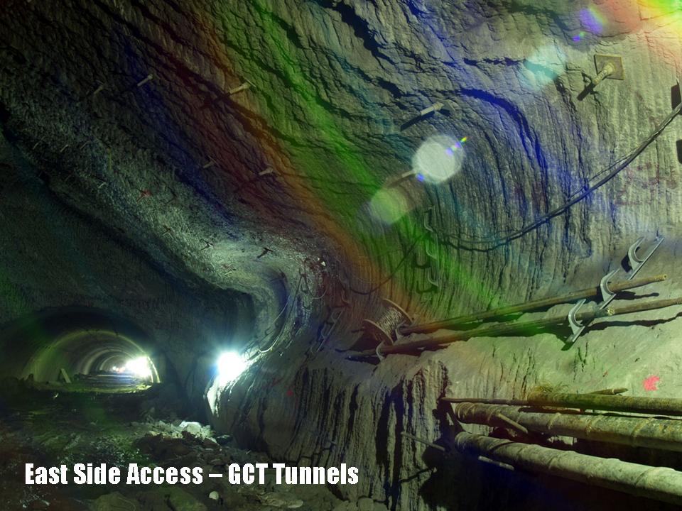
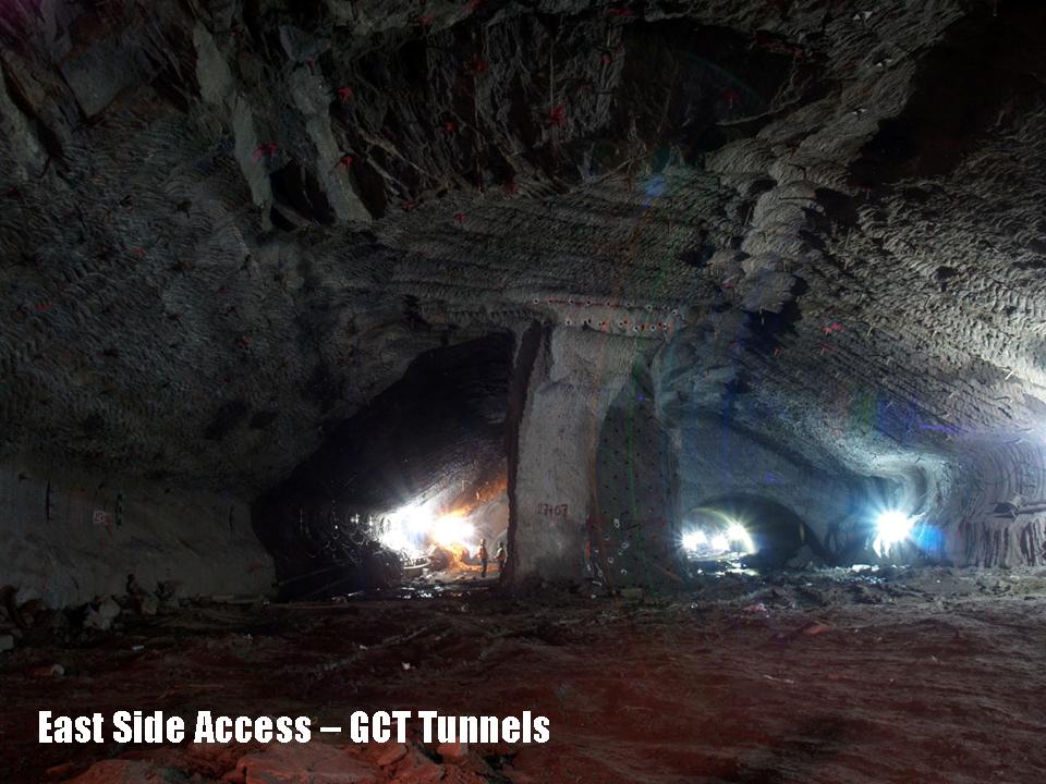
New York Mineralogical Club Show
Holiday Inn at 57th Street,
NYC, NY
Geologic Controls on Mega-Construction Projects in Subsurface New York City
Undaunted Dukelabs geologist Charles Merguerian was guest speaker at the biannual mineral show of the New York Mineralogical Club. He spoke on conditions of anonymity about the utilization of tunnel-boring machines in the subsurface of NYC. His lecture focused on exciting new construction contracts in NYC including the South Ferry Terminal, the Third NYC Water Tunnel, the Second Avenue Subway, the East Side Access project, and the #7 Line IRT Extension project.
17 October 2008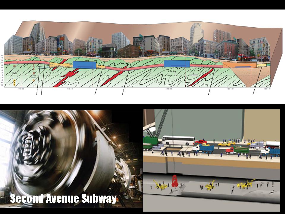
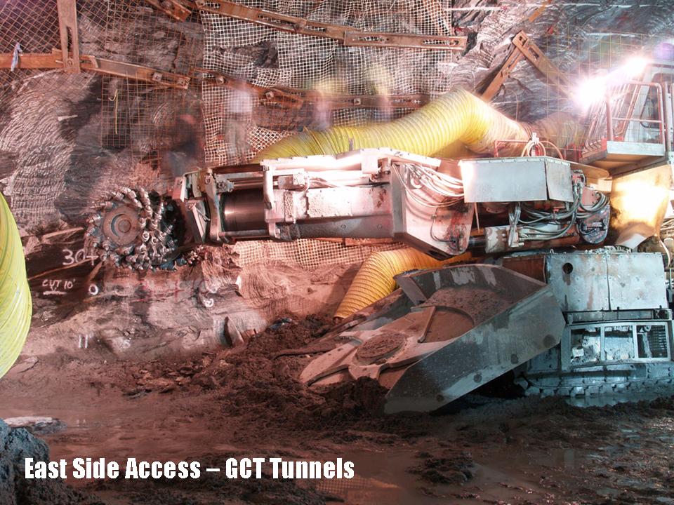
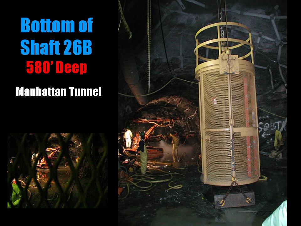
Geological Association of New Jersey
Montclair, NJ
Geological Controls on Means and Methods of Hard Rock Excavation, New York City, NY
Dr. Merguerian was the invited keynote speaker at the GANJ conference held at Montclair State University. By explaining the differences in rock types and their inherent mechanical strengths, Dr. Merguerian discussed the various choices available to contractors (TBM vs. mechanical means) for efficient rock excavation in NYC.
A .pdf (18 Mb) of his PowerPoint lecture can be found here.
An accompanying conference paper (Merguerian 2008c) can be found here.
12 September 2008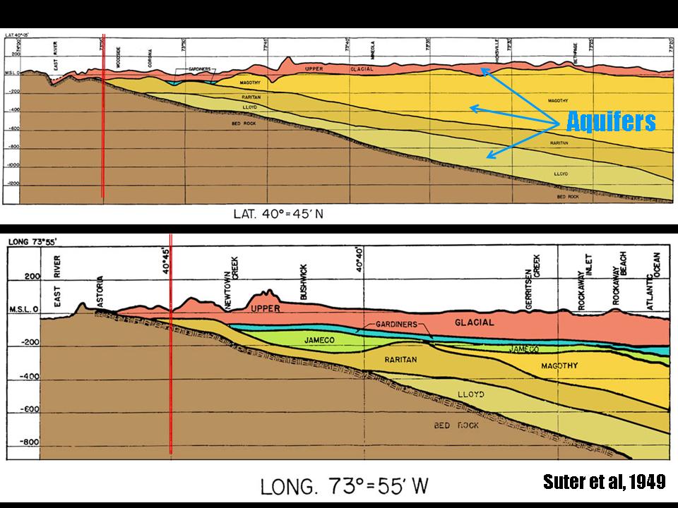

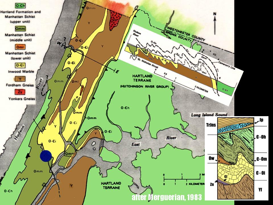
Deep Foundations Institute
Berlin, CT
Bedrock and Glacial Geology of New York City
Dr. Merguerian was an invited lecturer at the DFI conference in 2008 which was devoted to better understanding the underpinnings of NYC geology for the purpose of effcient foundation installations. His lecture focused on the constitution of the various soil types and bedrock of New York City in an effort to allow designers and contractors to better understand their excavation and support choices in the in-situ and transported regolith and bedrock units that constitute the region. Follow this link to Merguerian's 2008 National Geographic appearance on Naked Science - Birth of America.
And better still, a .pdf (10.4 Mb) of is now a legendary conference presentation can be found here.
08 May 2008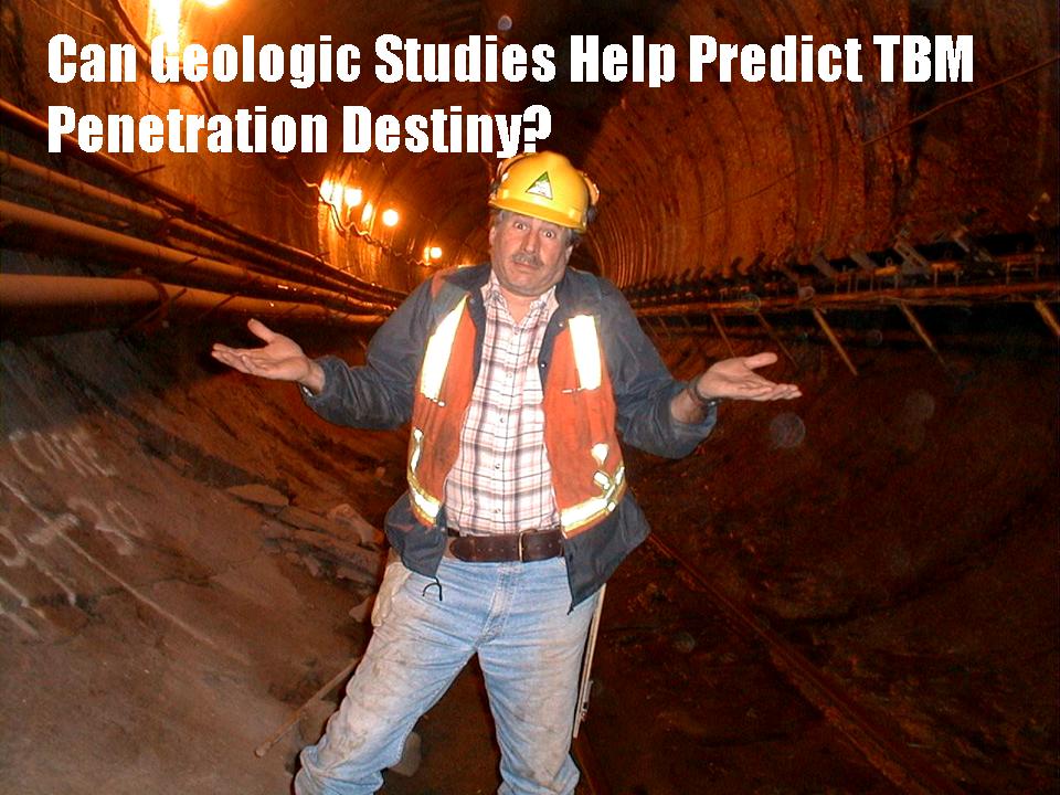
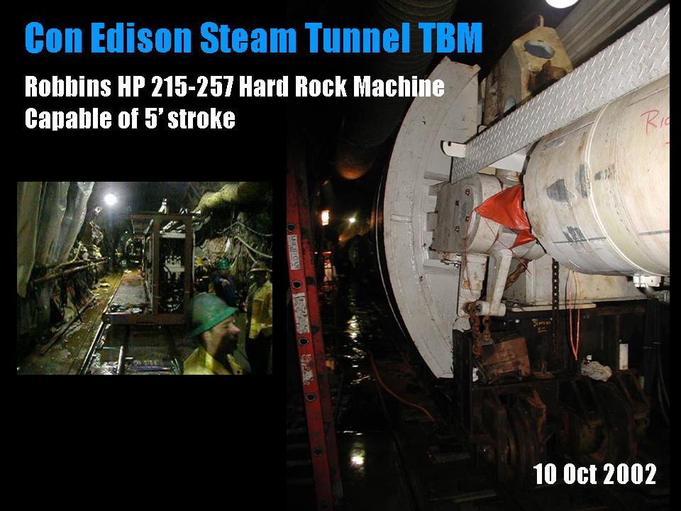
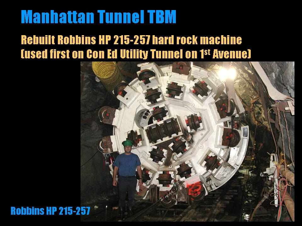
ASCE Met Section Geotechnical Group - Manhattan on the Rocks Seminar
New York City, NY
Evaluating Geological Controls on Hard Rock Excavation, New York City, NY
Dr. Merguerian was an invited lecturer at the full day Manhattan On-The-Rocks conference of the ASCE Metropolitan Section where he discussed the means and methods of hard rock excavation in the city of New York. His one-hour discussion focused on the geological evolution of New York City and how careful study of published books and maps by professional geologists and engineers can lay the foundation for cost-saving pre-bid investigations. Such academic studies are best backed up by the geotechnical study of borings (fractures, rock types, rock fabrics) as well as density studies and petrographic analysis. Such allied investigations better predict the subsurface conditions that allow contractors and designers to plan for cost-effective excavation methods. A related published paper (Merguerian 2008b) can be found here.
Merguerian's presentation was well received and he was awarded a Golden Apple statue for his effort - as were every other speaker who attended as well as the coffee table staff.
A fully digital .pdf (16 Mb) of his presentation can be found here.
For even more geotechnical fun, check out the following link:12 March 2008
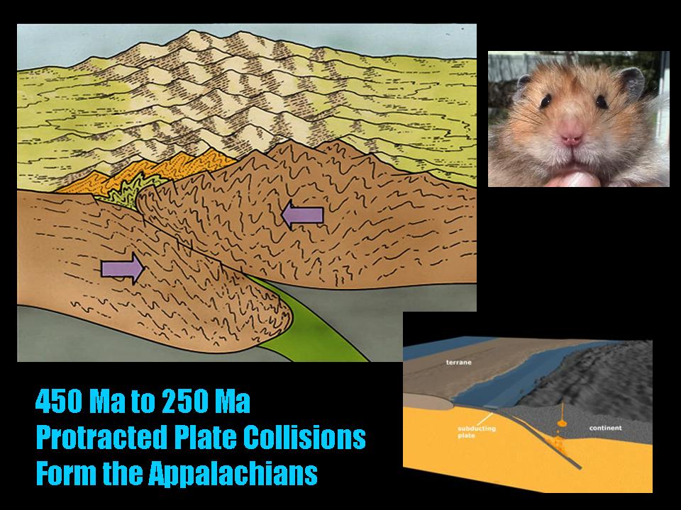
Geology Department
Brooklyn College, NY
Mega-Construction Projects in Subsurface New York City
Dr. Merguerian’s academic lecture concentrated on the history of tunnel boring machines and the geologic controls on machine excavation in the subsurface of NYC. His lecture focused on exciting new tunneling contracts in NYC including the Queens Water Tunnel, the Con Edison Steam Tunnel, the Manhattan Water Tunnel, the East Side Access project, the Second Avenue Subway, the IRT #7 Line Extension, the South Ferry Terminal project, and the proposed LI Cross Sound Link Tunnel.
For an unedited, recycled .pdf (15 Mb) of his PowerPoint production simply click here.
25 February 2008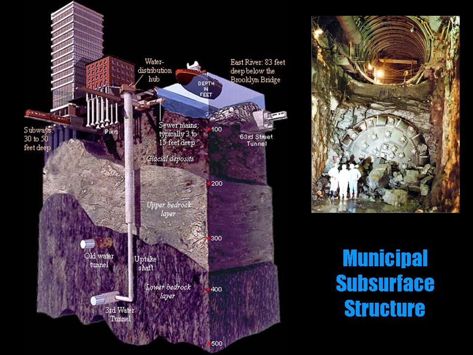
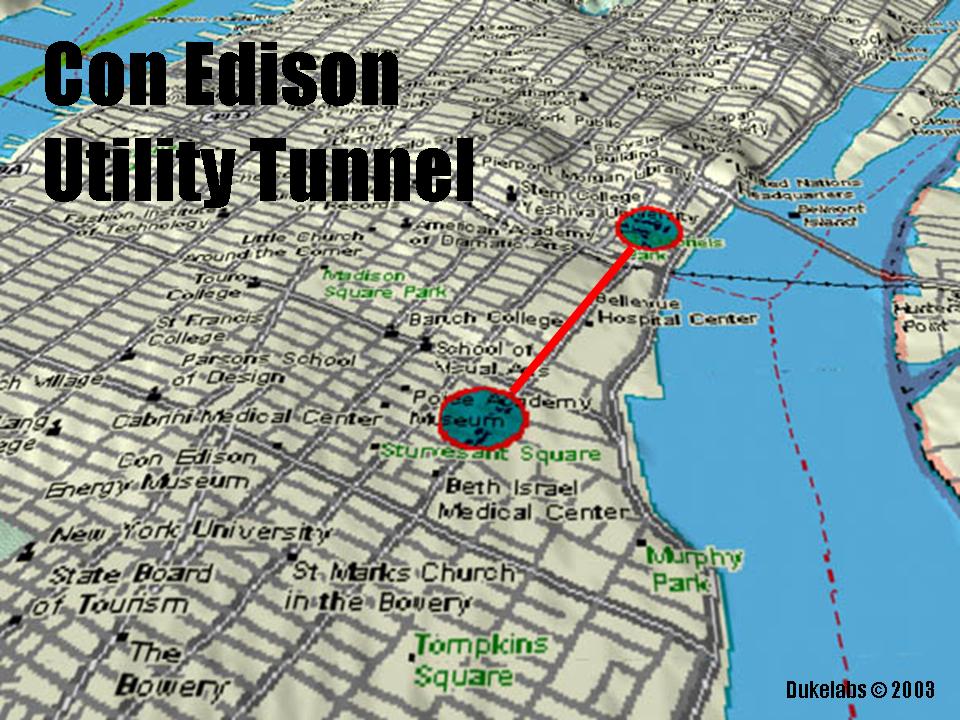
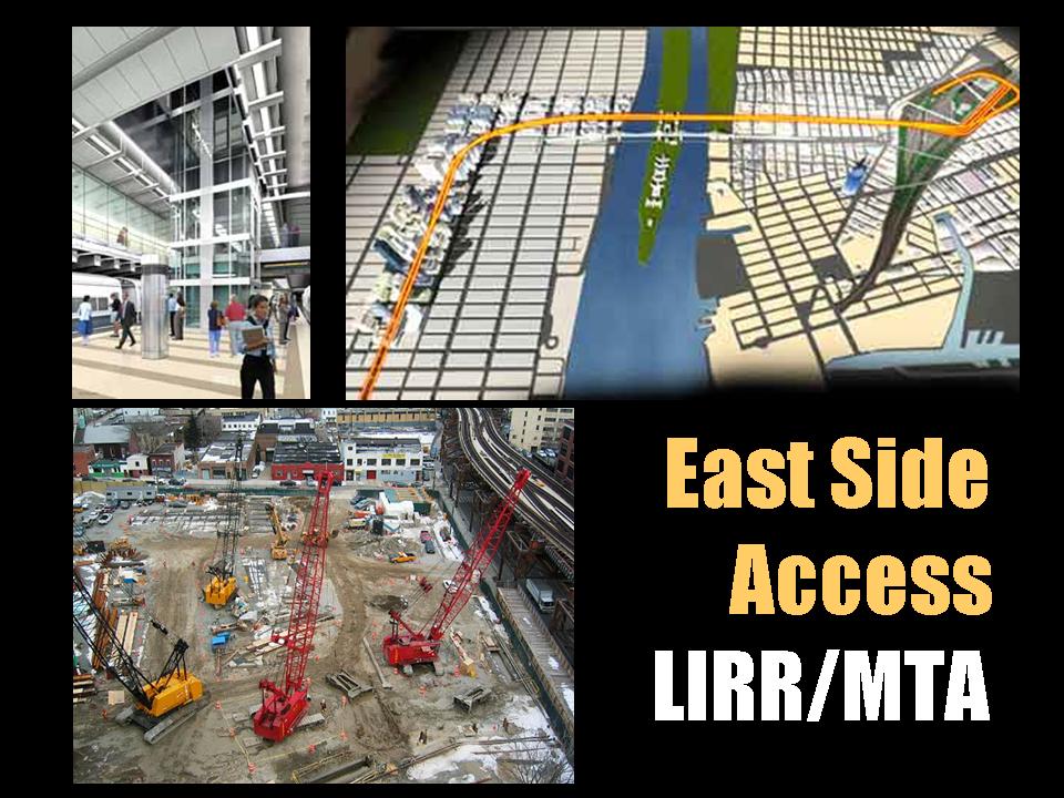
Suffolk Gem and Mineral Club
East Islip Library, NY
Geologic Controls on Mega-Construction Projects in Subsurface New York City
Constructing new and the repair of existing water tunnels, subway tunnels and buildings all involve digging into what lies beneath New York City (NYC). Having spent many years specializing in investigating the surface and subsurface geology of NYC, Dr. Merguerian’s lecture concentrated on geologic controls on the utilization of tunnel-boring machines in the subsurface of NYC.
In the event you've not had enough of this, click this link for a .pdf (15 Mb) of his presentation.
16 November 2007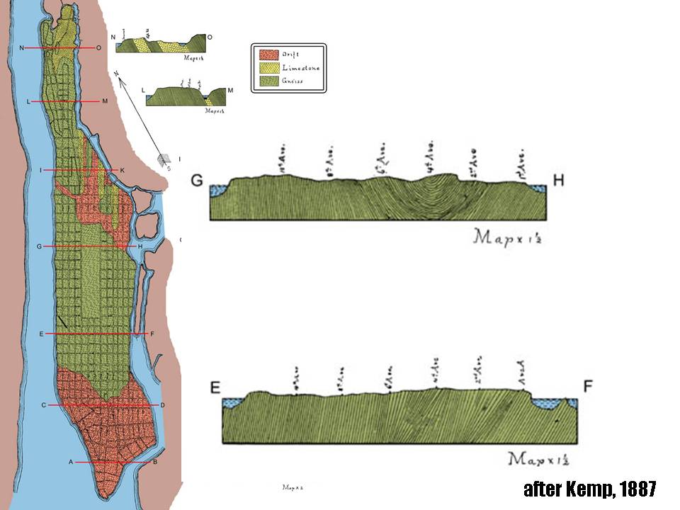
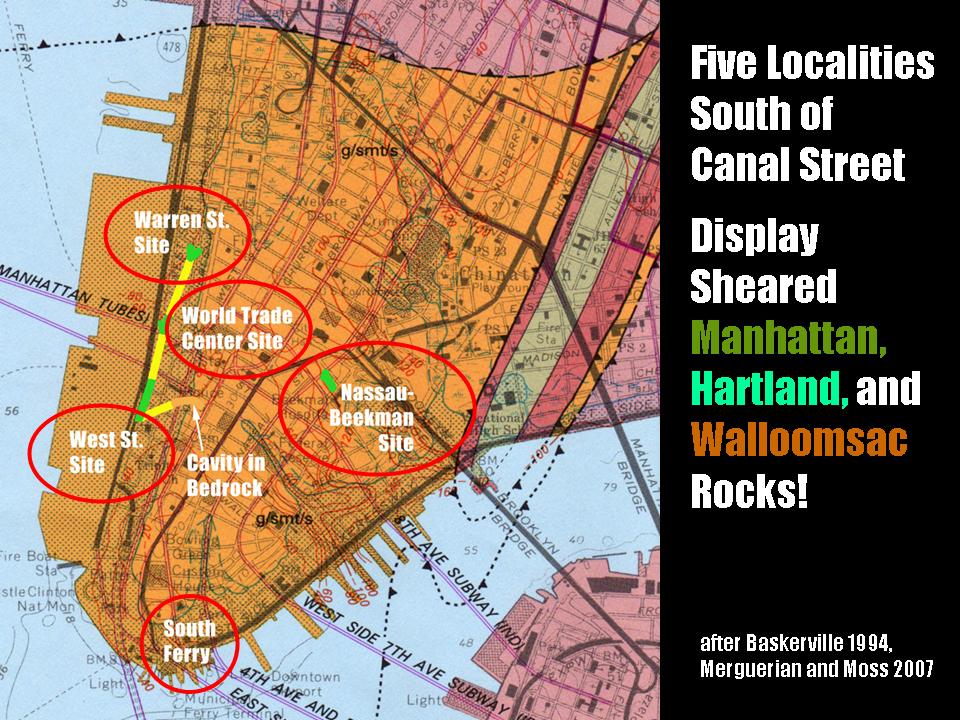
Natural Science Research Symposium
Hofstra University, NY
Geology and Tectonics of the World Trade Center
Dr. Merguerian presented the preliminary results of his research on the lithology and structural geology of the World Trade Center site in southern Manhattan at the 4th Annual Division of Natural Sciences Research Day at Hofstra University. Speaking in front of a packed house of students, faculty, and staff, his Powerpoint lecture described the techniques of gathering geological information in an active construction zone, showed images of rock outcrops exposed at that time in the west bathtub area of the site and presented some important new ideas concerning the distribution and structure of the various rock types of the Walloomsac and Hartland formations.
A .pdf (8 Mb) of his presentation can be found here.
08 November 2007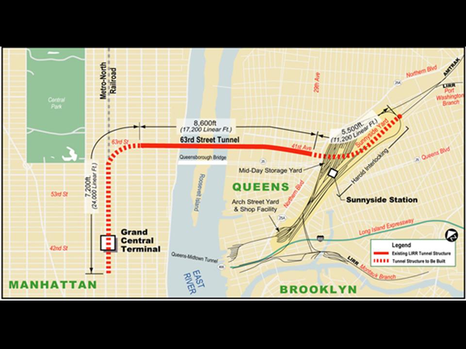
IDEAS Institute
Hofstra University, NY
Geologic Controls on Mega-Construction Projects in Subsurface New York City
Constructing new and the repair of existing water tunnels, subway tunnels and buildings all involve digging into what lies beneath New York City (NYC). Having spent many years specializing in investigating the surface and subsurface geology of NYC, Dr. Merguerian’s lecture concentrated on geologic controls on the utilization of tunnel-boring machines in the subsurface of NYC. His research has paved the way for more efficient tunneling in crystalline terrains and has opened the field for municipal mega-construction projects, including water, utility and transportation tunnels. His lecture focused on exciting new tunneling contracts in NYC including the third NYC Water Tunnel, the Second Avenue Subway, the East Side Access project, and the #7 Line IRT Extension project.
A .pdf (14.6 Mb) of his presentation can be found here.
10 October 2007; 7:00 PM
New York Mineralogical Club
People's Center - American Museum of Natural History,
NYC, NY
Geological Wonders of Yellowstone National Park, Wyoming
Our courageous Dukelabs geologist Charles Merguerian spoke to the New York Mineralogical Club on the brewing danger of a volcanic eruption at Yellowstone National Park - home of Yogi Bear and BooBoo! Already presented at the March 2007 NYMC Show in NYC, he dusted off his presentation for the general club meeting. His video-enhanced lecture embraced the regional geology of the area including the Grand Teton range, the 1925 Gros Ventre rock slide, hot spot tracks of the American west and the natural thermal beauty of Yellowstone. Three eruptive events were discussed in the context of modern studies of the Yellowstone caldera. These include the 640 Ka – Lava Creek Caldera, the 1.3 Ma – Mesa Falls Caldera, and the 2.1 Ma – Huckleberry Ridge Caldera. Do the math! Cleary, we are overdue for a major eruption at this important landmark. The lecture was based on a Hofstra University field course conducted in 2006 for which an online guide is available for download.
Suitable for wrapping fish when printed, a .pdf (18 Mb) of his lecture can be found here.
14 April 2007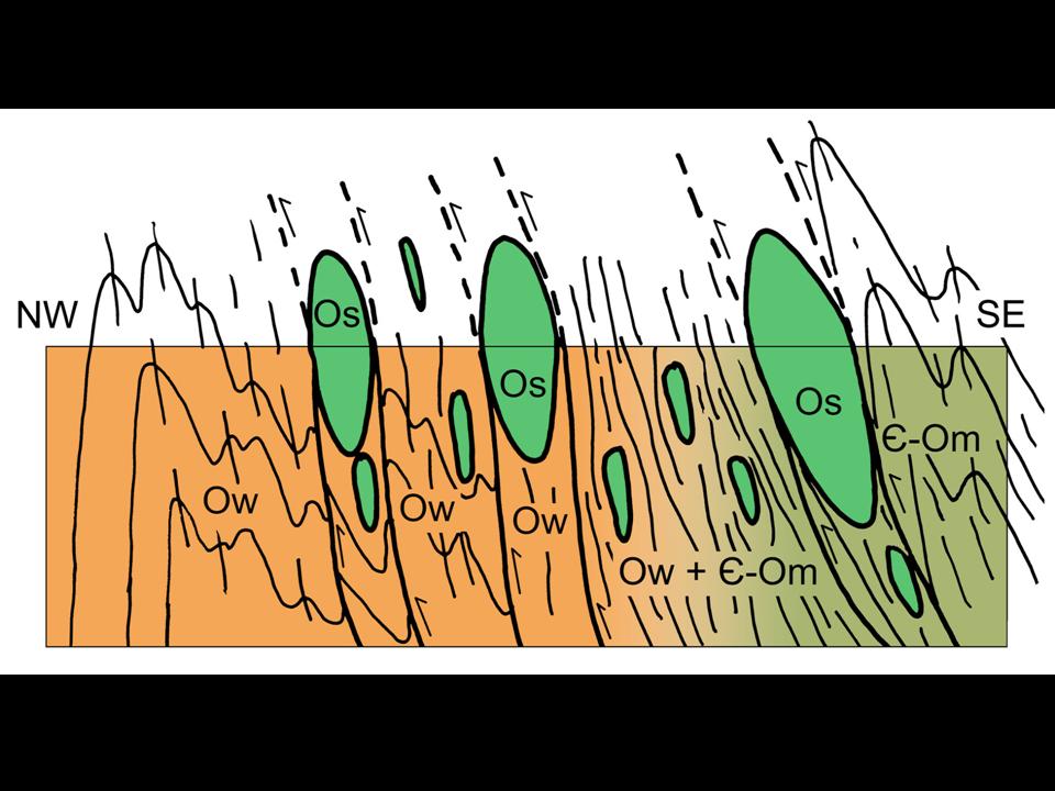
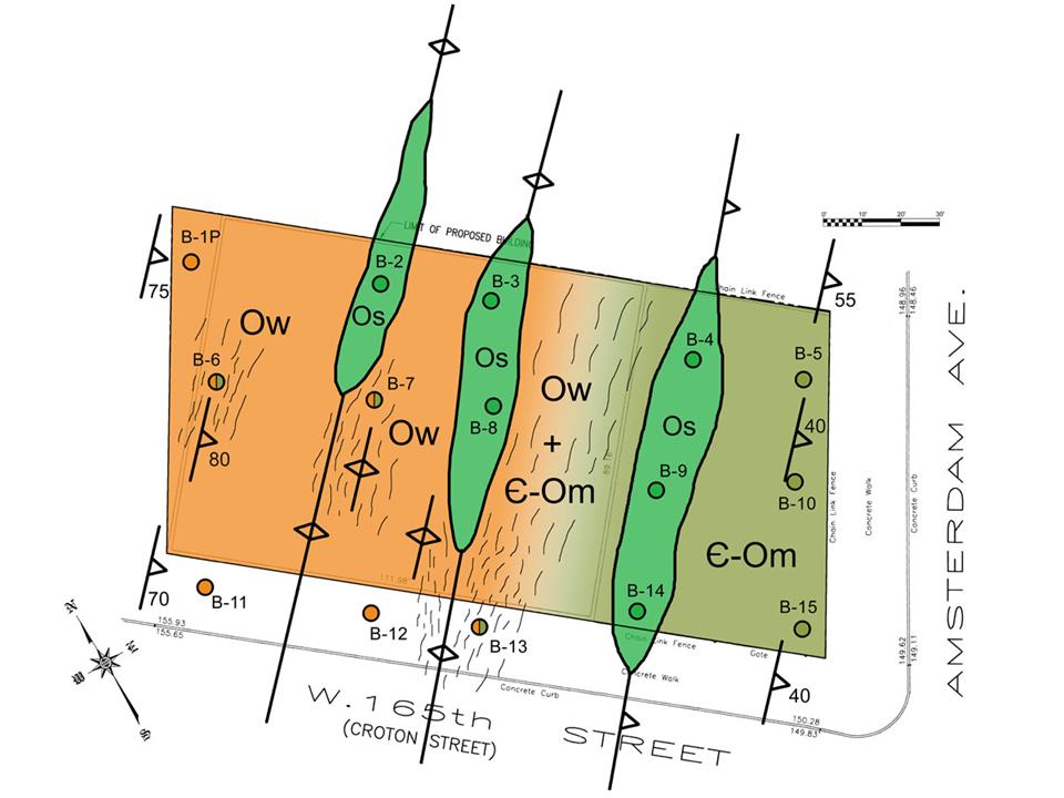
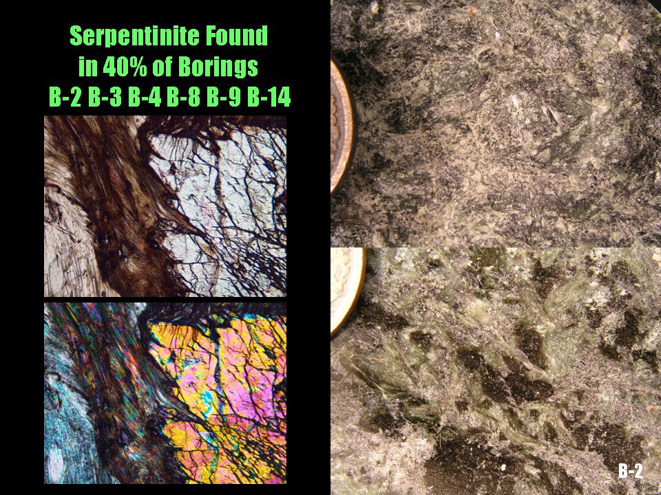
Long Island Geologists
Stony Brook, NY
Newly Discovered Serpentinite Bodies Associated with the St. Nicholas Thrust Zone in Northern Manhattan
Merguerian spoke at the Long Island Geologists conference on the tectonic significance of slivers of serpentinite found in borings at a building excavation at 165th Street and Amsterdam Avenue in NYC with coauthor Cheryl Moss of Mueser-Rutledge Consulting Enginners. His powerpoint lecture shared images and thin sections of the core samples used in their study. Download their joint paper (Merguerian and Moss 2007). An oblique regional view of the distribution of all serpentinites known in NYC and vicinity has helped outline the Taconian suture zone in NYC.
A .pdf (11 Mb) of his PowerPoint lecture on these unusual sheared bodies can be found at this link.
What is more, Dr. Merguerian coauthored two other papers at the same conference (dubbed the Merguerian Power Hour by accomplice in geo-crime Daniel Vellone). Dan presented a joint paper (Vellone and Merguerian 2007) on their joint study concerning the measurement of intrinsic enginnering properties of NYC rocks using the Schmidt Rebound Hammer. A .pdf (7.5 Mb) of Daniel's PowerPoint presentation can be seen here.
To complete the Merguerian Power Hour, coauthor Cheryl Moss presented a paper (Moss and Merguerian 2007) on unusual glacial strata in Brooklyn. Unfortunately, we do not have a .pdf of her presentation.
12 April 2007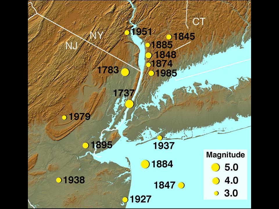
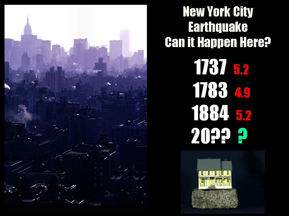
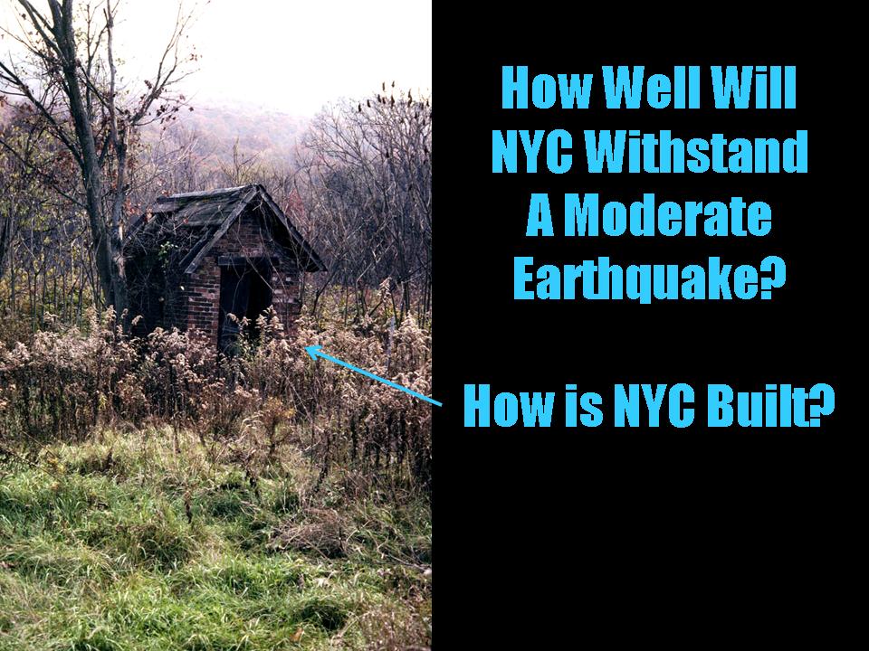
Jones Beach Conservation Society
Jones Beach, NY
New York City Earthquakes - Fact or Fiction
Dr. Merguerian spoke at a packed house (five people showed up - but only two paid!) at the Jones Beach Conservation Society in New York on the possibility of a damaging earthquake striking NYC. Merguerian's research has provided the first evidence for surface deformation in response to faulting in NYC suggesting that ground-breaking rupture and seismic activity can not and certainly should not be ruled out for this region. This new data identifies a potential failure surface along which earthquake energy could be released - important because large magnitude earthquakes struck NYC in 1737, 1783, and 1884. Do the math - we're about due!
A .pdf (14.8 Mb) of his PowerPoint presentation can be found here.
03 March 2007
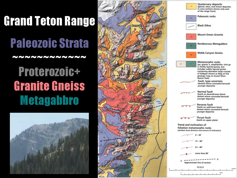
New York Mineralogical Club Show
Holiday Inn at 57th Street,
NYC, NY
Geological Wonders of Yellowstone National Park, Wyoming
Fearless Dukelabs geologist Charles Merguerian was the guest speaker at the biannual mineral show of the New York Mineralogical Club on the brewing danger of a volcanic eruption at Yellowstone National Park - home of Yogi Bear and BooBoo. His video-enhanced lecture embraced the regional geology of the area including the Grand Teton range, the 1925 Gros Ventre rock slide, hot spot tracks of the American west and the beauty of Yellowstone. Three eruptive events were discussed in the context of modern studies of the Yellowstone caldera. These include the 640 Ka – Lava Creek Caldera, the 1.3 Ma – Mesa Falls Caldera, and the 2.1 Ma – Huckleberry Ridge Caldera. Cleary, we are overdue for a major eruption at this important landmark. The lecture was based on a Hofstra University field course conducted in 2006 for which an online guide is available.
02 March 2007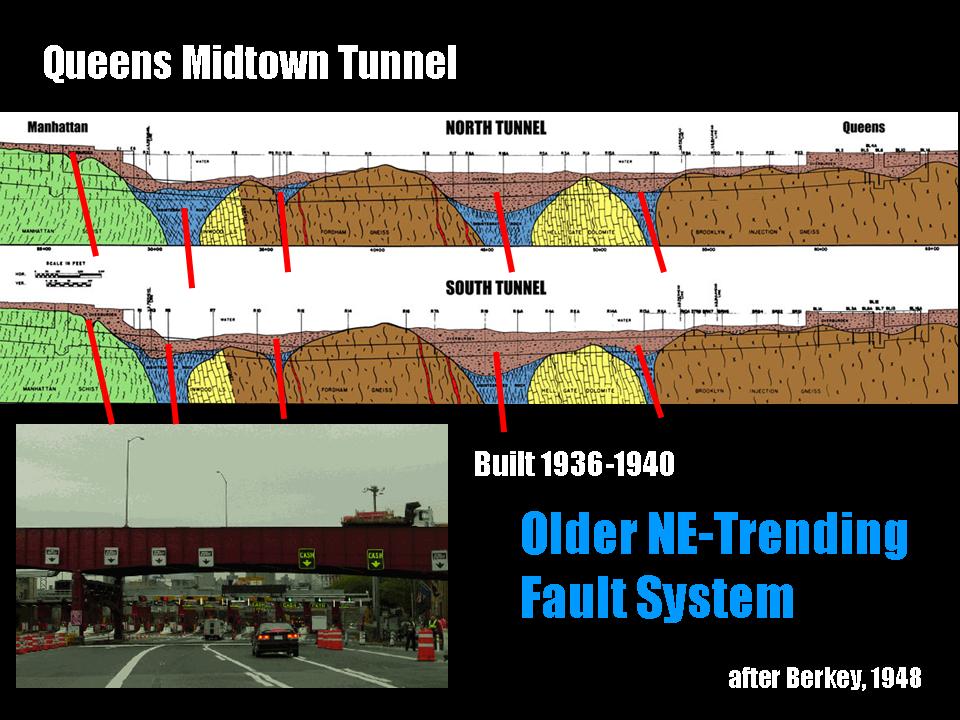
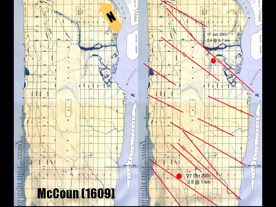
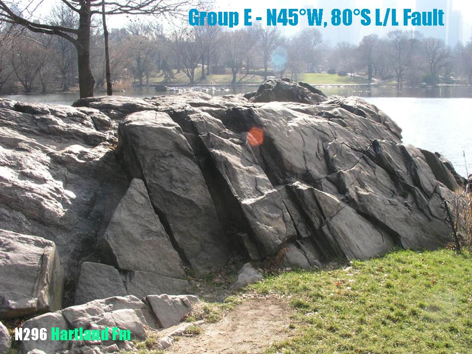
Asian American/Asian Research Institute
NYC, NY
New York City Earthquakes - Fact or Fiction
Dr. Merguerian spoke at the Asian American/Asian Research Institute in New York City on the possibility of a damaging earthquake striking NYC. Merguerian's research provides the first evidence for surface deformation in response to faulting in NYC suggesting that ground-breaking rupture and seismic activity can not and certainly should not be ruled out for this region. Because large magnitude earthquakes have struck NYC in 1737, 1783, and 1884, this new data identifies a potential failure surface along which earthquake energy could be released. Given the population, cultural development, infrastructure, and financial investment concentrated in New York City, the specter of a massive earthquake must be considered in revising existing building code designs and emergency preparedness procedures. Unfortunately, despite the scientific community’s pleas for action, severely limited emergency planning exists at the present time. Clearly, this should be changed as pre-emptive urban seismic planning is an absolute necessity in New York City. A .pdf (17 Mb) of his lecture can be downloaded here and we're in luck as his AAARI lecture was recorded and is available "live" online at this link.
27 October 2006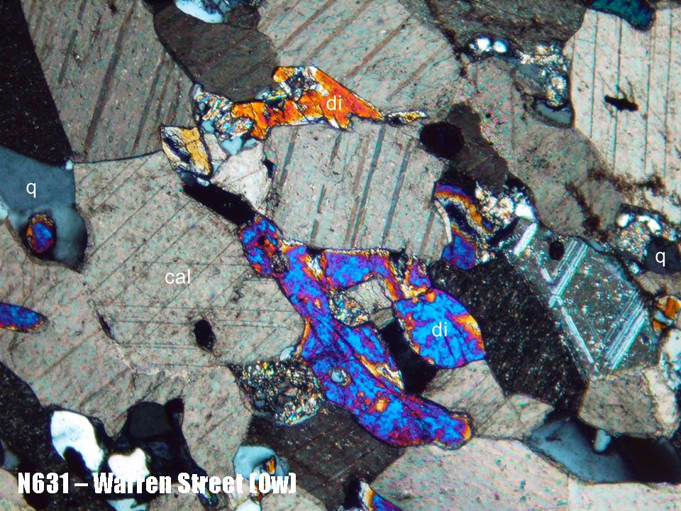
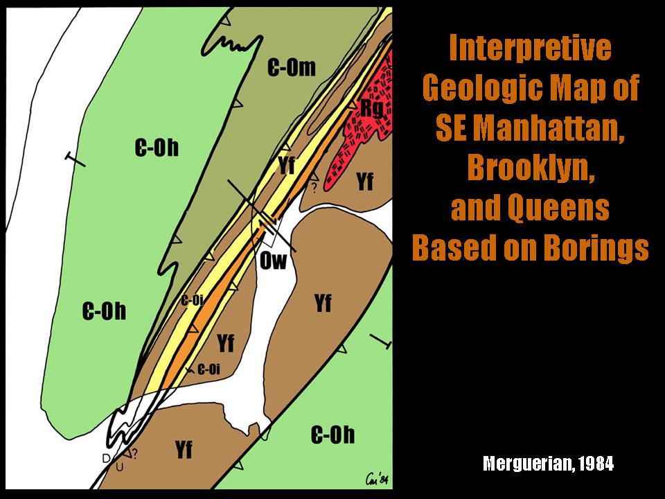
Natural Science Research Symposium
Hofstra University, NY
New Geological Discoveries in Southern Manhattan
Dr. Merguerian spoke on his field work and analysis of southern New York City. Drill core examined from over two dozen separate locations south of Canal Street in Manhattan over the past three years have been fruitful in affording surface mapping from areas of natural exposures north of 59th Street. In this southern area of rare surface exposure, drill core and other forms of subsurface information prevail. They indicate that the region is underlain by internally sheared units of the Walloomsac, Manhattan, and Hartland formations together with sheared slivers of serpentinite and foliated granitoid rock.
This work supports his contention that the venerable Manhattan Schist formation actually consists of three schistose units, now mapped as the Hartland, Manhattan, and Walloomsac formations. These coeval lithostratigraphic units have different paleogeographic origins. In addition, a newly discovered belt of schistose and calcareous rocks appears south of Canal Street in NYC in two separate along strike areas near the World Trade Center site and also reappears across town near the Brooklyn Bridge. Exposed as a result of new construction efforts, the duplication of hitherto unrecognized Walloomsac rocks on either side of southern Manhattan suggests repetition by folding and/or faulting.
A .pdf (9.8 Mb) of his PowerPoint lecture can be found here.
26 September 2006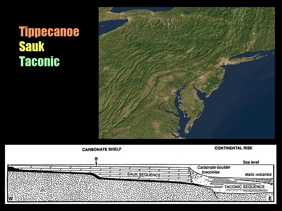
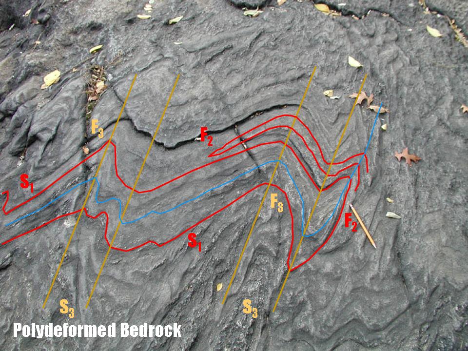
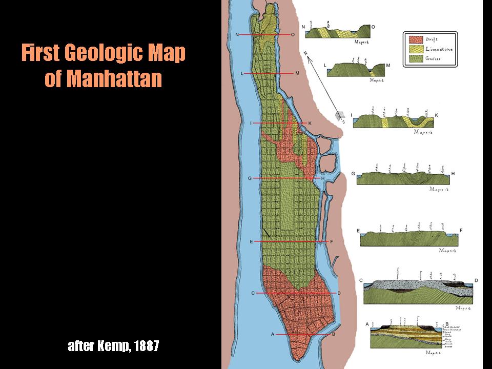
Department of Earth and Planetary Sciences
American Museum of Natural History, NYC, NY
New Insights into the Structural Geology of NYC
A luncheon presentation at the Mineral Sciences Department of the American Museum of Natural History by Dr. Charles Merguerian focused on new discoveries from construction sites in NYC. Recent work indicates that in southern Manhattan duplication of a continuous belt of sheared Hartland schist and granofels and Walloomsac graphitic schist and calc-silicate rocks occurs in a tract where aluminous rocks of the Manhattan formation were expected. Based on new data concerning the distribution of serpentinites and a wealth of existing data from historic construction efforts, new insights and interpretations of the structural geology and tectonics of the region were discussed. A highly spirited question and answer period delighted all attendees and resulted in tar and feathering of the featured speaker. Some remarked that "it was about time."
Wrestled back from the Nobel Prize Committee, a .pdf (16.6 Mb) of his PowerPoint presentation can be found at this link.
See Merguerian (1994a) for a summary on the structural geology of NYC here.
09 May 2006
Stamford Mineral Society
Stamford, CT
Mega-Construction Projects in New York City
Taking his show on the road, Dr. Merguerian presented an animated lecture at the annual dinner of the Stamford Mineralogical Society - animated by people exiting hastily from the onset. His talk described new tunneling contracts in the City of New York including elements of the Third NYC Water Tunnel, the Second Avenue Subway, the East Side Access project, and the #7 Line Extension. He discussed new discoveries in deep tunnels that have changed our views of the geology of New York City and show examples of minerals found during mapping of the Queens Tunnel. In the past decade, Merguerian's research has strayed to include geologic mapping and analysis of tunnels bored by tunnel boring machines (TBMs). This work has verified geological relationships established by surface mapping and has provided new insights into the relationships between TBM penetration rates, geological structure, and rock type in the New York City area. Geotechnical research, along with engineering, have evolved efficient methods in constructing water, utility, and transportation tunnels in urban areas.
22 April 2006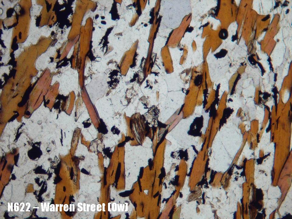
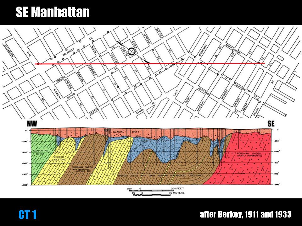
Long Island Geologists
Stony Brook, NY
Structural Implications of Walloomsac and Hartland Rocks Displayed by Borings in Southern Manhattan
A joint paper presented by Charles Merguerian (speaker) and Cheryl Moss of Mueser-Rutledge Consulting Engineers focused on a new discovery of a continuous belt of Walloomsac graphitic schist and calc-silicate rocks in an area of Manhattan where aluminous rocks of the Hartland formation were anticipated. Always on the look-out for the unusual, Merguerian and coauthor Moss have spent countless afternoons examining drill core and construction excavations and have found the presence of unusual calcareous and graphitic rocks. This extended abstract was presented at the 13th Annual Meeting of the Long Island Geologists and is available (Merguerian and Moss 2006a) for download here.
What is more, a .pdf (5.8 Mb) of his Powerpoint lecture can be found here.
22 April 2006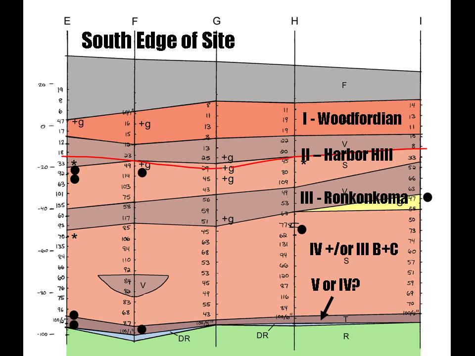
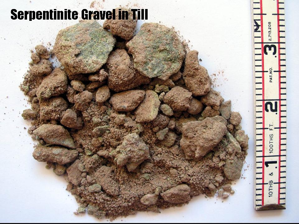
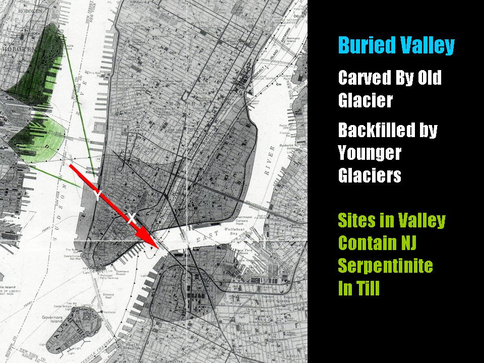
Long Island Geologists
Stony Brook, NY
Evidence for Multiple Glacial Advances and Ice Loading From a Buried Valley in Southern Manhattan
Cheryl Moss (speaker) and Charles Merguerian also presented a paper on a newly discovered NW-trending buried valley in southern Manhattan that holds evidence for multiple glaciations. Always on the look-out for the unusual, Cheryl Moss of Mueser-Rutledge Consulting Engineers and coauthor Charles Merguerian of Hofstra University have found serpentine-pebble-bearing basal till overlain by additional glacial drift units. They will report on their findings and the support for the multi-glacier hypothesis for New York and vicinity. Their joint extended abstract can be accessed here.
A .pdf (4 Mb) of her Powerpoint lecture can be found here.
22 April 2006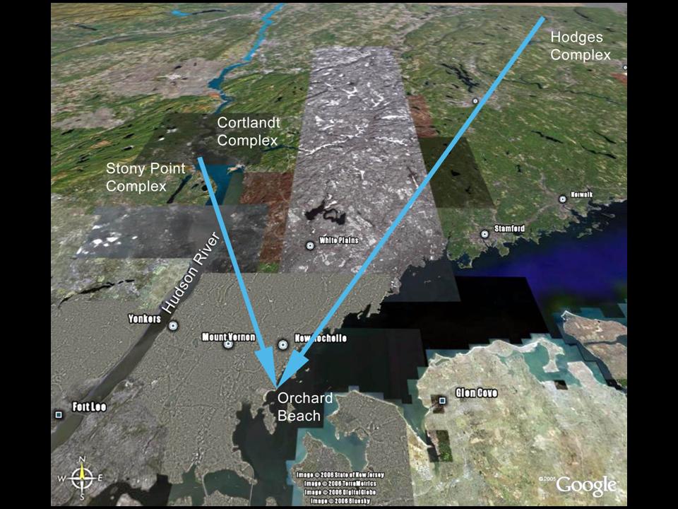
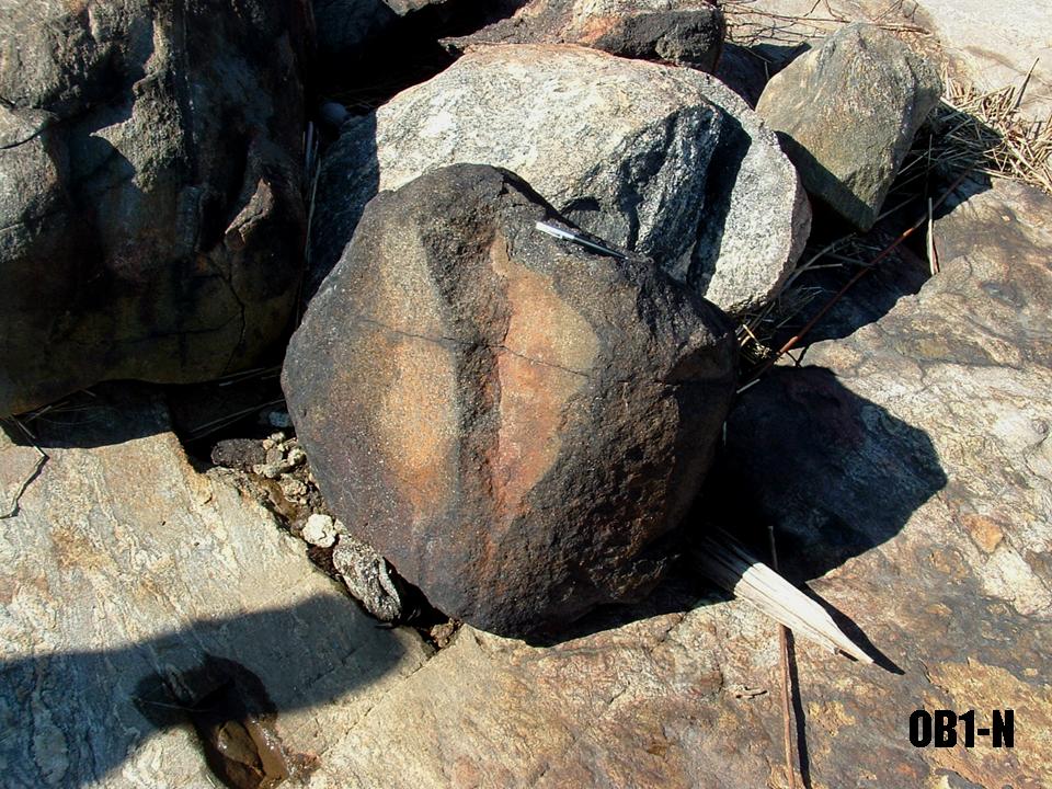
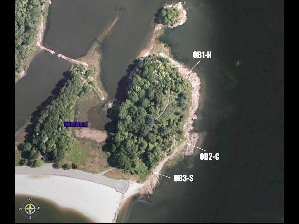
Long Island Geologists
Stony Brook, NY
Orchard Beach Ultramafic Erratics – Where Are They From?
Drs. Nehru E. Cherukupalli (Speaker) and Charles Merguerian (Benched Listener) presented the preliminary results of their petrographic and geochemical analysis of three separate and seemingly unique ultramafic erratics found on striated bedrock at Orchard Beach, NY. Their joint paper is available here.
16 April 2005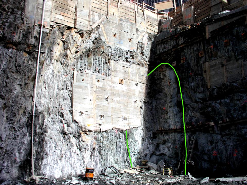
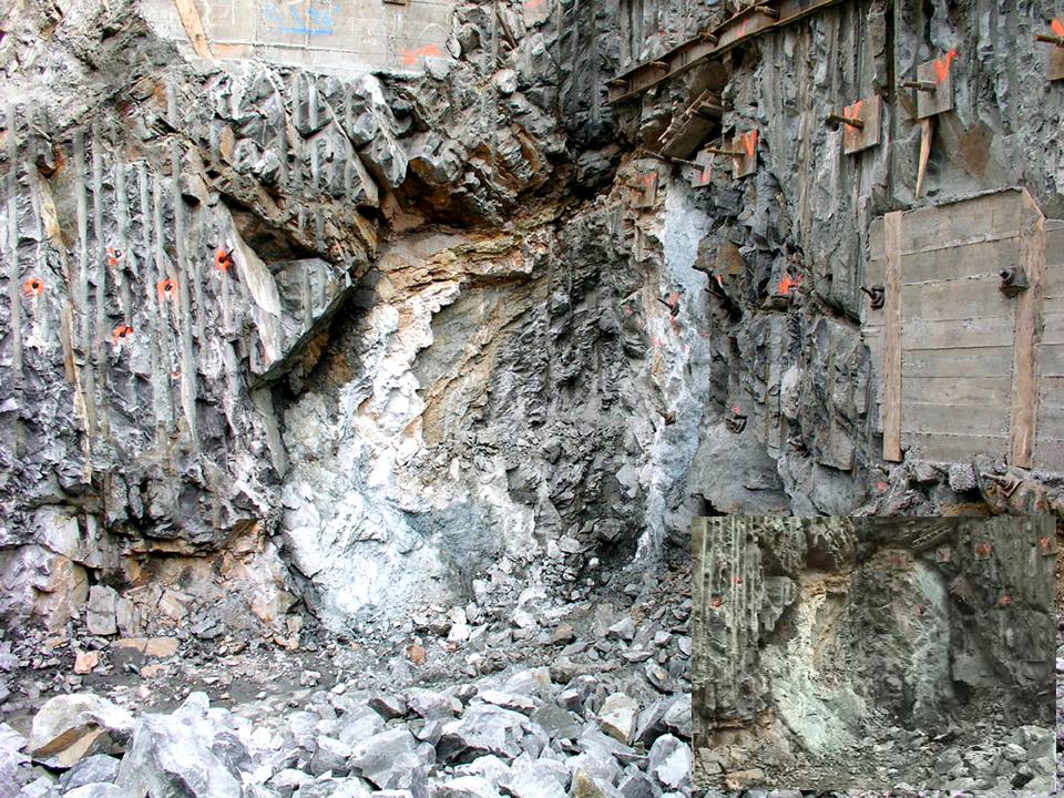
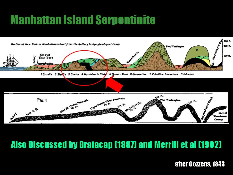
Long Island Geologists
Stony Brook, NY
Newly Discovered Ophiolite Scrap in the Hartland Formation of Midtown Manhattan
Dr. Charles Merguerian delivered yet another joint paper at the Twelfth Annual Meeting of the Long Island Geologists on a new discovery of a mass of sheared serpentinite in midtown Manhattan. Always on the look-out for the unusual, Merguerian and coauthor Cheryl Moss of Mueser-Rutledge Consulting Engineers spent four afternoons examining the geology and contact relationships of a small, highly deformed and elongated serpentinite body that was uncovered in a deep building construction site at the SW corner of 43rd Street and Sixth Avenue in midtown Manhattan.
Serpentinites are black to greenish-black, fine-textured rocks containing serpentine group minerals including chrysotile, lizardite, and antigorite together with amphiboles, chlorite, brucite, magnesite, talc, calcite, and relict chromite, magnetite, olivine and pyroxene. Similar to the famous Staten Island and Hoboken NJ serpentinites, many scattered bodies of serpentine rock have been encountered in the subsurface of NYC over the years as a result of construction.
In addition to the legendary mass known from Manhattan between 54th and 62nd Streets along the shore and 10th Avenue (Cozzens 1843; Gratacap 1887), a few bodies were penetrated by borings in the geotechnical investigation stages of the #7 Line extension in Manhattan and in transit tunnels excavated beneath the Hudson River. Their joint extended abstract makes a bold comparison between Appalachian serpentinites and those of the Coast Ranges of California, suggesting that they originated in a similar convergent tectonic setting.
What is more, a .pdf (7.3 Mb) of his PowerPoint lecture can be sought here.
16 April 2005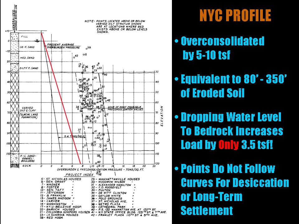
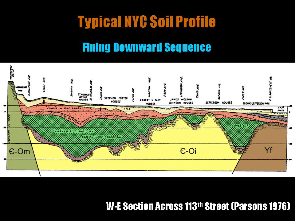
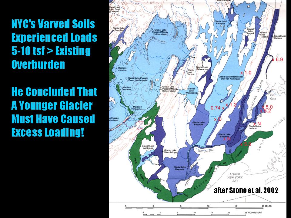
Long Island Geologists
Stony Brook, NY
Loading Patterns in Varved Pleistocene Sediment in the NYC area
Another joint paper with Merguerian in the background, this one presented by Cheryl Moss of Mueser-Rutledge Consulting Engineers highlighted their (mostly her) work on the loading of Pleistocene lake strata. The data shows a systematic geographical distribution pattern that may indicate where younger glacial ice once over-rode pre-deposited lake strata. Although preliminary at the present time, such data may prove beneficial in establishing the thickness, scope, and extent of the Woodfordian glacier and help to support the multi-glacier hypothesis of Sanders and Merguerian (1998).
Their joint extended abstract on loading patterns in NYC can be found here.
Cheryl's Powerpoint lecture as a .pdf (2.9 Mb) can be found here.
16 April 2005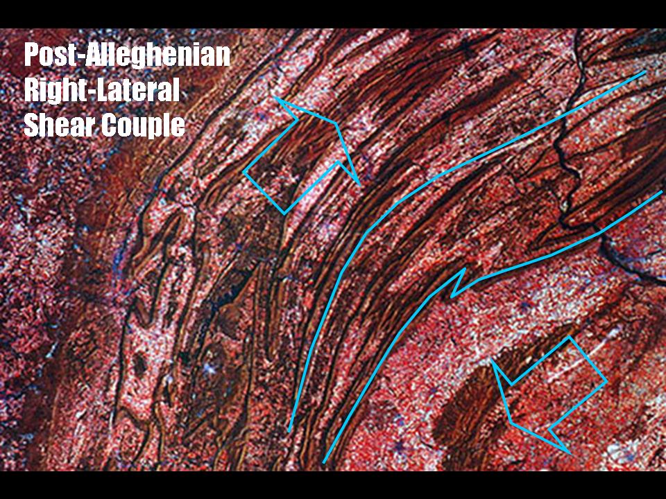
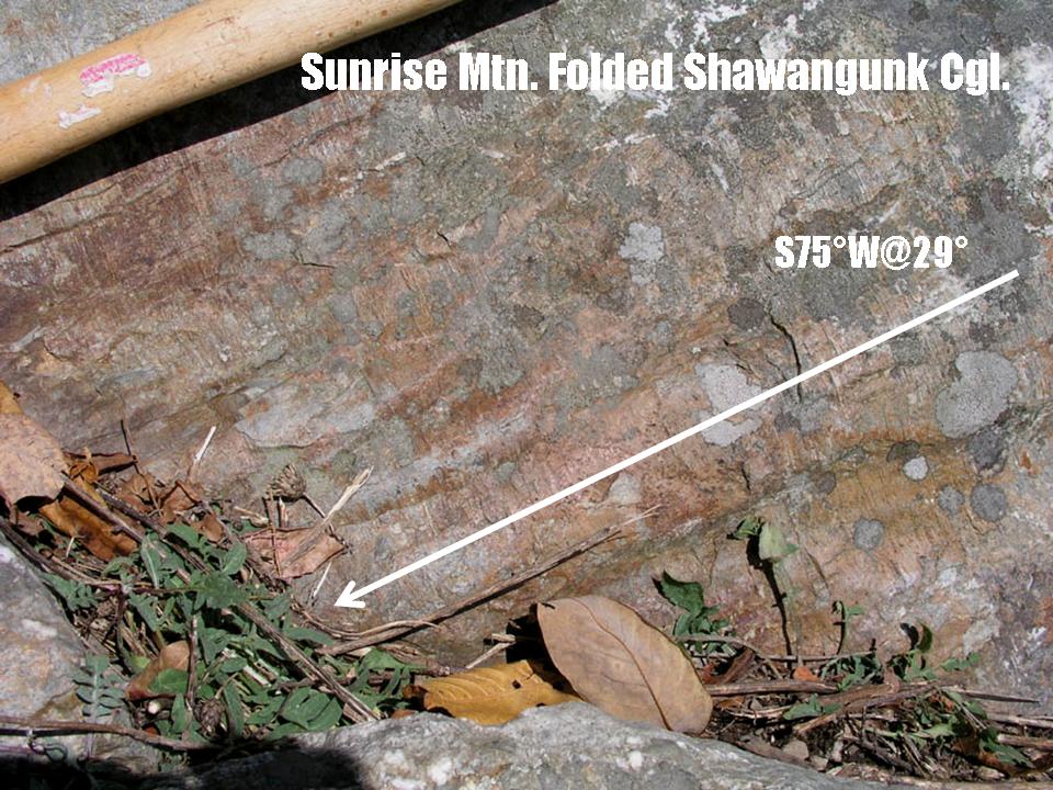
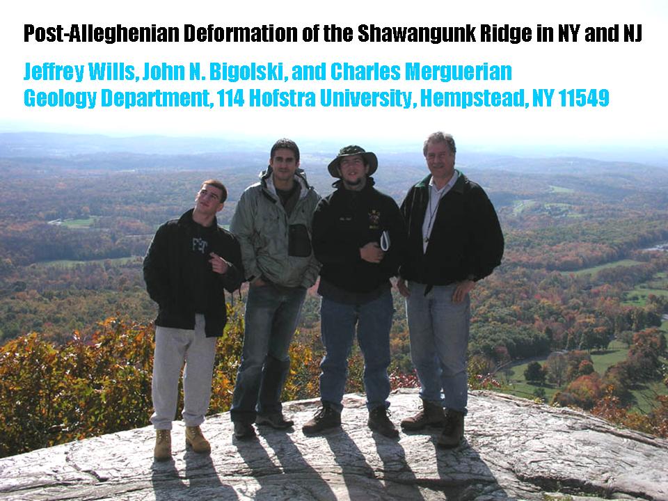
Long Island Geologists
Stony Brook, NY
Post-Alleghenian Deformation of the Shawangunk Ridge in NY and NJ
Based on a research trip with Hofstra University structural geology students led late in 2004, new field data supports the idea that deformation of the Shawangunk ridge in NY and NJ may be of Mesozoic age. At High Point State Park in NJ, the Shawangunk strata is overturned and changes in strike away from typical non-Appalachian trends. The geometry of the structures forces the conclusion that deformation was the result of right lateral shear, perhaps resulting from an early stage of opening of the Atlantic ocean basin. In a joint paper at the Twelfth Annual Meeting of the Long Island Geologists, Hofstra University students Jeff Wills, John Bigolski, and Charles Merguerian share some new ideas on the age and style of Appalachian deformation saw the light of day in poster form. Their joint extended abstract can be found here.
We've retained a .pdf (3.3 Mb) copy of Merguerian's lecture here.
08 April 2005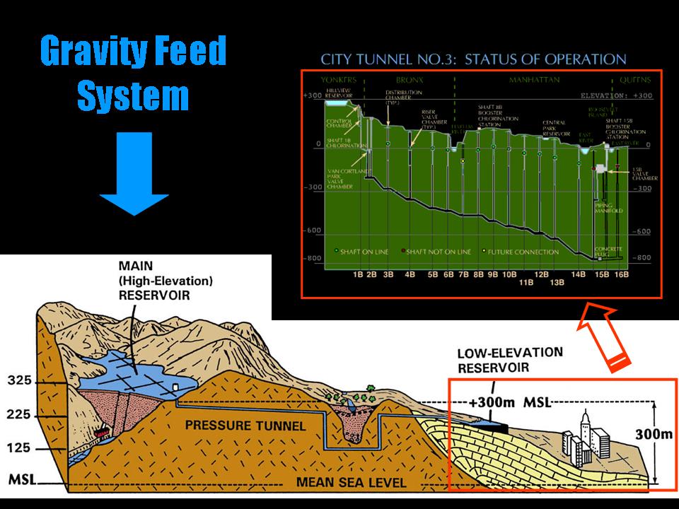

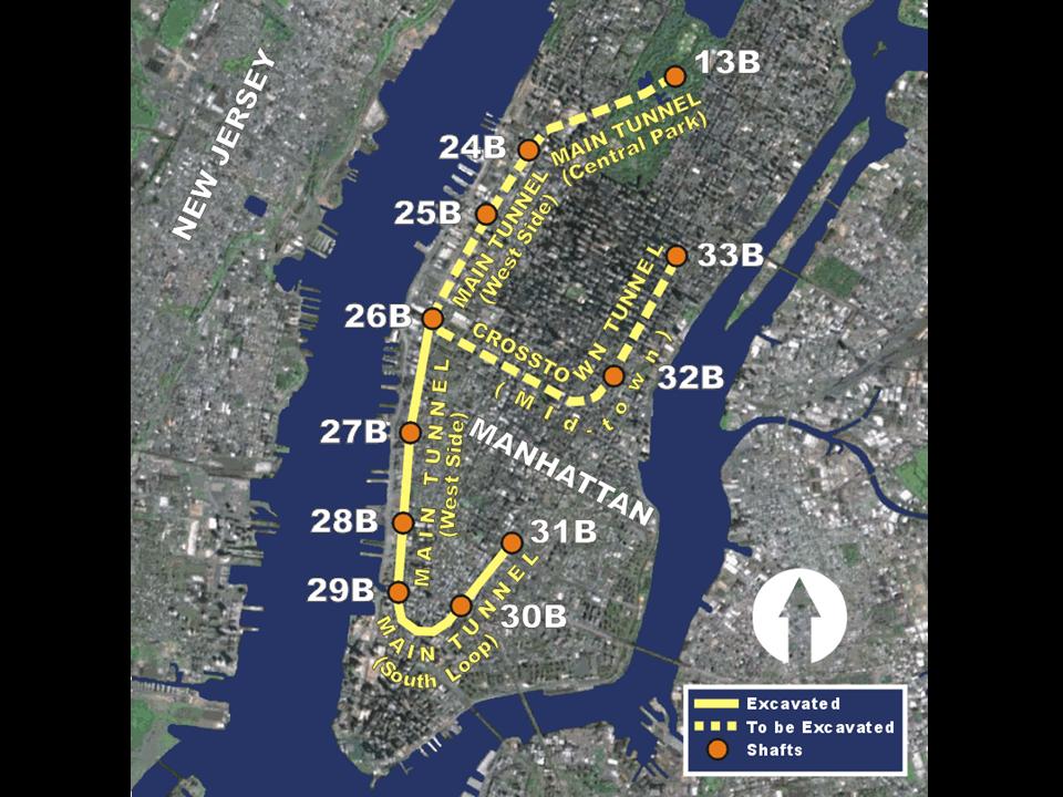
Colonial Academic Conference
Hofstra University, NY
Applications of Geology to Mega-Construction Projects in New York City
Merguerian delivered a keynote after-dinner candle-lit talk to research students attending the Colonial Academic Conference at Hofstra University in April 2005. His lecture was based on research which has concentrated on geologic mapping of tunnels bored by tunnel boring machines (TBMs) which has verified geological relationships established by surface mapping and has provided important new insights into the relationships between TBM penetration rates, geological structure, and rock type in the New York City area.
Those interested in a .pdf (14.8 Mb) of his lecture should click here, then seek help.
05 March 2005
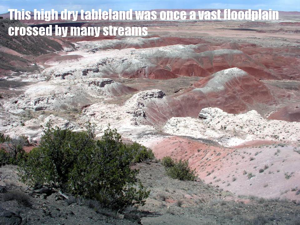
New York Mineralogical Club Show
People's Center, American Museum of Natural History
NYC, NY
Geology of the Painted Desert and Petrified Forest, AZ
Awed by a visit to the region in July 2004 with his assistant and son unit Mickey, the elder Merguerian spoke at the New York Mineralogical Club Mineral Show about the landscape formation and geology of the Painted Desert and Petrified Forest region of northeastern Arizona. In the 1800s, U.S. Army map makers and surveyors described the "Painted Desert" and its trees turned to stone. Here, the geologic history of the region peaks during Mesozoic time - an era when dinosaurs ruled the earth. After growing to great height and thickness, the tall trees fell and were washed by swollen streams into a broad floodplain. There they were covered by silt, mud, and volcanic ash, and this blanket of deposits cut off oxygen and slowed the logs decay. Gradually, silica-bearing ground waters seeped through the logs and encased the original woody tissue with silica. Slowly the process continued, the silica crystallized into quartz, and the logs were preserved as dense, multi-hued petrified wood. Images of these magnificent petrified logs and video clips of the region adorned the Powerpoint presentation on this unique area. CM's 2010 geological field guide to northern Arizona can be found here.
Those who would like a .pdf (15.5 Mb) of his presentation can access it here.
05 November 2004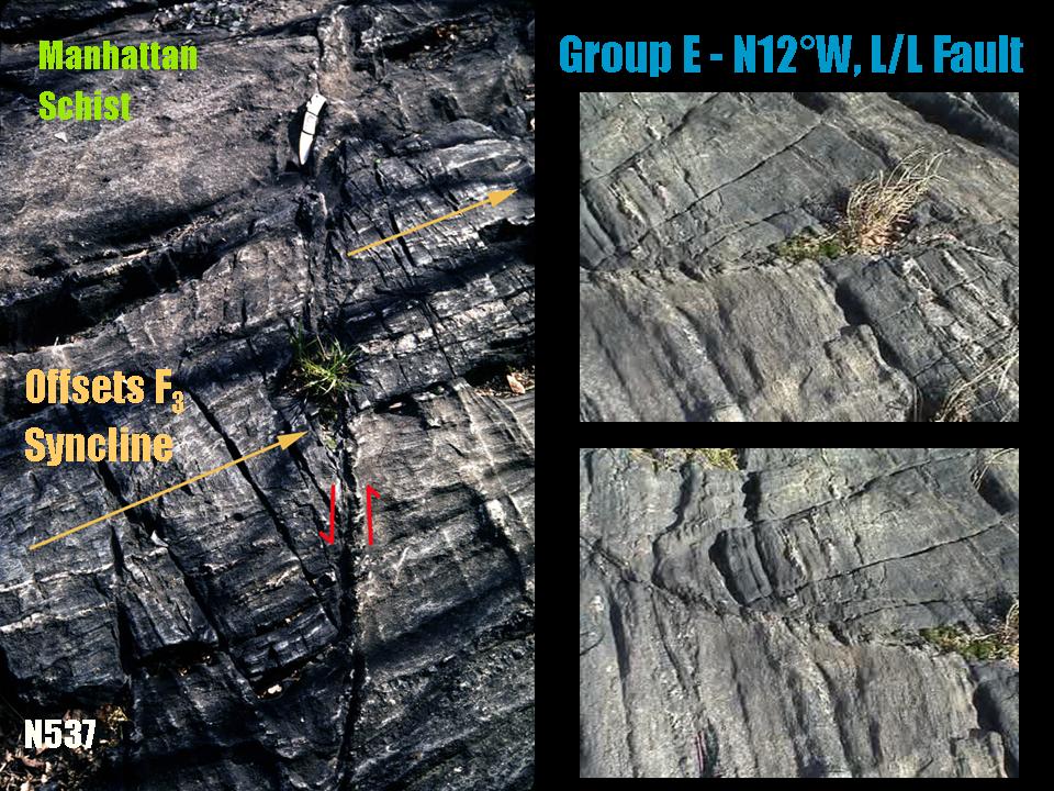


New York Academy of Sciences
NYC, NY
Inquiry Teaching of Geology in New York City Parks
Dr. Merguerian spoke to the Education Section of the New York Academy of Sciences to end the 2004 lecture circuit on the subject of utilizing New York City parks to teach inquiry based geological education. His lecture focused on the bedrock and glacial features exposed in Central, Inwood, and Riverside parks in Manhattan, the New York Botanical Garden, and some smaller parks in The Bronx that best illustrate the inquiry method of teaching geology in New York City. Participants, many of whom were tired from teaching at their day job, brought ripe fruits and vegetables and limber throwing arms for some big-time lecture fun.
A .pdf (23.2 Mb) of his lecture can be found here.
21 October 2004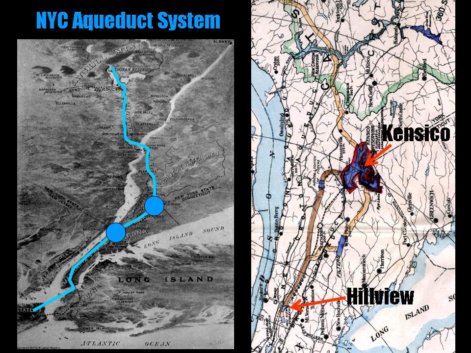
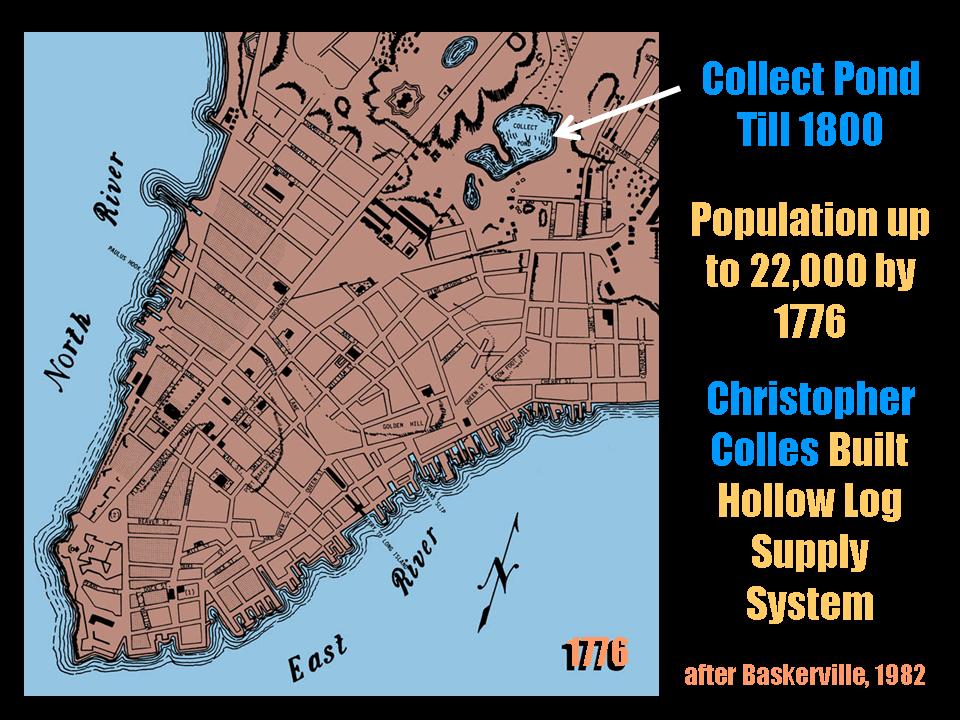
IDEAS Institute
Hofstra University, NY
12 Million Thirsty People: Supplying New York City and Long Island with Fresh Water
Most of New York City and all of Long Island are, in fact, islands surrounded by salt water. So how do we get enough fresh drinking water to supply 12 million thirsty people and their dehydrated pets? Speaking for the IDEAS Institute Lectures Series at Hofstra University, Dr. Merguerian diagrammed how Long Island sits above trillions of gallons of fresh groundwater that is pumped to the surface for drinking water and how, by contrast, New York City relies on a system of gravity-feed pressure tunnels to bring fresh water from reservoirs over a hundred miles away in the Catskills. These huge water tunnels and their distribution systems constitute the greatest engineering work of our twentieth century (and let's face it - what a century it was!). Participants (thanks Mabel, for showing up) were treated to a video-laced Powerpoint presentation that took them deep under the city inside a huge water tunnel constructed beneath Queens, Brooklyn and now in Manhattan. Follow this link to a supplementary handout on the History and Construction of the NYC Water Supply.
15 October 2004
Natural Science Research Symposium
Hofstra University, NY
The Narrows Flood - A Catastrophic Glacial Meltwater Breach of the Narrows Channel, NYC
Geotechnical investigations specific to the Narrows have provided the tantalizing interpretation that an episodic breach took place through the Harbor Hill moraine which drained northern meltwater lakes and eroded the Narrows channel. Subsurface information compiled from multiple sources indicates that two tills, outwash fans, and varved lake strata form a continuous blanket of regolith in the NY Harbor area and support a multi-glacier hypothesis for the region. Varved lake clays provide evidence that the Harbor Hill moraine acted as a dam, impounding glacial lakes in the Hudson Valley. In a brief cameo appearance (10 minutes), Professor Merguerian spoke at the Divisional Natural Sciences Research Day at Hofstra University to explain, to a small but obviously stunned audience, how such an event could have redirected the flow of the ancestral Hudson River across the Upper New York Bay into its modern course. Follow this link to a 2003 extended abstract on this subject.
For a .pdf (3.7 Mb) of his lecture simply click here.
08 September 2004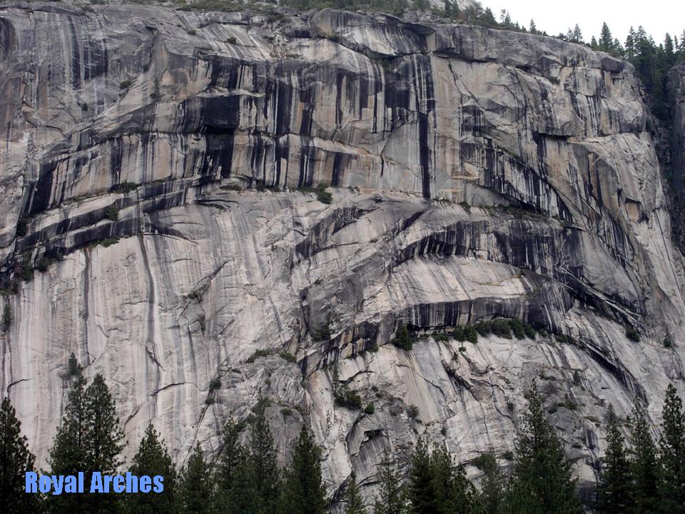
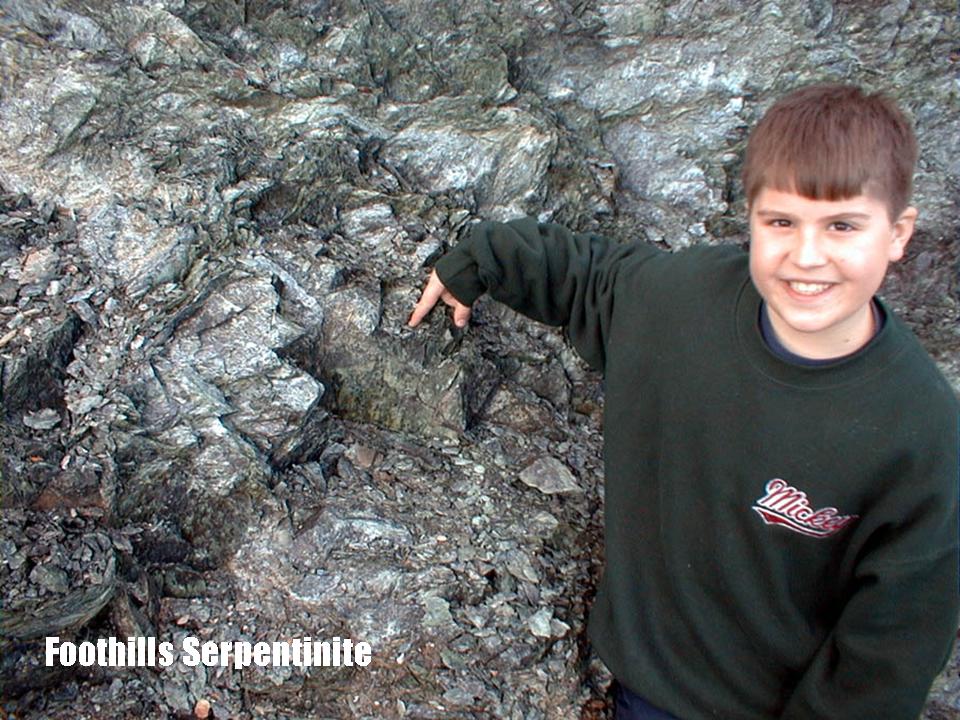

New York Mineralogical Club
People's Center, American Museum of Natural History
NYC, NY
Geology of California and the Mother Lode Gold Belt
Dr. Charles Merguerian of Hofstra University of Duke Geological Laboratories spoke to the New York Mineralogical Club at the Museum of Natural History. Based on his experience mapping in the foothills gold belt of the Sierra Nevada, Merguerian described a west to east transect view of the geology of the state and then focused on the geology and history of the Mother Lode gold belt. With first-hand knowledge and an extensive line of bull as a composite resource, his video-enhanced Powerpoint lecture featured images of many crystalline gold specimens found in the area of the Mother Lode.
A bloated .pdf (30.7 Mb) of his fluidal PowerPoint lecture can be found here.
A field guide to the region can be found here.
This link will bring you to guidebooks and papers on the geology of California.
17 April 2004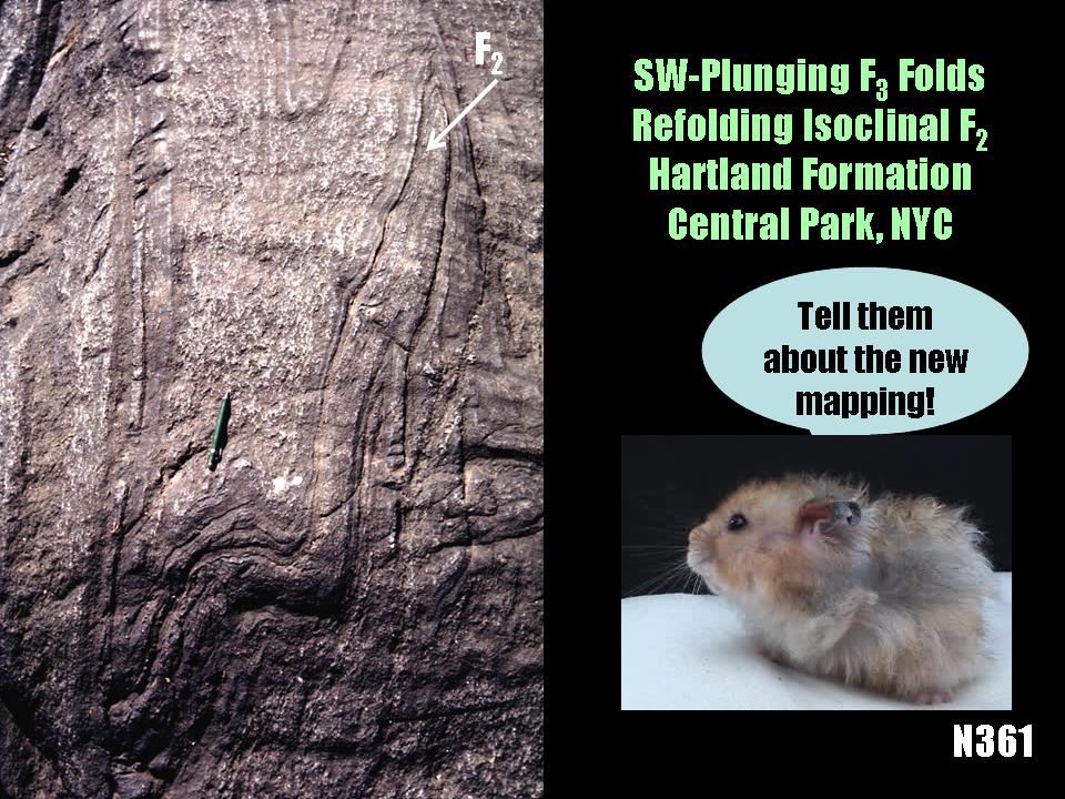
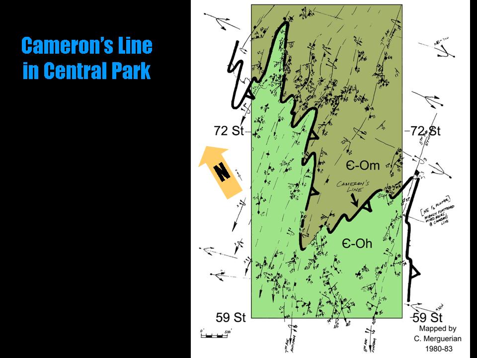
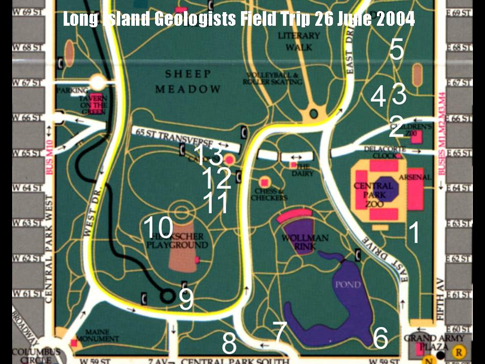
Long Island Geologists
Stony Brook, NY
Geology of Central Park - From Rocks to Ice
Charles Merguerian spoke about the joint research project in Central Park conducted with Dukelabs advance scout Mickey in late 2003. New lithologic mapping has redefined the extent of aluminous rocks mapped as Hartland formation throughout Central Park. Their field guide covers the south part of the park - the area most visited by travelers and tourists. They also conducted a field trip on 26 June 2004 for the Long Island Geologists.
A .pdf (8.1) of his PowerPoint lecture can be found here.
Their fully extended abstract and field guide can be found here.
25 March 2004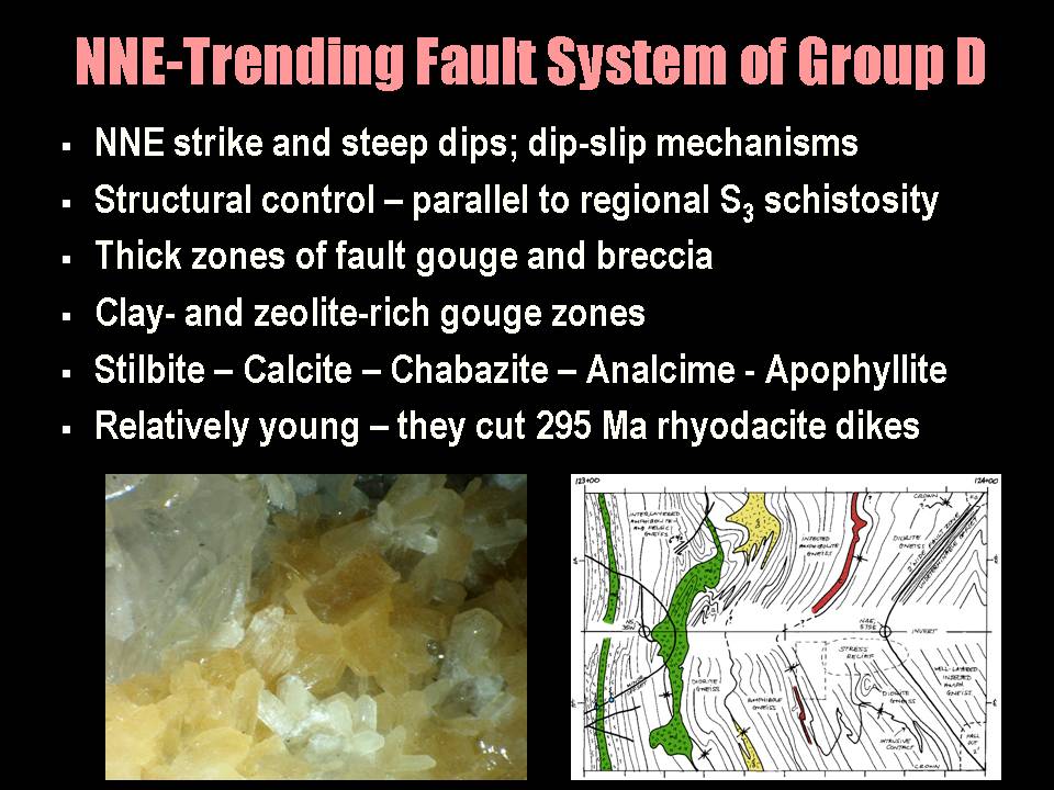
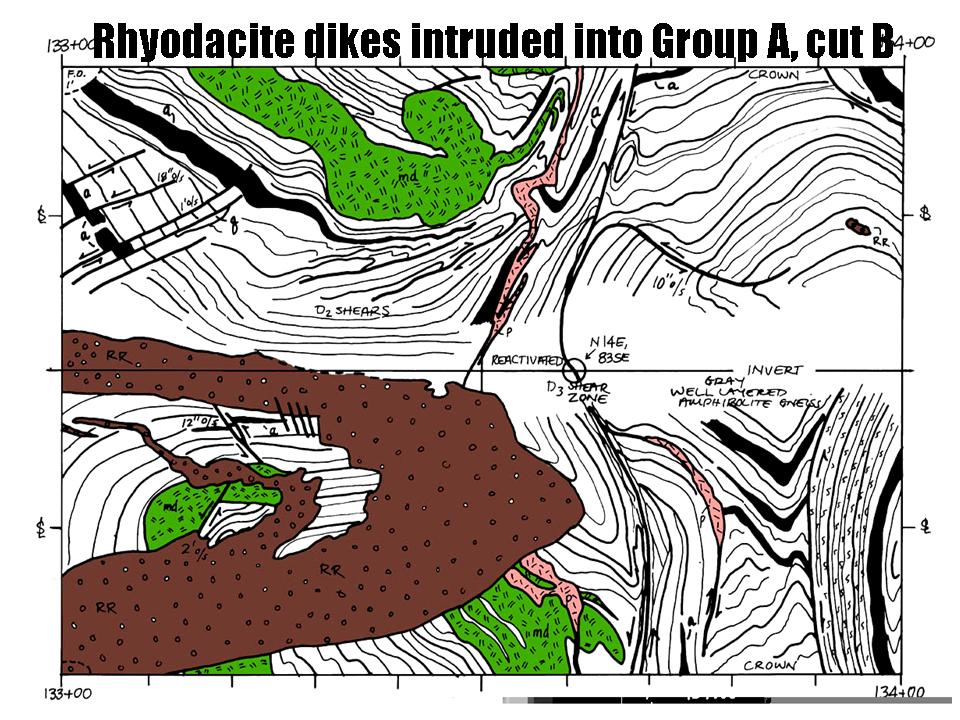

Geological Society of America, NE Section
Tysons Corner, VA
Brittle Fault Chronology of New York City
Hofstra University Professor and Dukelabs Principal Dr. Charles Merguerian discussed the chronology of the brittle faults of New York City, pointing to evidence of neotectonic activity along NNW and NW-trending faults and their bearing on the potential for intraplate earthquakes in NYC.
A .pdf (6.5 Mb) of his well-attended lecture can be seen here.
21 February 2004

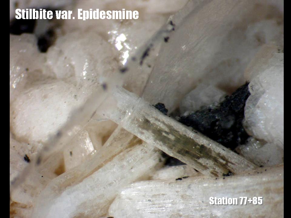
New York State Museum Show
Albany, NY
Geology and Minerals of the Queens Tunnel
Our geologist and talkative lecturer Charles Merguerian hoofed it to Albany with able assistant Mickey Merguerian to speak on one of his favorite topics - "The Minerals of the Queens Tunnel". Along NNE and NNW trending faults in New York City, pulses of low-temperature mineralization left their trace in the form of beautifully grown zeolites, calcite, quartz, and pyrite. Participants ooohed and aaahed at the many crystal specimens shown.
Click this link for a .pdf (10.6 Mb) of his presentation.
This link brings you face to face with a gallery of many of the specimens found during his mapping.
This link will bring you to some cool images of Queens Tunnel Thin Sections.
29 December 2003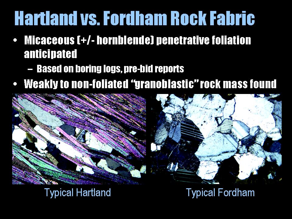
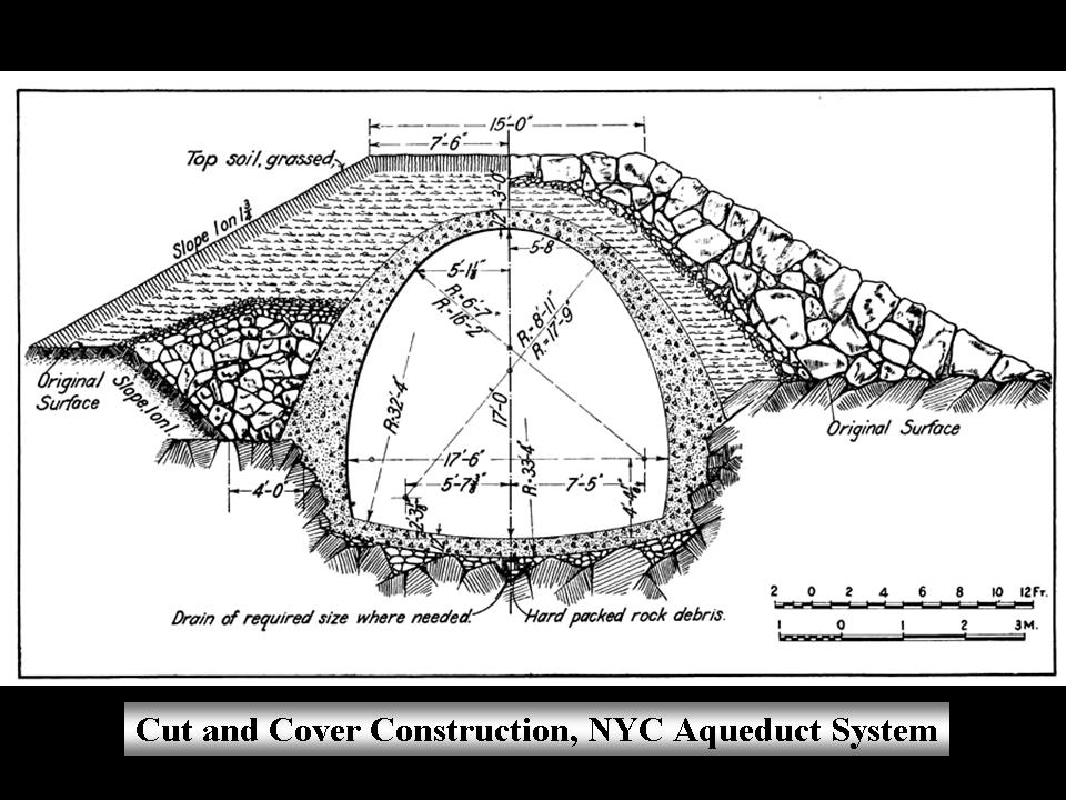
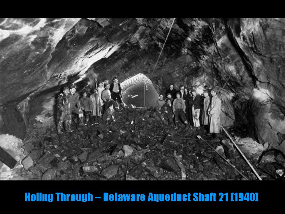
Department of Earth and Planetary Sciences
American Museum of Natural History, NY
Geology of the NYC Water Tunnel System
Dukelabs geologist and Hofstra University Professor Dr. Charles Merguerian discussed the geology of the NYC aqueduct system paying particular attention to the distribution tunnels beneath NYC. His Powerpoint talk focused on the results of over 25 years of research in the water tunnel system showing many subsurface views. The subsurface data has helped verify Merguerian's surface mapping and points to the presence of hitherto unknown rock units, ductile- and brittle faults, and volcanic rocks, never before found in NYC. A handout on the history of the NYC aqueduct system can be found here.
Click this link for a .pdf (15.4 Mb) of his soggy presentation.
08 October 2003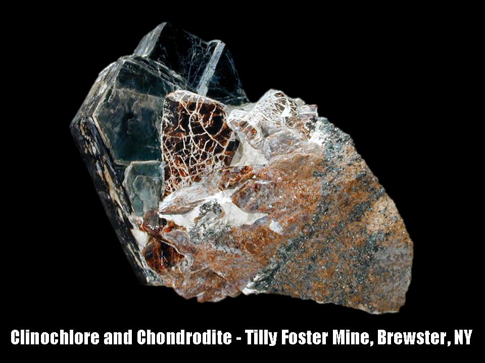
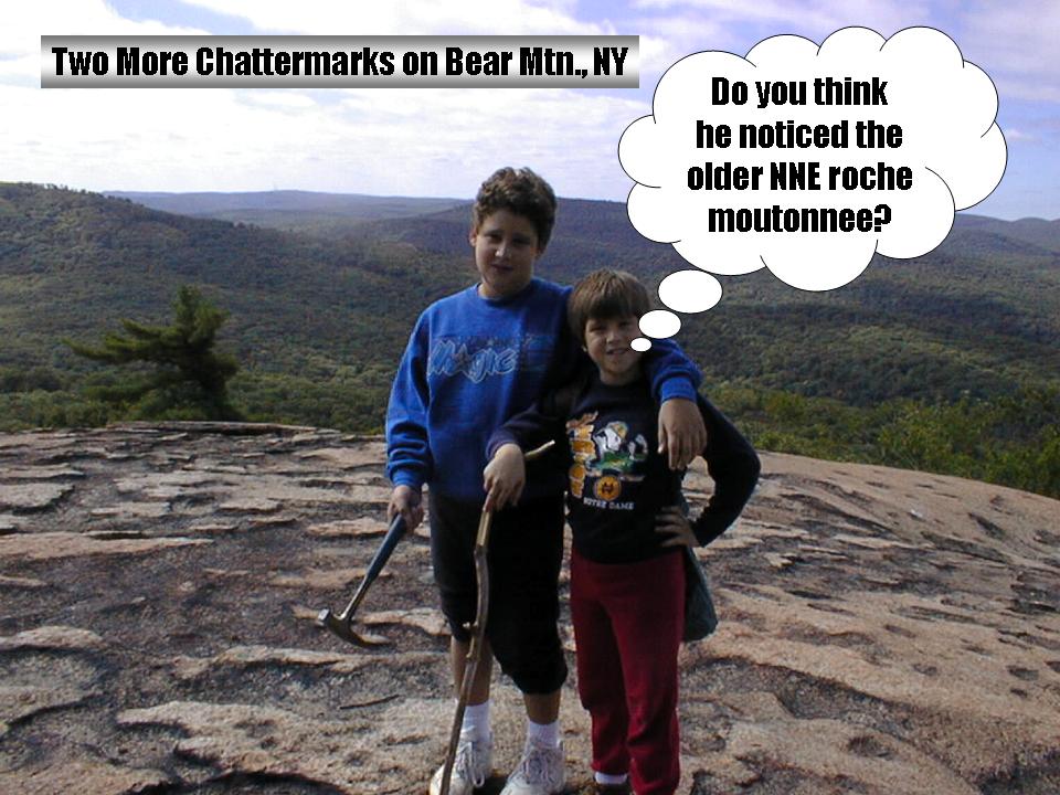

New York Mineralogical Club
People's Center
American Museum of Natural History
NYC, NY
Geology and Scenery of the Bear Mountain Region
Dukelabs geologist and Hofstra University Professor Dr. Charles Merguerian discussed the geologic control on the scenery of the Hudson Highlands in the vicinity of Bear Mountain at the October meeting of the New York Mineralogical Club. The talk explained both the bedrock and glacial geology of the region and explained causes for mineral formation.With the direct help of Mike Hawkins and Erik Rutnik of the New York State Museum, images of minerals from classic localities were shown.
Ancient rock of over a billion year vintage decorate the Hudson Highlands in this tract of New England. The Hudson River course is emphatically controlled by the structural geology with bends in the river conforming to major cross faults. The erosive effects of glacial ice flow from two major contrasting directions (NW to SE and NE to SW) was superimposed on the prevailing geologic structure, resulting in truly spectacular scenery. Many brought vegetables in the event Merguerian screwed up. This link will bring you more about the 1923-24 construction of the Bear Mountain bridge.
A .pdf (22.8 Mb) of CM's lecture can be found here.
22 June 2003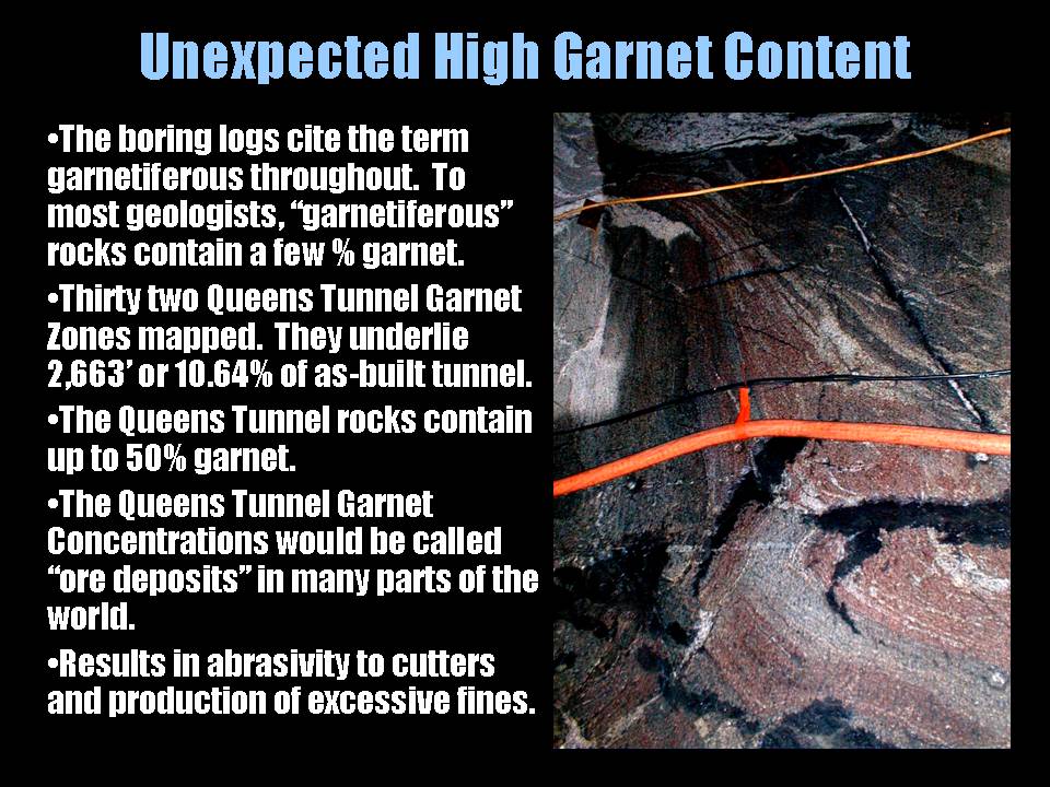

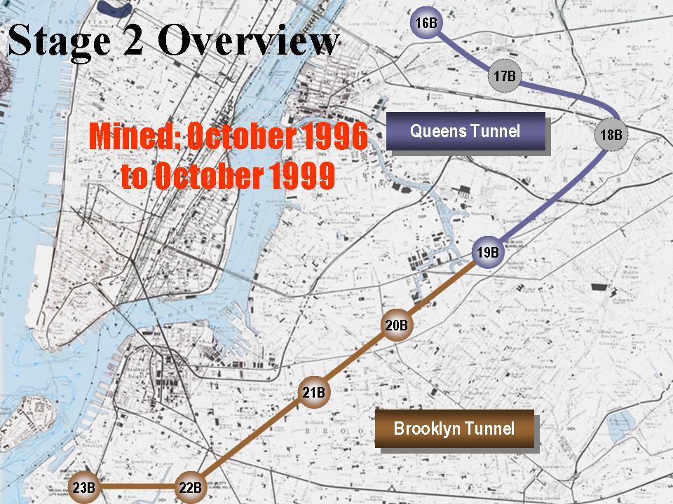
Rapid Excavation and Tunneling Conference
New Orleans, LA
Rock Mass Properties and Hard Rock TBM Penetration Rate Investigations, Queens Tunnel Complex, NYC Water Tunnel #3, Stage 2
Enduring great hardship and expense, Merguerian traveled to New Orleans and spoke at the Rapid Excavation and Tunneling Conference in mid-June. Between visits to Bourbon Street and a local clinic, he presented a coauthored paper (Merguerian and Ozdemir, 2003) on TBM penetration rate studies from the Queens Water Tunnel of City Water Tunnel #3.
A .pdf (8.3 Mb) of his presentation can be downloaded here.
17 April 2003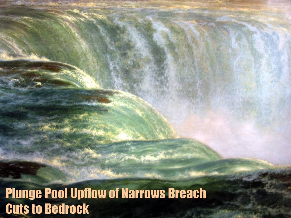
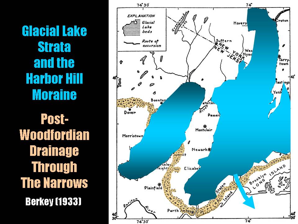
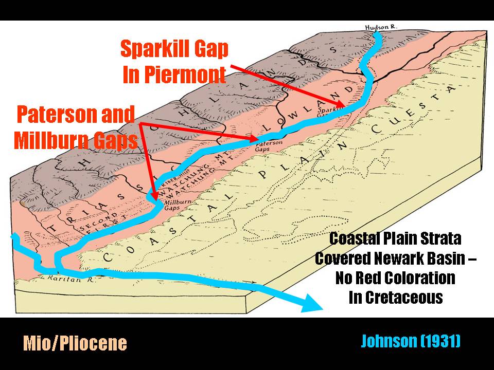
Long Island Geologists
Stony Brook, NY
The Narrows Flood – Post-Woodfordian Meltwater Breach of the Narrows Channel, NYC
Merguerian spoke at the 10th Annual meeting of the Long Island Geologists. Showing tremendous diversity and an unfathomable ability to concoct bizarre conclusions from weak data spanning divergent branches of geology, he spoke on the subject of the Narrows Meltwater Breach and coauthored an ezxtended abstract with Hofstra students on Quicktime Virtual Reality.
His Narrows Flood contribution (Merguerian 2003) can be found here.
A .pdf (8.6 Mb) of his PowerPoint lecture can be seen here.
01 March 2003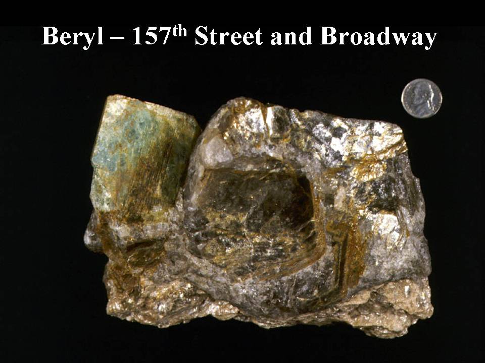
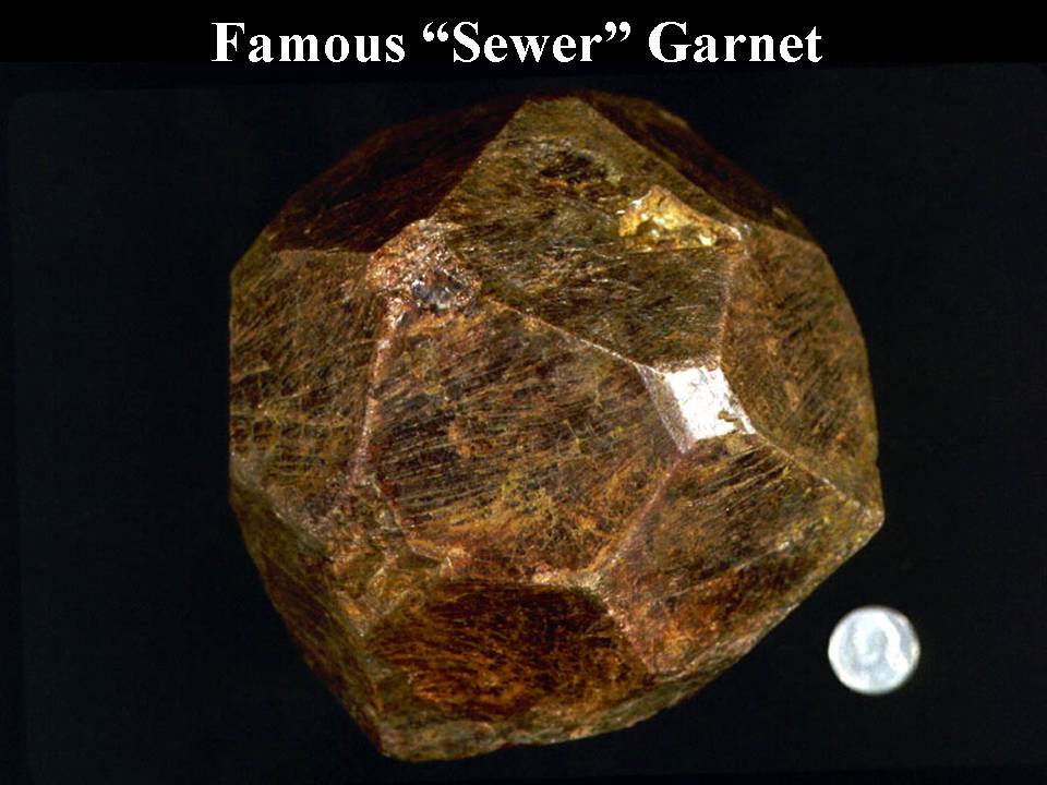
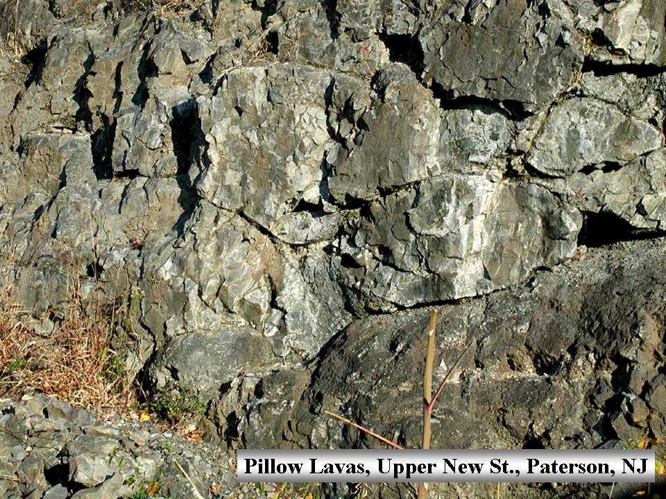
New York Mineralogical Club Show
Holiday Inn,
57th Street,
NYC, NY
The Classic Minerals of New York City
Dukelabs geologist and Hofstra University professor Charles Merguerian spoke at the NY Mineral Club Show on the subject of NYC Minerals. Long the focus of thorough geologic investigation and multi-level excavation over the past 150 years, NYC has yielded many spectacular mineral specimens. These specimens are sought after by collectors because such specimens are rare in crystalline terranes such as found in NYC. Much of the rock floor of NYC is covered by younger strata. Luckily, surface and subsurface rock removal as a prelude to construction of buildings and municipal systems have allowed for the preservation of minerals, typically found along faults and in pegmatite veins.
Dr. Merguerian, who has studied the geology of this region throughout his career and still promises one day to get it right, discussed the geological background for NYC mineralization, the formation of minerals from various geological environments, and described the joys of urban mineral collecting. His talk was highlighted by views of classic and new NYC mineral specimens, some of which come from the NY Mineralogical Club's collection. This link will bring you to NYC mineral heaven.
This link will bring you to a .pdf (14.9 Mb) of his PowerPoint lecture.
20 November 2002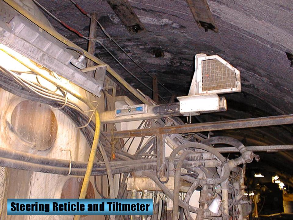
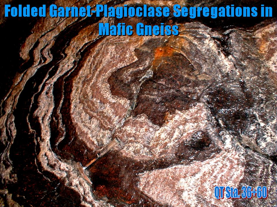
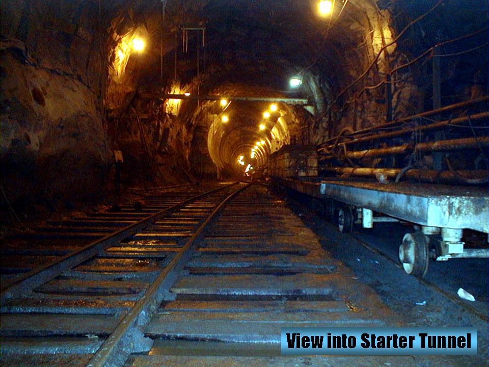
Sigma Xi Lecture
C.W. Post University, NY
Geological Wonders of the Queens Tunnel
Thrilled with the prospect of being chosen to speak to Sigma Xi, Merguerian spoke on his experiences mapping the structural geology of the Queens Tunnel. His lecture focused on an absolutely thrilling three-year long research project mapping the structural geology of the Third New York City Water Tunnel in western Queens. Varying in depth from 690’ to 760’ below the surface and extending in a curved path from Maspeth northeastward to Woodside thence westward to Long Island City, the tunnel has been excavated by a 300’ long tunnel boring machine or TBM. Beginning in October 1996, the TBM bored a cylindrical 23’ diameter transect through metamorphic rocks of the Appalachian mountain chain. The five-mile long tunnel afforded a magnificent continuous exposure of the subsurface geology of western Queens, a region not touted in the Michelin travel brochures for it's natural surface exposures.
Download a bloated .pdf (29.7 Mb) of his PowerPoint lecture here.
This link will bring you to some cool images of Queens Tunnel Minerals.
This link will bring you to some cooler images of Queens Tunnel Thin Sections.
17 April 2002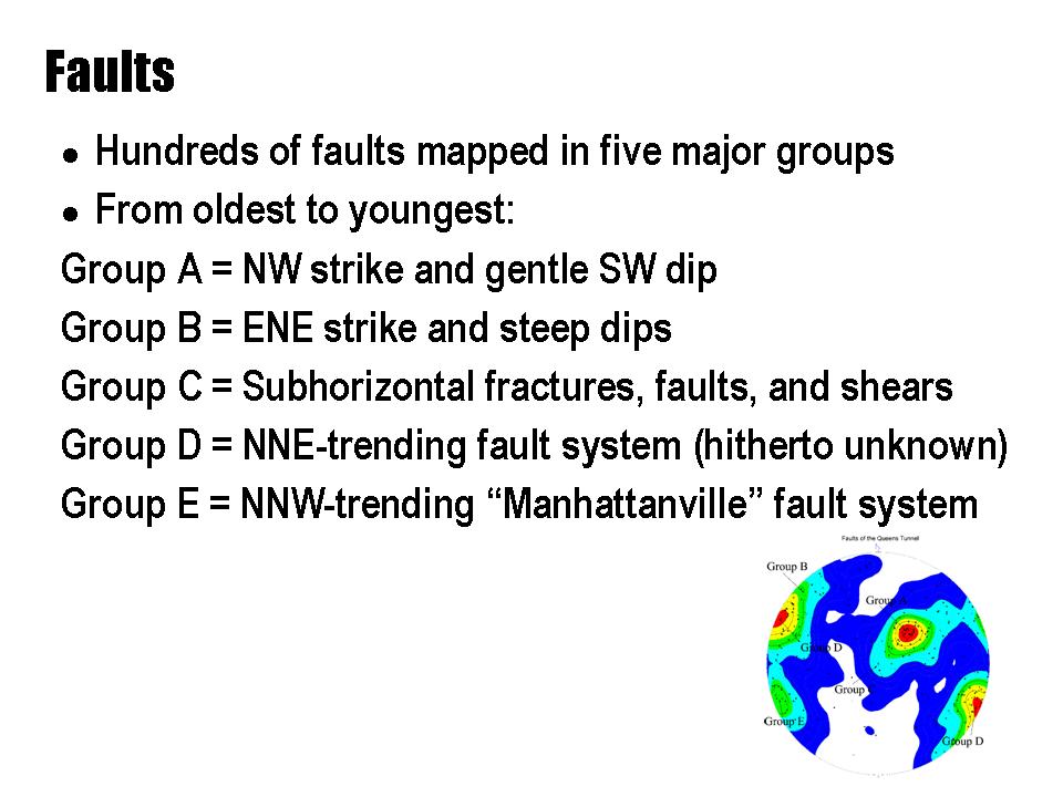
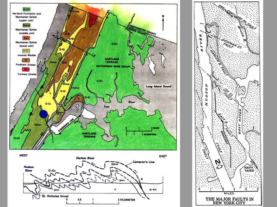
Long Island Geologists
Stony Brook, NY
Brittle Faults of the Queens Tunnel Complex, NYC Water Tunnel #3
Extending his streak of non-compensated appearances, Charles Merguerian spoke at the Ninth Annual Long Island Geologists Conference at Stony Brook on Saturday, 20 April 2002. His topic was on the brittle faults of the Queens Tunnel. Superimposed on the granulite facies gneisses of the Queens Tunnel Complex, are a sequence of brittle faults. Each with its unique character, orientation, and relative age, the youngest episode of brittle faulting trends NW-SE with steep dip and show predominately strike-slip offset. Correlative with the famous "125th Street fault" of New York City and parallel to many faults in the NYC area, the faults define a set of fractures along which a recent (2001) earthquake has been localized.
Hosted by our long-time friend and colleague, Dr. Gil Hanson, the conference is a mainstay for geologists and students to meet and present the results of their research on the Geology of the New York Metropolitan region. Click on the link above for past conference publications and the other fine programs organized by the LIG. An extended abstract (Merguerian 2002b) can be found here.
A .pdf (6.2 Mb) of his Powerpoint lecture can be found here.
22 March 2002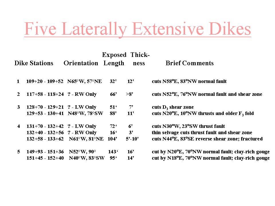
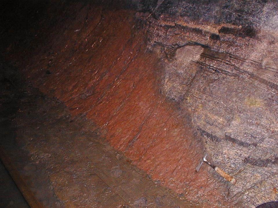
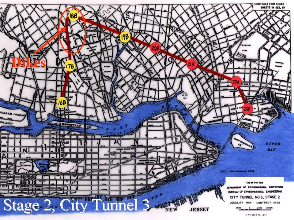
Geological Society of America
Springfield, MA
Rhyodacite Dikes of the Queens Tunnel Complex, NYC Water Tunnel #3
On the road again, Merguerian spoke at the 37th Annual meeting of the NE Section of the Geological Society of America on the subject of rhyodacite dikes. He discussed the scientifically startling and unforeseen discovery made during excavation of the Queens Tunnel. Exposed ~800' beneath Woodside, Queens, a suite of at least five sub-parallel red-colored rhyodacite dikes display pristine igneous textures. Although the tunnel boring machine (TBM) may have removed dikes no longer visible in the tunnel walls, the exposed dike rocks underlie a minimum of 667' between stations 109+20 and 152+40 and compose 15.4% of the tunnel perimeter rocks within that 4,320' tunnel reach. They occur as tabular, discordant bodies roughly oriented N53°W and average just under 10' in thickness.
The rhyodacites are highly porphyritic. Suspended in the red, siliceous groundmass are phenocrysts of hornblende, clinopyroxene, biotite, plagioclase, and subordinate K-feldspar. The groundmass is enriched in quartz and K-feldspar and dusted with fibrous aggregates of iron oxide - the probable result of quenching and devitrification of initial felsitic volcanic glass. Cracked and partly replaced hornblende phenocryst suspended in hyalocrystalline groundmass rich in iron oxides.
The dikes crosscut folded Proterozoic Y granulite facies rocks of the Queens Tunnel Complex with which they are genetically and temporally unrelated. The dikes are cut by a generation of steep, NNE-trending brittle faults that are cut by younger, steep NW-trending faults. The injection of a suite of rhyodacite dikes that are chemically, texturally, and temporally unrelated to their bedrock hosts, mark an anomalous geological formation that adds a new chapter to the evolution of the New York City area. The GSA abstract and a related paper (Merguerian 2001a) can be found here.
Click here for a .pdf (5.7 Mb) of his Powerpoint lecture.
13 February 2002
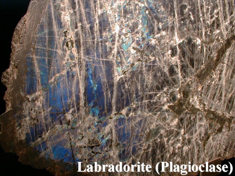
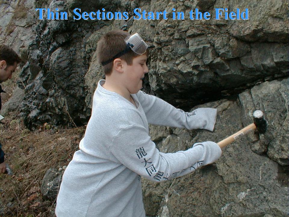
New York Mineralogical Club
People's Center
American Museum of Natural History
NYC, NY
The Petrographic Microscope - The Field Geologist's Second Best Friend
Dukelabs Geologist Charles Merguerian spoke at a meeting of the New York Mineralogical Club. Accompanied by his field assistant, J. Mickey Merguerian, his digital talk was entitled: "The Petrographic Microscope - The Field Geologist's Second Best Friend". If carefully handled, rocks can be sliced so thin that most minerals in them become transparent to visible light. Viewed under a polarizing (petrographic) microscope, with light penetrating them from beneath, such thin sections reveal the identity and composition of minerals by exhibiting their unique optical properties. By viewing their textures and spatial relationships, the mineral paragenesis (sequence of formation) can be learned in this way. Field geology is enhanced tremendously using petrographic techniques to peer into the invisible world of internal mineral relationships.
His talk was in digital format using the most modern technology available that morning. He explained the art of thin section preparation from field collecting, to rock chip preparation, to final production of the thin section – basically a rock and glass sandwich (hold the lettuce and mayo – add the epoxy!). Rock textures unique to the igneous, metamorphic, and sedimentary rock types were examined next as an introduction to the secrets of interpreting geologic history through the magic and natural beauty of the petrographic microscope.
For a .pdf (11.8 Mb) of his lecture, click here.
12 November 2001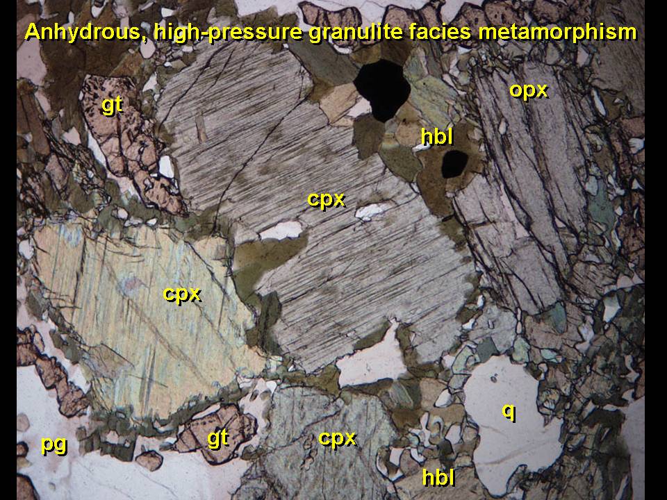
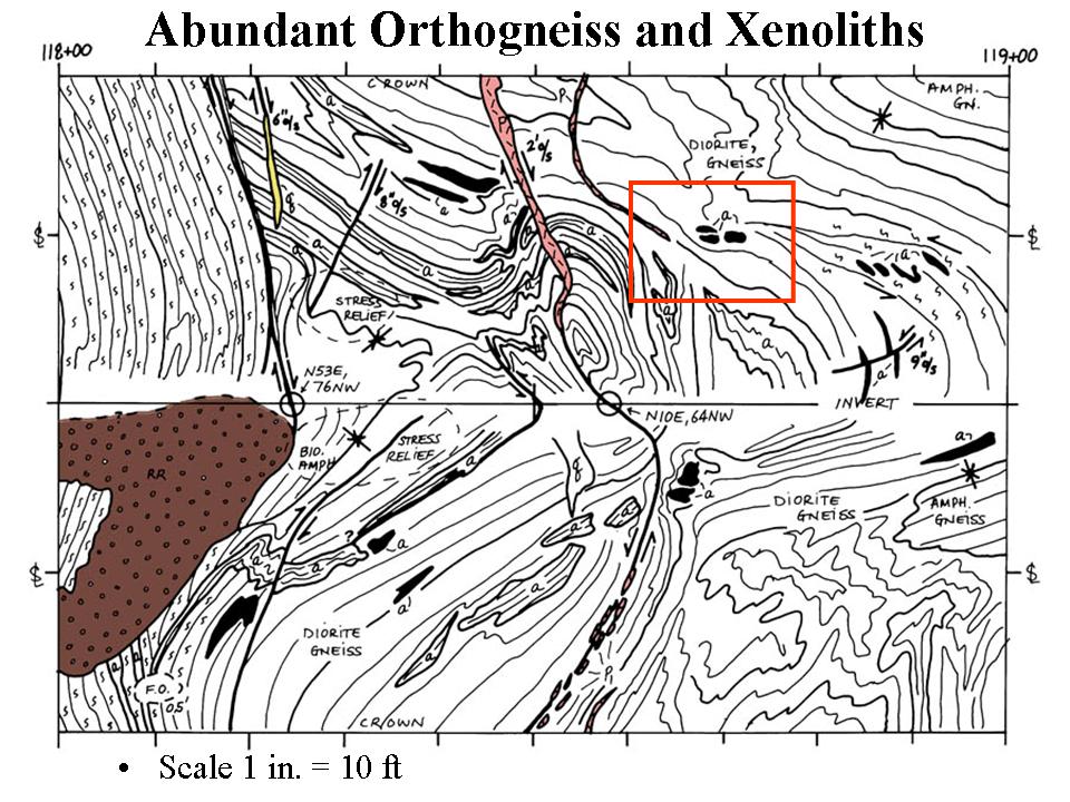
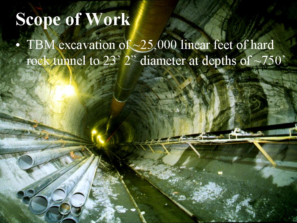
Geological Society of America
Boston, MA
The Queens Tunnel Complex - a Granulite Facies Orthogneiss Terrane Exposed in NYC Water Tunnel #3
Having spent the better part of three years working on the geologic mapping and analysis of the Queens Tunnel, our very own Dr. Merguerian of Hofstra University has coauthored a paper with Drs. Pamela and Patrick Brock from Queens College about the anomalous bedrock formation found in the tunnel. Based on detailed mapping by CM and joint analysis with the Brocks, they have recognized that the tunnel exposes predominately complexly deformed crystalline rocks of great age, hardness, and high metamorphic grade. Twice the age of the Hartland bedrock series that was anticipated in the subsurface of western Queens as based on existing maps, surface mapping in adjacent areas, and projections from exposed rock in the vicinity, granulite facies Fordham Gneiss is now recognized in the subsurface of western Queens. Their joint paper entitled "The Queens Tunnel Complex - a granulite facies orthogneiss terrane exposed in NYC Water Tunnel #3" was presented by Charles Merguerian at a special theme session at the 2001 Annual Meeting of the Geological Society of America. Their joint abstract can be found here.
A .pdf (5.4 Mb) of his PowerPoint lecture can be found here.
21 April 2001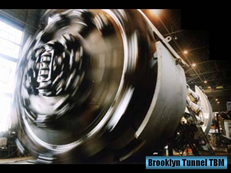
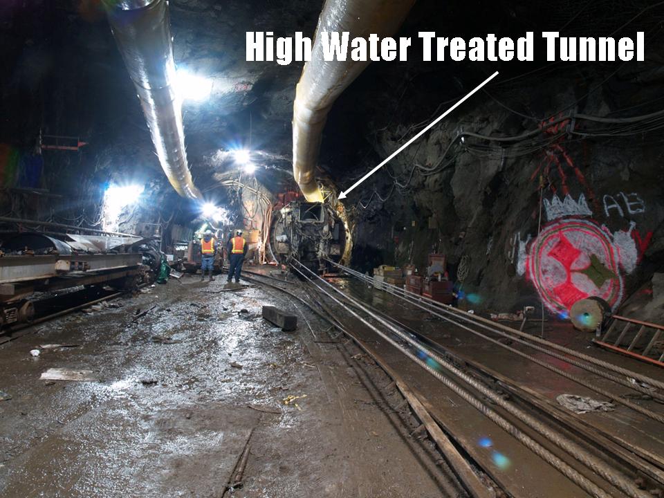
Long Island Geologists
Stony Brook, NY
Young Rhyodacite Dikes Found in the Queens Tunnel, beneath Woodside, Queens
Charles Merguerian and Pamela Chase Brock spoke at the Eighth Annual Long Island Geologists Conference at Stony Brook University. Hosted by our long-time friend and colleague, Dr. Gil Hanson, the conference is a mainstay for geologists to meet and present the results of their research on the Geology of the New York Metropolitan region.
Pamela Brock spoke about the petrographic, geochemical, and geochronologic data that have together proven that the rocks of the Queens Tunnel are Grenvillian in age (Brock, Brock, and Merguerian 2001).
Merguerian spoke about mapping of the raw tunnel excavation exposed by the Queens Tunnel TBM (tunnel boring machine) and an anomalous suite of red-colored volcanic dike rocks ~700’ beneath Woodside, Queens (Merguerian 2001). Chemical- and petrographic studies indicate that the rocks are rhyodacitic in composition (chemically between rhyolite and dacite) and exhibit textures and other characteristics typical of shallow-level (hypabyssal) volcanic rocks. Because they are now found adjacent to the high grade (granulite facies) bedrock series exhumed from depths of roughly 40 km, their presence in a depth position close to where they were initially injected forces a new view of the developmental geology of the NYC region. Rocks of this composition and structural setting have never before been reported from the New England Appalachians.
Click here for a .pdf (5.3 Mb) of his Powerpoint lecture.
27 September 2000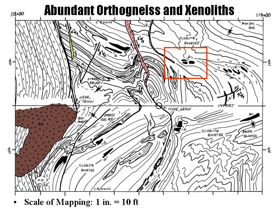
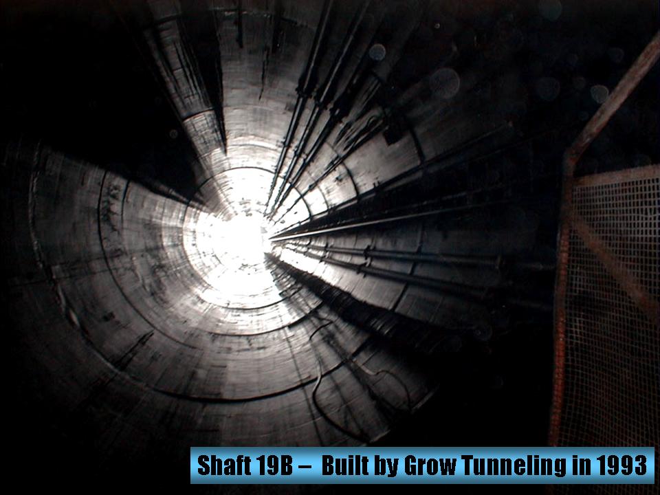
Distinguished Faculty Lecture
Hofstra University, NY
Tunnel Vision - Subterranean Paradise or Name That Quake
An indication of the poor level of scholarship in higher education, Dr. Merguerian was chosen as the 2000 Distinguished Faculty Lecturer at Hofstra University where he explained his facscinating experiences mapping the Queens Tunnel from 1997-2000. Be sure to download an unsigned, non-peer-reviewed copy of his lecture text here (great for wrapping fish, blocking sunlight, shimming tables, and soaking up oil spills). As this lecture was given with 35mm slides, no .pdf of the lecture has been saved. A byproduct of this effort was a supplementary handout on the History and Construction of the NYC Water Supply.
19 June 2000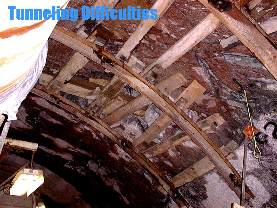
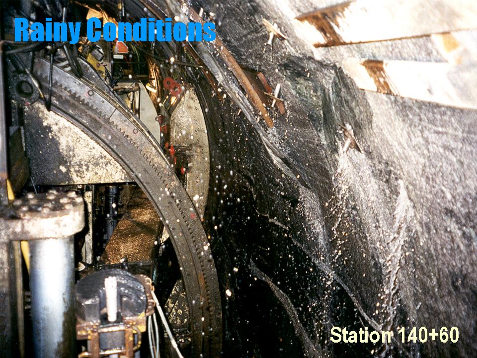
Queens Mineralogical Society
Flushing, NY
Geology of the Queens Tunnel
In June 2000 Merguerian spoke at the Annual Meeting of the Queens Mineralogical Society on the topic of "are there or are there not, flying saucers?" Oops, sorry Jimi. The topic was the Geology of the Queens Tunnel. In the audience at the time were Drs. Patrick and Pamela Brock whose interest and experience in granulite-grade rocks of New England led to new enlightenment and collaborative research with Dr. Merguerian on the Queens Tunnel Complex. As this lecture was given with 35mm slides, no .pdf of the lecture exists and slides, like his career, are fading fast.
This link will bring you to some cool images of Queens Tunnel Minerals
This link will bring you to some cooler images of Queens Tunnel Thin Sections
11 June 2000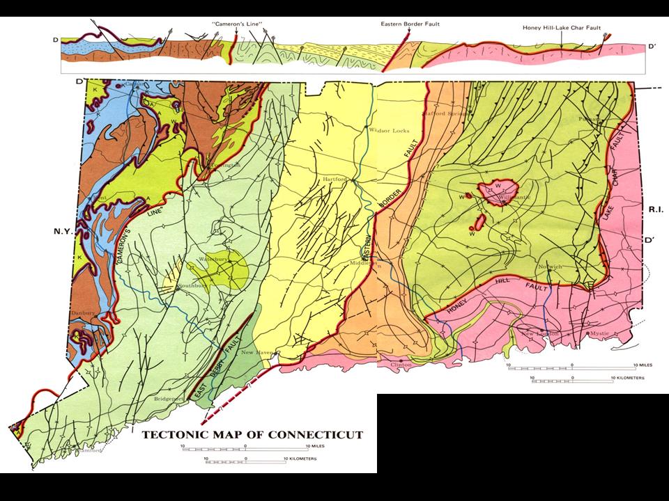
Nassau Mineralogical Club
Mineola, NY
Geology, Mines, and Minerals of Connecticut
Geologist Charles Merguerian spoke to the Nassau Mineralogical Club in early June 2000 on the topic "Geology, Mines, and Minerals of Connecticut". Having spent over twenty-five years mapping the bedrock geology of western Connecticut and having developed and promoted more outlandish, baseless hypotheses per square mile than any living geologist, CM was uniquely qualified to lead this discussion. He shared tales of geology, "locality lore", mining history, obscure package store localities, and many other useful tidbits of information. Some of the kodachromes of the region's mineral specimens in his collection are shown above. As this lecture was not given with 35mm slides, a .pdf (11.5 Mb) of the lecture has been saved for posterity.
This link will bring you to guidebooks on mineral collecting in Connecticut.
10 March 2000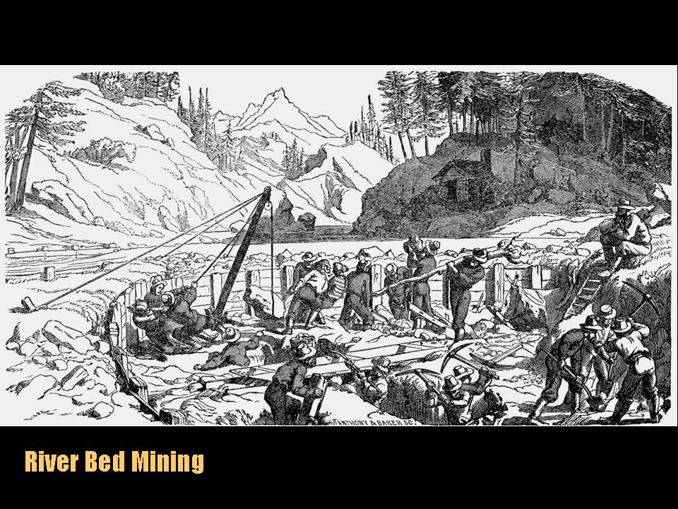
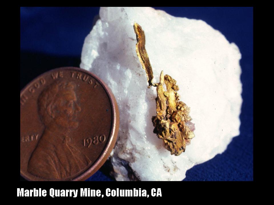
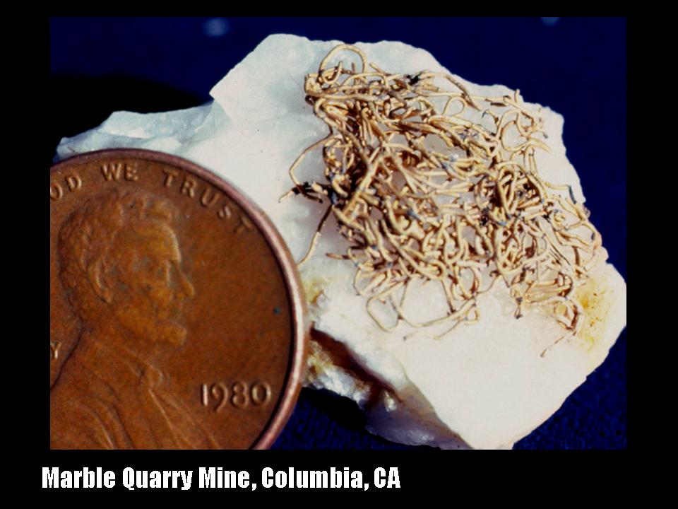
Nassau Mineralogical Club
Mineola, NY
California Gold and Gold Mining
To begin the twenty-first century utilizing twentieth century technology, Dukelabs geologist Dr. Charles Merguerian spoke to the Nassau Mineralogical Club meeting on the subject of California Gold and Gold Mining. Using grassroots technology of 35mm slides (thus no .pdf of the lecture!) he explained the bedrock geology of the California gold belt and brought images of the mines and mining techniques (both old and new) used to extract gold. The lecture was highlighted by images of actual gold specimens from the gold terrains of California that he visited while conducting summer field research from 1978-1981.
This link will bring you to guidebooks and papers on the geology of California.
E-mail: info@dukelabs.com
 Homepage
Note: The material on this page and subpages are protected by copyright statutes and can not be used for any commercial purpose unless you cut us in big time! Educators are free to use any and all of these materials for instructional purposes with proper acknowledgement [© 2026] .